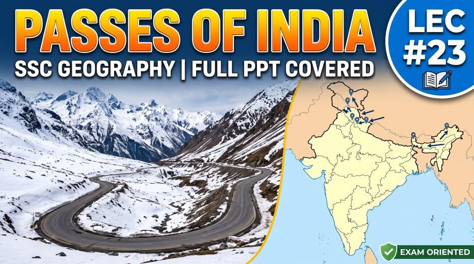
This article accompanies the SSC Geography Passes of India PPT (LEC #23) – Serial #102 of the Complete Foundation Batch for All SSC Exams PPT Series on slideshareppt.net. With 113 slides in bilingual Hindi + English format, this PPT covers India’s mountain passes in complete depth – from the highest motorable passes in Ladakh to the historical passes of the Himalayas, NE India, Western Ghats, and the Vindhya-Satpura region – all aligned to the SSC exam pattern.
Mountain passes are the strategic gateways of India – controlling the flow of people, armies, trade, and ideas across the Himalayas and other hill ranges for thousands of years. For SSC CGL, SSC CHSL, SSC MTS, SSC GD Constable, and RRB Group D exams, passes are tested in the specific pattern of ‘which pass connects which regions, which state it lies in, and what it is known for.
PPT Resource Overview
| Detail | Information |
| Lecture Number | LEC #23 (Geography Series) |
| Serial Number in Complete Batch | #102 |
| Subject | Geography – Passes of India (भारत के दर्रे) |
| Series Name | Complete Foundation Batch for All SSC Exams (PPT Series) |
| Total Slides | 113 PPT Slides |
| File Size | 24 MB |
| Language | Hindi + English (Bilingual) |
| Format Available | Google Slides & Google Drive (PDF also available) |
| Website | www.slideshareppt.net |
| Target Exams | SSC CGL, SSC CHSL, SSC MTS, SSC GD Constable, RRB Group D |
| Suitable For | Students (self-study & marathon revision) and Teachers (classroom use) |
SSC Geography Passes of India PPT (LEC #23)
Note: Above is PPT in GOOGLE SLIDES (HTML AND IFRAME COMBINATION) and if you wish to download the Complete SSC series (PPT slides), visit this Link – REDIRECT PAGE.
Passes of India – Overview and Significance
A mountain pass (दर्रा) is a navigable route through a mountain range or terrain that would otherwise be impassable. India’s passes are of critical strategic, military, trade, and cultural importance. The northern Himalayan passes connect India to China (Tibet), Nepal, and Bhutan. The northwestern passes of J&K connect to Pakistan. The northeastern passes connect to Myanmar. Passes in the Western Ghats connect the coastal plains to the Deccan Plateau. The most important passes for SSC exams are those that: connect India to specific countries, lie in specific states, are on famous military or trade routes, or are the highest motorable roads. The famous Khyber Pass – while not in India – is the historically most significant pass connecting the Indian subcontinent to Central Asia through Pakistan/Afghanistan, and is frequently asked in SSC GK context.
All Major Passes of India – Complete Master Reference Table
| Pass Name | State / UT | Mountain Range | Altitude | Connects | Key SSC Facts |
| Karakoram Pass | Ladakh | Karakoram Range | ~5,540 m | India (Ladakh) to China (Xinjiang) | One of the highest passes in the world; historical Silk Road route; extreme altitude and weather; not regularly open for civilian traffic |
| Khardung La | Ladakh | Ladakh Range | ~5,359 m | Leh to Nubra Valley (and Siachen Glacier region) | Claimed to be one of the world’s highest motorable roads; access to Nubra Valley and Siachen area; on the Leh-Nubra road |
| Chang La | Ladakh | Eastern Ladakh ranges | ~5,360 m | Leh to Pangong Lake (Pangong Tso) | Route to Pangong Tso – famous lake near India-China LAC; strategic military importance; highly motorable road |
| Taglang La (Tanglang La) | Ladakh | Ladakh Range (on Manali-Leh Highway) | ~5,328 m | On the Manali-Leh highway (beyond Baralacha La) | On the highest stretches of the Manali-Leh Highway; claimed to be one of highest road passes in the world |
| Baralacha La | Himachal Pradesh / Ladakh border | Greater Himalayas | ~4,890 m | Keylong (HP) to Leh; on Manali-Leh highway | On the Manali-Leh highway; Bhaga and Yunam rivers originate near here |
| Rohtang Pass | Himachal Pradesh | Pirpanjal Range (Lesser Himalayas) | ~3,978 m | Manali (Kullu Valley) to Lahaul-Spiti Valley (Keylong) | On the Manali-Leh highway; now largely bypassed by Atal Tunnel (Rohtang Tunnel), opened Oct 2020; snowbound Oct–May |
| Kunzum Pass | Himachal Pradesh | Himalayas (Spiti region) | ~4,590 m | Lahaul Valley to Spiti Valley | Famous motorbike touring route; Chandratal Lake is nearby; connects two remote valleys |
| Shipki La | Himachal Pradesh (Kinnaur) | Greater Himalayas | ~3,933 m | India (Kinnaur, HP) to China (Tibet) | Sutlej River enters India through this pass; India-China trade route; Khab is the confluence point of Spiti and Sutlej rivers nearby |
| Zoji La | J&K / Ladakh border | Greater Himalayas | ~3,528 m | Srinagar (Kashmir Valley) to Kargil and Leh | Strategic gateway – connects Kashmir to Ladakh; snowbound in winter cutting off Ladakh; Atal Tunnel equivalent under construction (Z-Morh and Zoji La tunnels) |
| Banihal Pass / Jawahar Tunnel | J&K | Pirpanjal Range | ~2,832 m (pass); tunnel lower | Jammu (south) to Srinagar (north) | Jawahar Tunnel (1.5 km) provides year-round road access; Banihal Pass above it is seasonal; on the Jammu-Srinagar National Highway |
| Pir Panjal Pass | J&K | Pirpanjal Range | ~3,490 m | Kashmir Valley to Rawalakot (Pakistan-administered Kashmir) | Historically important trade route; now in disputed territory |
| Nathu La | Sikkim | Himalayan Range (Sikkim) | ~4,310 m | India (Gangtok/Sikkim) to China (Tibet, Chumbi Valley) | Reopened for border trade between India and China in 2006; historically on the ancient Silk Road; Indian Army post; strategic for bilateral relations |
| Jelep La | Sikkim | Himalayan Range (Sikkim) | ~4,267 m | India (Sikkim) to China (Tibet, Chumbi Valley) | Near Nathu La; historically more important trade route; now less used |
| Lipulekh Pass | Uttarakhand (Pithoragarh) | Greater Himalayas | ~5,334 m | India (Uttarakhand) to China (Tibet); also used for Kailash-Mansarovar Yatra | India built road to Lipulekh in 2020; Nepal disputed as it claims Kalapani region; sacred route to Mount Kailash |
| Mana Pass | Uttarakhand (Chamoli) | Greater Himalayas | ~5,610 m | India (near Badrinath) to China (Tibet) | One of the highest passes on the India-China border; near the source of Saraswati River; near Badrinath (Char Dham pilgrimage) |
| Niti Pass | Uttarakhand (Chamoli) | Greater Himalayas | ~5,068 m | India (Chamoli) to Tibet (China) | One of the more open passes on Uttarakhand-China border; near Niti village – India’s last village near Tibet |
| Munsiyari / Milam Pass | Uttarakhand | Himalayan region | ~5,400 m | Uttarakhand to Tibet (China) | Milam Glacier route; trekking and ancient trade route |
| Tawang Pass / Se La | Arunachal Pradesh | Himalayan Range | ~4,170 m | Tezpur/Guwahati (Assam) to Tawang (Arunachal Pradesh) | Strategic – Tawang was nearly lost in 1962 India-China War; Se La pass is the gateway to Tawang district; road frequently blocked in winter |
| Bum La | Arunachal Pradesh | Himalayan Range (McMahon Line) | ~4,700 m | India (Arunachal Pradesh, near Tawang) to China (Tibet) | Near the McMahon Line; hotly contested area in 1962 war; Chinese claim Arunachal Pradesh as South Tibet |
| Diphu Pass | Arunachal Pradesh | Patkai Range | ~4,587 m | India, China, and Myanmar trijunction | Near India’s easternmost regions; strategic trijunction point |
| Patkai Pass / Pangsau Pass | Arunachal Pradesh | Patkai Hills | ~300 m (low pass) | India (Arunachal) to Myanmar (Naga Hills) | Stilwell Road (Ledo Road from WWII) passes through Pangsau Pass; old WWII supply route from India to China; low-altitude pass |
| Tuzu Pass | Manipur | Manipur Hills (NE India) | ~2,499 m | India (Manipur) to Myanmar | Route to Myanmar from Manipur |
| Pal Ghat Gap (Palakkad Gap) | Kerala / Tamil Nadu border | Western Ghats | ~150 m (very low) | Kerala (Palakkad) to Tamil Nadu (Coimbatore) | Lowest and most important break in the Western Ghats; road, rail, and wind pass through; allows NE monsoon into Kerala; named Palakkad Pass |
| Thal Ghat | Maharashtra | Western Ghats (Sahyadri) | ~583 m | Mumbai/Thane to Nashik (Deccan) | On Mumbai-Nashik-Agra highway; road and rail route through Sahyadri |
| Bhor Ghat (Khandala-Lonavala) | Maharashtra | Western Ghats (Sahyadri) | ~623 m | Mumbai to Pune (Deccan Plateau) | Mumbai-Pune Expressway and old road/rail pass through this ghat; Lonavala-Khandala towns at the pass; busy commercial route |
| Amboli Ghat | Maharashtra (Sindhudurg) / Goa | Western Ghats (Sahyadri) | ~690 m | Sawantwadi (coastal MH) to Belgaum (Karnataka/Deccan) | Scenic ghat; high rainfall in monsoon; part of biodiversity hotspot |
| Khyber Pass | Now in Pakistan / Afghanistan | Hindu Kush-Safed Koh range | ~1,070 m | Pakistan (Peshawar) to Afghanistan (Kabul) | Most historically significant pass in the Indian subcontinent; all major invaders (Aryans, Persians, Greeks, Mughals) entered India through this pass; now in Pakistan after 1947 Partition |
| Bolan Pass | Pakistan (Balochistan) | Toba Kakar Range (Balochistan) | ~1,793 m | Pakistan (Quetta) to Afghanistan | Alternative to Khyber Pass; used by Baloch traders; British used it in Anglo-Afghan wars; now in Pakistan |
| Karakoram Highway Pass | Pakistan / China border | Karakoram Range | Khunjerab Pass ~4,693 m | Pakistan to China (Xinjiang) | CPEC (China-Pakistan Economic Corridor) route; Khunjerab Pass is the specific pass on this route |
Passes Grouped by Region – Quick Study Reference
Ladakh Passes (India-China / Military Access)
| Pass | Altitude | Key Connection | Primary Importance |
| Karakoram Pass | ~5,540 m | India-China (Xinjiang) | Historical Silk Road; one of world’s highest |
| Khardung La | ~5,359 m | Leh to Nubra Valley | Highest motorable road (claimed); Siachen access |
| Chang La | ~5,360 m | Leh to Pangong Lake | Military access to LAC; Pangong Tso |
| Taglang La | ~5,328 m | Manali-Leh Highway | On Manali-Leh Highway; extreme altitude road |
| Baralacha La | ~4,890 m | HP to Leh (Manali-Leh Highway) | On Manali-Leh highway; river sources |
Himachal Pradesh Passes
| Pass | Altitude | Key Connection | Primary Importance |
| Rohtang Pass | ~3,978 m | Manali to Lahaul-Spiti | Bypassed by Atal Tunnel (2020); snowbound Oct-May |
| Kunzum Pass | ~4,590 m | Lahaul to Spiti Valley | Motorbike touring; Chandratal Lake nearby |
| Shipki La | ~3,933 m | India to China (Tibet) | Sutlej River entry point into India |
Jammu & Kashmir Passes
| Pass | Altitude | Key Connection | Primary Importance |
| Zoji La | ~3,528 m | Srinagar to Kargil/Leh | Critical strategic gateway; snowbound in winter |
| Banihal / Jawahar Tunnel | ~2,832 m | Jammu to Srinagar | Year-round access via tunnel under Pirpanjal |
| Pir Panjal Pass | ~3,490 m | Kashmir to Rawalakot (PoK) | Historical trade route; now in disputed territory |
Sikkim and Uttarakhand Passes (India-China)
| Pass | State | Altitude | Key Connection | Primary Importance |
| Nathu La | Sikkim | ~4,310 m | India to China (Tibet, Chumbi Valley) | Border trade reopened 2006; Silk Road historically |
| Jelep La | Sikkim | ~4,267 m | India to China (Chumbi Valley) | Near Nathu La; historically used for trade |
| Lipulekh Pass | Uttarakhand | ~5,334 m | India to China; Kailash-Mansarovar Yatra | India built road in 2020; Nepal disputes; sacred pilgrimage |
| Mana Pass | Uttarakhand | ~5,610 m | India to China (near Badrinath) | Near Badrinath; highest pass on this border |
| Niti Pass | Uttarakhand | ~5,068 m | India to China | Near Niti village (last Indian village) |
Arunachal Pradesh and Northeast Passes (India-China / India-Myanmar)
| Pass | Altitude | Key Connection | Primary Importance |
| Se La (Sela Pass) | ~4,170 m | Assam to Tawang (AP) | Gateway to Tawang; strategic since 1962 war |
| Bum La | ~4,700 m | India (AP) to China (Tibet) | Near McMahon Line; hotly disputed; 1962 war route |
| Diphu Pass | ~4,587 m | India-China-Myanmar trijunction | Near India’s easternmost corner |
| Pangsau Pass (Patkai) | ~300 m | India (AP/Nagaland) to Myanmar | Stilwell Road from WWII passes through; low pass |
| Tuzu Pass | ~2,499 m | Manipur to Myanmar | NE India–Myanmar connectivity |
Western Ghats Passes (Connecting Coast to Deccan)
| Pass / Ghat | State | Altitude | Key Connection | Primary Importance |
| Pal Ghat (Palakkad Gap) | Kerala-TN border | ~150 m | Kerala coast to Tamil Nadu / Coimbatore | Lowest gap in Western Ghats; major road-rail route; NE monsoon entry to Kerala |
| Thal Ghat | Maharashtra | ~583 m | Mumbai/Thane to Nashik (Deccan) | Mumbai-Nashik highway; road and rail |
| Bhor Ghat (Khandala) | Maharashtra | ~623 m | Mumbai to Pune (Deccan) | Mumbai-Pune expressway; Lonavala-Khandala |
| Amboli Ghat | Maharashtra-Goa border | ~690 m | Sawantwadi to Belgaum | Scenic; biodiversity hotspot; high rainfall |
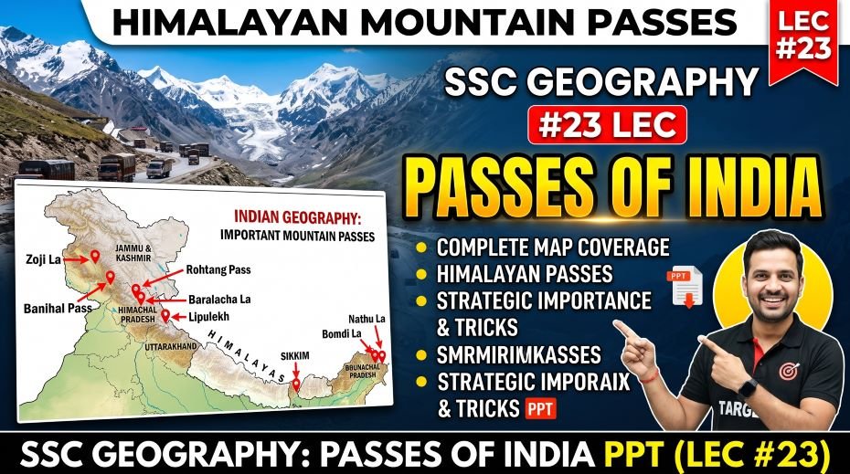
Historically Important Passes – Now in Pakistan
| Pass | Location (post-1947) | Altitude | Historical Significance |
| Khyber Pass | Pakistan (NWFP / KPK) – connects Peshawar to Afghanistan (Kabul) | ~1,070 m | Most historically significant pass in South Asian history; route through which Aryans, Persians, Alexander the Great, Mahmud of Ghazni, Babur, and other invaders entered the Indian subcontinent; name literally means ‘pass’ in Pashto; now fully in Pakistan after Partition |
| Bolan Pass | Pakistan (Balochistan) – connects Sibi to Quetta to Afghanistan | ~1,793 m | Alternative southern route into the subcontinent; used by Baloch tribes; British troops used it during the Anglo-Afghan Wars; connects Indus plains to Afghan plateau; important for CPEC planning |
| Gomal Pass | Pakistan (South Waziristan) – connects Dera Ismail Khan to Afghanistan | ~2,515 m | Another historic western pass; tribal area; important historically for trade and migration between Afghanistan and India |
Atal Tunnel (Rohtang Tunnel) – Special Topic
| Parameter | Detail |
| Official Name | Atal Tunnel (named after former PM Atal Bihari Vajpayee) |
| Also Known As | Rohtang Tunnel |
| Location | Himachal Pradesh – under the Pirpanjal Range |
| Connects | Manali (Kullu Valley) to Sissu (Lahaul valley) – bypasses Rohtang Pass |
| Length | ~9.02 km – longest highway tunnel above 10,000 feet altitude in the world |
| Altitude | South portal: ~3,060 m; North portal: ~3,071 m |
| Inauguration | October 2020 – inaugurated by Prime Minister Narendra Modi |
| Significance | Provides year-round connectivity to the Lahaul-Spiti valley (previously cut off for ~6 months due to snow at Rohtang Pass); also provides faster access to Leh via the Manali-Leh highway |
| Type | Single-tube, double-lane road tunnel; fireproof, avalanche-proof design |
| SSC Importance | Very high – world record tunnel at altitude; opened 2020; Rohtang connection; Atal Bihari Vajpayee naming |
Strategic Military Significance of Key Passes
| Pass | Strategic Significance |
| Zoji La (J&K-Ladakh) | Critical military gateway – loss of Zoji La in winter cuts Ladakh off from the rest of India; was captured briefly by Pakistan in 1947 war and recaptured by the Indian Army under Major General Thimayya using tanks (first time tanks used at this altitude) |
| Nathu La (Sikkim) | Closed after the 1967 Nathu La and Cho La incidents where Indian and Chinese troops clashed; reopened for trade in 2006; symbolic of India-China relations |
| Se La / Sela Pass (Arunachal) | Gateway to Tawang; Chinese forces came through here during the 1962 India-China War; fall of Sela Pass led to the fall of Tawang; now well-defended; Sela Tunnel under construction to ensure all-weather connectivity |
| Khardung La (Ladakh) | Access to the Siachen Glacier – scene of the world’s highest military conflict between India and Pakistan; Indian Army supply route to Siachen since 1984 |
| Banihal / Jawahar Tunnel (J&K) | Only year-round road connection between Jammu and Srinagar; of extreme strategic value; any disruption cuts the Kashmir Valley off from the rest of India |
| Lipulekh (Uttarakhand) | Road to Lipulekh Pass built by India in 2020 for strategic access and Kailash-Mansarovar Yatra; disputed by Nepal which claims the Kalapani area as Nepali territory – caused diplomatic tension with Nepal |
ALSO READ: SSC Geography Hills of India PPT (LEC #22)
Quick Fact Table – Passes of India for SSC Exams
| Question / Fact | Answer |
| Most historically significant pass in Indian subcontinent | Khyber Pass – now in Pakistan; used by all major invaders |
| Second important historical pass (now in Pakistan) | Bolan Pass – Balochistan, Pakistan |
| Claimed world’s highest motorable road pass | Khardung La (~5,359 m) – Ladakh |
| Pass connecting Srinagar to Leh | Zoji La (~3,528 m) – J&K/Ladakh |
| Pass connecting Manali to Lahaul-Spiti (now bypassed) | Rohtang Pass (~3,978 m) – HP |
| Tunnel that bypasses Rohtang Pass | Atal Tunnel (Rohtang Tunnel) – opened Oct 2020; ~9 km long |
| Longest highway tunnel above 10,000 ft in the world | Atal Tunnel – Himachal Pradesh |
| Pass connecting India (Kinnaur, HP) to China via Sutlej River | Shipki La – Sutlej enters India here |
| Pass connecting India (Sikkim) to China; reopened for trade 2006 | Nathu La – Sikkim (~4,310 m) |
| Pass on Kailash-Mansarovar Yatra route | Lipulekh Pass – Uttarakhand (Kalapani dispute) |
| Lowest pass in the Western Ghats | Pal Ghat (Palakkad Gap) – Kerala-TN border (~150 m) |
| Mumbai to Pune road/highway through | Bhor Ghat (Khandala) – Maharashtra (~623 m) |
| Mumbai to Nashik highway through | Thal Ghat – Maharashtra (~583 m) |
| Pass connecting Assam to Tawang (Arunachal Pradesh) | Se La (Sela Pass) – Arunachal Pradesh (~4,170 m) |
| Highest altitude pass on India-China border (Uttarakhand) | Mana Pass (~5,610 m) |
| WWII Stilwell Road passes through which pass? | Pangsau Pass (Patkai Hills) – Arunachal Pradesh-Myanmar |
| Jammu to Srinagar year-round road access via | Jawahar Tunnel (under Banihal Pass) – J&K |
| Pass at India-China-Myanmar trijunction | Diphu Pass – Arunachal Pradesh |
| Pass connecting Leh to Pangong Lake | Chang La (~5,360 m) – Ladakh |
| Atal Tunnel named after | Former PM Atal Bihari Vajpayee |
| Pass where Sutlej River enters India from Tibet | Shipki La – Kinnaur, Himachal Pradesh |
| Lahaul Valley to Spiti Valley pass (for bikers) | Kunzum Pass (~4,590 m) – Himachal Pradesh |
| Leh to Nubra Valley and Siachen region | Khardung La – Ladakh |
| Gate to Nubra Valley | Khardung La, Ladakh |
| All invaders entered India through (historically) | Khyber Pass (now Pakistan) |
| Pass near Tawang; contested in 1962 war | Bum La (~4,700 m) – Arunachal Pradesh |
| Sela Tunnel (under construction) | To bypass Sela Pass and ensure all-weather access to Tawang, Arunachal Pradesh |
| Year Nathu La was reopened for trade | 2006 |
| Pangsau Pass altitude (approximate) | ~300 m – one of the lowest passes; in the Patkai Hills |
| Pass used in CPEC (China-Pakistan Economic Corridor) | Khunjerab Pass – between Pakistan and China (not in India) |
PYQ:
Q1: Why is the Khyber Pass so historically important for the Indian subcontinent?
The Khyber Pass, at approximately 1,070 m altitude in the Hindu Kush mountains connecting present-day Pakistan (Peshawar) to Afghanistan (Kabul), is the most historically significant mountain pass in the history of the Indian subcontinent. For thousands of years, it was the primary gateway between Central Asia and the South Asian subcontinent, and virtually every major invasion and migration into India passed through it. The Indo-Aryan migrations (~1500 BCE), Persian Emperor Darius I’s campaigns, Alexander the Great’s invasion (327 BCE), Mahmud of Ghazni’s raids (10th–11th century CE), Genghis Khan’s Mongol forces, Tamerlane, and Babur (who founded the Mughal Empire) all used the Khyber Pass. After 1947 Partition, the pass became entirely part of Pakistan, but it remains one of the most frequently asked historical geography facts in SSC exams.
Q2: What is the strategic importance of Zoji La and why is it critical for India?
Zoji La at approximately 3,528 m on the J&K-Ladakh border is the only road pass connecting the Kashmir Valley to the Ladakh region (via the Srinagar-Leh highway). When Zoji La is blocked by snow – typically from November to May – Ladakh becomes accessible only by air. This makes Zoji La critically important for military supply to the Siachen Glacier, the Kargil region, and India’s forward posts along the Line of Actual Control with China. In the 1947 India-Pakistan War, Pakistan captured Zoji La, temporarily threatening Leh. Indian Army General Thimayya famously had tanks carried over the pass in pieces to retake it – the first time tanks were used at such altitude in the world. The Indian government is building a tunnel under Zoji La to provide year-round connectivity, similar to the Atal Tunnel under Rohtang Pass.
Q3: What makes the Atal Tunnel (Rohtang Tunnel) a world record?
The Atal Tunnel, named after former Prime Minister Atal Bihari Vajpayee and inaugurated in October 2020, is approximately 9.02 km long and is the world’s longest highway tunnel above 10,000 feet (3,048 m) altitude. It passes under the Pirpanjal Range in Himachal Pradesh, connecting Manali in the Kullu Valley to Sissu in the Lahaul valley – bypassing the Rohtang Pass which was previously blocked by snow for about six months every year (October to May). Before the tunnel, the Lahaul-Spiti valley and Leh were effectively cut off from the rest of India by road during winter, requiring either air evacuation or extremely hazardous mountain driving. The Atal Tunnel reduced the Manali-Leh distance by approximately 46 km and provides all-weather road connectivity to the strategically important Ladakh region.
Q4: How did the 1962 India-China War reshape India’s approach to mountain passes?
The 1962 India-China War, in which Chinese forces made rapid advances through passes including Bum La (near Tawang, Arunachal Pradesh) and Se La, was a turning point in India’s strategic thinking about mountain passes. The fall of the Se La Pass – a high-altitude strategic gateway to Tawang – led to Chinese forces reaching Tawang, which was nearly handed over before a ceasefire was called. After 1962, India significantly invested in building roads to its forward military posts, improving connectivity to passes in Ladakh, Sikkim, and Arunachal Pradesh. Projects like the Atal Tunnel, roads to Lipulekh and Nathu La, and the ongoing Sela Tunnel (to provide all-weather access to Tawang, bypassing Sela Pass) are all direct legacies of the 1962 strategic lessons.
Q5: What is the Pal Ghat (Palakkad Gap) and why is it the most important pass in South India?
The Pal Ghat or Palakkad Gap is a natural break in the Western Ghats approximately 25–30 km wide on the Kerala-Tamil Nadu border, at an altitude of only about 150 m – making it by far the lowest and widest gap in the entire Western Ghats chain. Unlike the passes of the Himalayas which are high-altitude crossings, the Pal Ghat is a genuine gap where the Western Ghats’ mountains are absent. This gap serves multiple critical functions: it is the main corridor for road and railway connectivity between Kerala’s coast and Tamil Nadu and the rest of India; it allows the Northeast Monsoon (October-December) to penetrate into Kerala through the opening, giving interior Kerala rain during the NE monsoon period unlike the rest of the state; and it has been a major route for trade and migration between the Kerala coast and the Deccan plateau for centuries. Coimbatore (Tamil Nadu) and Palakkad (Kerala) are the major cities on either side.
Q6: What is the significance of Nathu La’s reopening in 2006?
Nathu La at ~4,310 m in Sikkim was historically one of the most important trading routes on the ancient Silk Road, connecting Bengal and India’s tea trade to Tibet and China via the Chumbi Valley. After the 1959 Tibet uprising and Chinese military build-up, India closed Nathu La in 1962 when the India-China War broke out. In 1967, major India-China clashes occurred at both Nathu La and Cho La in Sikkim. The pass remained closed for over four decades. Its reopening for limited border trade in 2006, as part of improving India-China relations and a boundary agreement on Sikkim, was a significant diplomatic milestone – it acknowledged India’s sovereignty over Sikkim (China formally accepted Sikkim as part of India in 2003) and re-established the historic trade link. The pass is a symbol of the complex but economically important India-China bilateral relationship.
Q7: Why does the Lipulekh Pass create diplomatic tension between India and Nepal?
The Lipulekh Pass at ~5,334 m in Uttarakhand (Pithoragarh district) is where India’s road to Tibet (China) and the Kailash-Mansarovar Yatra route passes. In May 2020, India inaugurated a new road connecting Lipulekh Pass to the Dharchula region, significantly improving access to this strategic border crossing. Nepal immediately objected, claiming that the road passes through the Kalapani region – a triangular area where the Kali River originates and which Nepal considers part of its territory based on the 1816 Sugauli Treaty boundary. India disputes this, maintaining Kalapani has always been under India’s jurisdiction. Nepal issued a revised political map in 2020 showing Kalapani, Lipulekh, and Limpiyadhura as Nepali territory, straining India-Nepal relations. This ongoing territorial dispute around Lipulekh makes it a current affairs-geography crossover topic that SSC exams may reference.
Rapid Revision Cheat Sheet – Passes of India
| Topic | Key Point |
| Most historically significant pass | Khyber Pass – now Pakistan – used by all major invaders of India |
| Alternative historical western pass | Bolan Pass – now Pakistan (Balochistan) |
| Claimed world’s highest motorable road | Khardung La (~5,359 m) – Ladakh – Leh to Nubra Valley |
| Srinagar to Leh critical pass | Zoji La (~3,528 m) – J&K/Ladakh border |
| Manali to Lahaul-Spiti (bypassed) | Rohtang Pass (~3,978 m) – HP |
| Atal Tunnel (2020) | 9 km; world’s longest highway tunnel above 10,000 ft; bypasses Rohtang |
| India to China (Sikkim) | Nathu La (~4,310 m) – trade reopened 2006 |
| India to China (Kinnaur, HP) | Shipki La – Sutlej River enters India here |
| India to China (Badrinath area) | Mana Pass (~5,610 m) – highest on this border |
| Kailash-Mansarovar Yatra pass | Lipulekh Pass – Uttarakhand (disputed by Nepal) |
| Assam to Tawang (AP) | Se La (Sela Pass) (~4,170 m) – gateway to Tawang |
| India-China-Myanmar trijunction pass | Diphu Pass – Arunachal Pradesh |
| Stilwell Road (WWII) passes through | Pangsau Pass (Patkai Hills) – Arunachal-Myanmar |
| Jammu to Srinagar year-round road | Jawahar Tunnel under Banihal Pass |
| Leh to Pangong Lake | Chang La (~5,360 m) – Ladakh |
| Lahaul to Spiti (motorbike pass) | Kunzum Pass (~4,590 m) – HP |
| Lowest gap in Western Ghats | Pal Ghat (Palakkad Gap) (~150 m) – Kerala-TN border |
| Mumbai to Pune via | Bhor Ghat / Khandala (~623 m) – Maharashtra |
| Mumbai to Nashik via | Thal Ghat (~583 m) – Maharashtra |
| 1962 war pass near Tawang | Bum La (~4,700 m) – Arunachal Pradesh |
| Atal Tunnel named after | Atal Bihari Vajpayee (former PM of India) |
| Nathu La reopened for trade in | 2006 |
| Sela Tunnel purpose | All-weather access to Tawang bypassing Sela Pass (under construction) |
| Pass where Sutlej enters India | Shipki La – Kinnaur, HP |
| Khyber Pass altitude | ~1,070 m – relatively low but historically most important |
| Serial number of this PPT | #102 in the Complete Foundation Batch |
Conclusion
Passes of India is a compact but high-return topic in SSC and RRB Geography – questions are precise, predictable, and well-defined. Knowing which pass connects which two places, which state it lies in, and what its historical or strategic significance is will reliably yield 2–4 marks per paper. The combination of the Himalayan passes (Zoji La, Rohtang, Nathu La, Khardung La, Shipki La, Sela Pass), the historically significant passes now in Pakistan (Khyber, Bolan), and the Western Ghats passes (Pal Ghat, Thal Ghat, Bhor Ghat) covers the full range of likely SSC questions.
The SSC Geography Passes of India PPT (LEC #23), Serial #102, available at slideshareppt.net in bilingual Hindi + English format across 113 slides, gives you the complete visual framework for this topic. Study the master passes table, memorise the quick facts, and use the Rapid Revision Cheat Sheet in your final preparation days for consistent, reliable scoring.