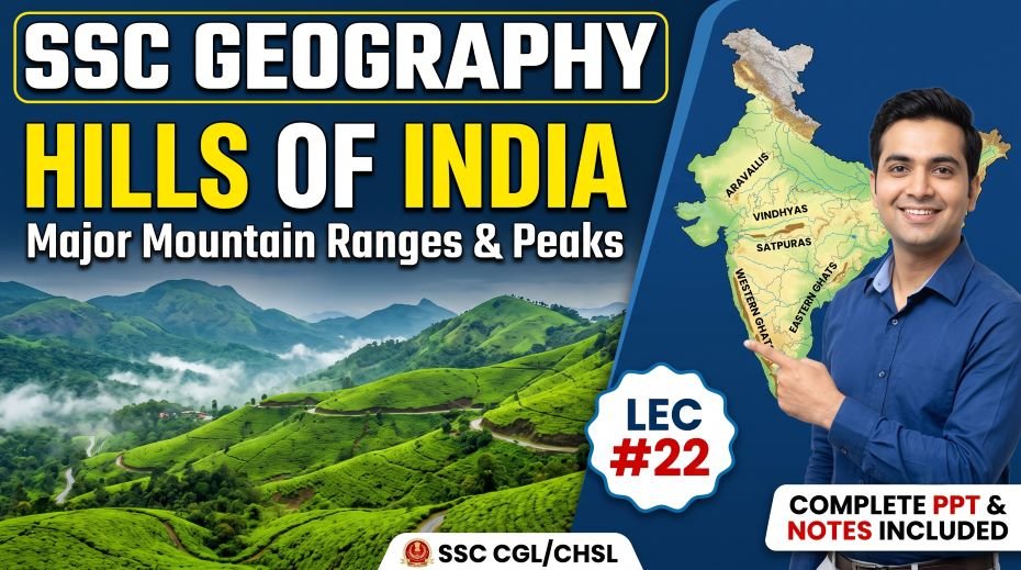
This article accompanies the SSC Geography Hills of India PPT (LEC #22) – Serial #101 of the Complete Foundation Batch for All SSC Exams PPT Series on slideshareppt.net. With 188 slides in bilingual Hindi + English format, this PPT covers India’s hill ranges – from the Aravallis to the Nilgiris and every major hill system in between – in complete depth, aligned to the SSC exam pattern.
India’s hills, hill stations, and hill ranges are among the most frequently tested sub-topics in SSC CGL, SSC CHSL, SSC MTS, SSC GD Constable, and RRB Group D Geography sections. Questions on hill stations (which hill station is in which state), famous hills, hill ranges by region, and the heights of important peaks appear consistently across papers.
PPT Resource Overview
| Detail | Information |
| Lecture Number | LEC #22 (Geography Series) |
| Serial Number in Complete Batch | #101 |
| Subject | Geography – Hills of India (भारत की पहाड़ियाँ) |
| Series Name | Complete Foundation Batch for All SSC Exams (PPT Series) |
| Total Slides | 188 PPT Slides |
| File Size | 70 MB |
| Language | Hindi + English (Bilingual) |
| Format Available | Google Slides & Google Drive (PDF also available) |
| Website | www.slideshareppt.net |
| Target Exams | SSC CGL, SSC CHSL, SSC MTS, SSC GD Constable, RRB Group D |
| Suitable For | Students (self-study & marathon revision) and Teachers (classroom use) |
SSC Geography Hills of India PPT (LEC #22)
Note: Above is PPT in GOOGLE SLIDES (HTML AND IFRAME COMBINATION) and if you wish to download the Complete SSC series (PPT slides), visit this Link – REDIRECT PAGE.
Hills of India – Overview and Classification
India has a remarkably diverse hill landscape – from the ancient, heavily eroded Aravalli Range in Rajasthan (one of the oldest mountain systems on Earth) to the relatively younger Eastern and Western Ghats and the distinct hill ranges of Northeast India. For the purpose of SSC exams, India’s hills can be grouped by location: Northern/Himalayan hills and passes, Central Indian hills (Vindhya, Satpura, Aravalli, Chota Nagpur), Southern Peninsular hills (Nilgiris, Cardamom, Anaimalai, Javadi, Shevaroy, Palani), Eastern Ghats ranges, and Northeastern hills. The Aravalli Range is the oldest fold mountain system in India and among the oldest on Earth, while the Nilgiris in the south are the highest range in peninsular India outside the Western Ghats proper.
Himalayan Hill Ranges and Sub-Ranges of India
| Range / Hills | State / Region | Key Peak / Height | Key SSC Fact |
| Karakoram Range | Ladakh (J&K/UT) | K2 – 8,611 m (2nd highest in world) | K2 is in Pakistan-administered territory; India-Pakistan-China trijunction area; Siachen Glacier is here |
| Ladakh Range | Ladakh (UT) | Peaks 5,000–6,000 m range | Separates Indus valley from Shyok valley; important for military access to Siachen |
| Zanskar Range | Ladakh (UT) | Nun Kun – 7,135 m (highest in Zanskar) | Separates Zanskar Valley from Indus valley; extreme high-altitude terrain |
| Pirpanjal Range | J&K and Himachal Pradesh | ~4,700 m | Part of the Lesser Himalayas; Banihal Pass/Jawahar Tunnel on this range; separates Kashmir valley from Jammu |
| Dhauladhar Range | Himachal Pradesh | ~4,500–5,500 m | Part of Lesser Himalayas; Dharamsala / McLeodganj (Dalai Lama’s base) at foothills; Kangra valley |
| Mussoorie Range | Uttarakhand | ~2,000–2,500 m | Part of Lesser Himalayas; Mussoorie hill station; Landour; overlooks Dehradun |
| Nag Tibba Range | Uttarakhand | ~3,022 m | Lowest Himalayan range; Nag Tibba is a popular trekking peak; Uttarakhand |
| Mahabharat Range | Uttarakhand/Nepal | ~3,000–4,000 m | Part of Lesser Himalayas; also called Lower Himalayas in parts; separates inner and outer Himalayas |
| Shivalik Hills (Siwalik) | From J&K to Arunachal Pradesh (entire Himalayan foothills) | ~300–1,500 m | Outer Himalayas / Shivalik; youngest and lowest Himalayan range; Dun valleys between Shivalik and Himachal ranges |
| Khasi Hills | Meghalaya | Highest peak: Shillong Peak (~1,966 m) | Plateau landform; Cherrapunji and Mawsynram on southern slopes – world’s highest rainfall; Shillong capital |
| Garo Hills | Meghalaya | ~900 m | Western part of Meghalaya Plateau; Tura is main town |
| Jaintia Hills | Meghalaya | ~1,000 m | Eastern part of Meghalaya Plateau; coal and limestone mining |
| Patkai Hills / Naga Hills | Arunachal Pradesh, Nagaland | ~3,000–3,841 m (Saramati) | Patkai Range forms India-Myanmar border; Saramati highest peak in Nagaland |
| Mizo Hills (Lushai Hills) | Mizoram | ~2,000 m (Blue Mountain/Phawngpui 2,157 m) | Phawngpui (Blue Mountain) – highest peak in Mizoram; Aizawl capital in Mizo Hills |
| Barail Range | Assam-Nagaland border | ~1,900 m | Divides Assam from Nagaland; source of some NE rivers |
Central Indian Hill Ranges
| Range / Hills | States | Direction | Highest Point | Key SSC Facts |
| Aravalli Range | Rajasthan, Gujarat, Haryana, Delhi | NE–SW (Delhi to Palanpur, Gujarat) | Guru Shikhar (1,722 m) – highest peak in Rajasthan and Aravallis; in Mount Abu | Oldest fold mountain system in India; one of the world’s oldest; acts as a barrier preventing Thar Desert from expanding; Delhi’s ridge is a northern extension |
| Vindhya Range | MP, UP, Bihar, Gujarat, Rajasthan | E–W | Dhupgarh is not in Vindhya; ~1,000–1,200 m | Separates North India (Ganga plains) from Peninsular India (Deccan); sacred in Hindu mythology; Vindhyavasini temple; Satna, Rewa in Vindhya region |
| Satpura Range | MP, Maharashtra, Chhattisgarh | E–W; parallel to Narmada and Tapi | Dhupgarh (1,350 m) – highest peak in MP and Satpura range | Between Narmada (north) and Tapi (south); Pachmarhi – highest hill station in MP on Satpura; Pench, Satpura Tiger Reserves |
| Mahadeo Hills | MP (Chhindwara, Narsinghpur) | Part of Satpura Range | Dhupgarh (1,350 m) | Part of Satpura – eastern section; Dhupgarh is highest point in MP |
| Kaimur Range | MP, UP, Bihar | E–W (extension of Vindhya) | ~600 m | Eastern extension of Vindhya; limestone and sandstone; Son River flows north of it |
| Chota Nagpur Plateau Hills | Jharkhand, WB, Odisha, CG | Plateau with isolated hills | Parasnath Hill (1,358 m) – highest in Jharkhand; sacred to Jains | Parasnath is the highest point in Jharkhand; ‘Ruhr of India’ – mineral wealth; Damodar river system |
| Rajmahal Hills | Jharkhand (Sahebganj) | NE–SW | ~567 m | Ancient volcanic basaltic hills in Jharkhand; on Ganga banks; last hills of the Chota Nagpur Plateau |
Southern Peninsular Hills – Complete Reference Table
| Hills / Range | State(s) | Highest Peak | Key SSC Facts |
| Nilgiri Hills | Tamil Nadu, Kerala, Karnataka (junction of all three) | Doddabetta (2,637 m) – highest peak in Nilgiris; 2nd highest in peninsular India | Junction of Western Ghats, Eastern Ghats, and Southern ranges; ‘Blue Mountains’ – named after the Kurinji flower (blooms every 12 years); Ooty (Udhagamandalam) hill station; Coonoor; UNESCO-recognised Nilgiri Biosphere Reserve |
| Anaimalai Hills | Tamil Nadu, Kerala | Anamudi (2,695 m) in Kerala (highest peninsular peak); Anai Mudi is in Anaimalai-Palani junction | Part of Southern Western Ghats; Anamalai Tiger Reserve; highest point in South India is Anamudi; Top Station viewpoint |
| Palani Hills | Tamil Nadu (Dindigul, Coimbatore) | Vembadi Shola (~2,513 m) | Kodaikanal hill station – the ‘Princess of Hill Stations’; Silent Valley National Park nearby |
| Cardamom Hills (Elamalai) | Kerala (Idukki, Pathanamthitta) | ~2,000 m | Major cardamom spice production zone; part of Western Ghats; Periyar Tiger Reserve; Idukki Arch Dam |
| Shevaroy Hills (Servaroyan) | Tamil Nadu (Salem) | Servaroyan Peak (~1,623 m) | Yercaud hill station – ‘Jewel of the South’; Salem region; orange, coffee, and spice cultivation |
| Javadi Hills | Tamil Nadu (Tiruvannamalai, Vellore) | ~1,200 m | Part of Eastern Ghats; Jawadhu Hills; Tiruvannamalai is nearby (Arunachala Hill) |
| Velliangiri Hills | Tamil Nadu (Coimbatore) | ~1,840 m | Sacred hills at the edge of Western Ghats near Coimbatore; trekking destination |
| Agasthyamalai (Agastya Hills) | Kerala, Tamil Nadu | Agasthyakoodam – 1,868 m | Southernmost major hills of Western Ghats; sacred peak (Agastya Muni legend); strict access limits; rich biodiversity |
| Biligirirangan Hills (BR Hills) | Karnataka, Tamil Nadu (border) | ~1,800 m | Only place where Eastern Ghats and Western Ghats meet; unique biodiversity; BR Hills Tiger Reserve |
| Bababudan Hills | Karnataka (Chikkamagaluru) | Mullayyanagiri – 1,930 m (highest peak in Karnataka) | Mullayyanagiri is Karnataka’s highest peak; coffee introduced to India through Bababudan Hills; Bababudan Giri peak |
| Brahmagiri Hills | Kerala, Karnataka | ~1,609 m | Source of the Kaveri River is near Talakaveri in this region; Western Ghats |
| Mahendragiri | Odisha, Andhra Pradesh | 1,501 m | Highest peak of the Eastern Ghats; in Odisha-AP border |
Famous Hill Stations of India – Complete Reference Table
| Hill Station | State | Hills / Location | Altitude (approx.) | Key SSC Fact |
| Shimla | Himachal Pradesh | Shivalik/Lesser Himalayas | ~2,206 m | Summer capital of British India; now capital of HP; connected by Toy Train (UNESCO World Heritage) |
| Mussoorie | Uttarakhand | Mussoorie Range (Lesser Himalayas) | ~2,005 m | ‘Queen of Hill Stations’; near Dehradun; overlooks Doon Valley; Kempty Falls nearby |
| Nainital | Uttarakhand | Kumaon Himalayas | ~2,084 m | Famous for Naini Lake (crater lake); Nainital Zoo; gateway to Kumaon hills |
| Darjeeling | West Bengal | Darjeeling Himalayan hills | ~2,042 m | ‘Queen of the Hills’; Darjeeling Himalayan Railway (Toy Train – UNESCO World Heritage); tea gardens; view of Kangchenjunga |
| Ooty (Udhagamandalam) | Tamil Nadu | Nilgiri Hills | ~2,240 m | ‘Queen of Hill Stations’ (also shared title); Nilgiri Mountain Railway (Toy Train – UNESCO); Botanical Garden; Ooty Lake |
| Kodaikanal | Tamil Nadu | Palani Hills | ~2,133 m | ‘Princess of Hill Stations’; Kodai Lake (star-shaped); Silent Valley connection; lavender fields |
| Munnar | Kerala | Anaimalai/Cardamom Hills (Western Ghats) | ~1,532 m | Tea plantations; Anamudi (highest peninsular peak) nearby; Eravikulam National Park – Nilgiri Tahr |
| Coorg (Kodagu) | Karnataka | Western Ghats (Brahmagiri/Pushpagiri hills) | ~900–1,400 m | Coffee capital of India; source of Kaveri River at Talakaveri (Brahmagiri Hills); Madikeri town |
| Yercaud | Tamil Nadu | Shevaroy (Servaroyan) Hills | ~1,515 m | ‘Jewel of the South’; in Salem district; orange and coffee gardens; Shevaroyan Temple |
| Coonoor | Tamil Nadu | Nilgiri Hills | ~1,858 m | Second largest hill station in the Nilgiris after Ooty; tea gardens; Sim’s Park; on Nilgiri Mountain Railway route |
| Manali | Himachal Pradesh | Kullu Valley / Beas River valley (Lesser Himalayas) | ~2,050 m | Adventure tourism; Rohtang Pass nearby; Beas River; Solang Valley skiing; Hadimba Temple |
| Leh | Ladakh | Indus Valley (Himalayas) | ~3,524 m | Highest altitude city of significant population in India; headquarters of Ladakh UT; Pangong Lake, Khardung La nearby |
| Pahalgam | J&K | Kashmir Himalayas (Lidder River valley) | ~2,140 m | Gateway to Amarnath Yatra (pilgrimage); Lidder River; Betaab Valley (Bollywood); cricket bat willow |
| Gulmarg | J&K | Kashmir Himalayas | ~2,650 m | India’s premier skiing destination; Gondola cable car (one of highest in world); meadow of flowers; Khilanmarg |
| Dharamsala / McLeodganj | Himachal Pradesh | Dhauladhar Range | ~1,457 m | Seat of the Tibetan Government in Exile; Dalai Lama’s residence in McLeodganj; cricket stadium at unusual altitude |
| Pachmarhi | Madhya Pradesh | Satpura Range | ~1,067 m | Only hill station in Madhya Pradesh; ‘Queen of Satpura’; Dhupgarh (highest peak in MP) nearby; Bee Falls, Jata Shankar Cave |
| Mount Abu | Rajasthan | Aravalli Range (southern end) | ~1,220 m | Only hill station in Rajasthan; Dilwara Jain Temples (11th-century marble temples); Guru Shikhar (1,722 m – highest peak in Rajasthan) nearby; Nakki Lake |
| Mahabaleshwar | Maharashtra | Western Ghats (Sahyadri) | ~1,372 m | Source of 5 rivers (Krishna, Koyna, Venna, Savitri, Gayatri) from one hill; strawberries; summer capital of Maharashtra during British era |
| Matheran | Maharashtra | Sahyadri (Western Ghats) | ~800 m | No motor vehicles allowed – India’s only no-automobile hill station; Matheran Hill Railway (mini toy train) |
| Lonavala-Khandala | Maharashtra | Sahyadri (Western Ghats) | ~622 m | Bhor Ghat pass; waterfalls during monsoon; popular weekend getaway from Mumbai/Pune |
| Shillong | Meghalaya | Khasi Hills (Shillong Plateau) | ~1,496 m | Capital of Meghalaya; ‘Scotland of the East’; Ward’s Lake; Don Bosco Museum |
| Cherrapunji (Sohra) | Meghalaya | Khasi Hills | ~1,430 m | Second wettest place on Earth (often claims record with Mawsynram); Nohkalikai Falls (India’s tallest plunge waterfall – ~340 m); Living Root Bridges |
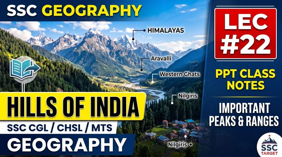
Important Hill Passes of India – Reference Table
| Pass | State / Region | Connects | Altitude | Key SSC Fact |
| Karakoram Pass | Ladakh | India (Ladakh) and China (Xinjiang) | ~5,540 m | One of the highest passes in the world; historically important Silk Road route |
| Khardung La | Ladakh | Leh to Nubra Valley and Siachen region | ~5,359 m | One of the world’s highest motorable roads; access to Nubra Valley |
| Chang La | Ladakh | Leh to Pangong Lake | ~5,360 m | Route to Pangong Tso; high-altitude road |
| Rohtang Pass | Himachal Pradesh | Manali to Lahaul-Spiti (Keylong) | ~3,978 m | On Manali-Leh highway; now bypassed by Atal Tunnel (opened 2020) |
| Baralacha La | HP-Ladakh border | Keylong to Leh (Manali-Leh highway) | ~4,890 m | On Manali-Leh highway |
| Zoji La | J&K / Ladakh | Srinagar to Leh | ~3,528 m | Critical pass – blocks in winter; strategic gateway between Kashmir and Ladakh |
| Banihal Pass / Jawahar Tunnel | J&K | Jammu (south) to Srinagar (north) | ~2,832 m | Jawahar Tunnel provides year-round road access; under Pirpanjal Range |
| Shipki La | Himachal Pradesh | India (Kinnaur) to China (Tibet) | ~3,933 m | Sutlej River enters India through this pass; Indo-China trade route |
| Nathu La | Sikkim | India (Sikkim) to China (Tibet, Chumbi Valley) | ~4,310 m | Reopened for border trade in 2006; historically on Silk Road |
| Jelep La | Sikkim | India (Sikkim) to China (Tibet) | ~4,267 m | Alternative pass to Chumbi Valley; near Nathu La |
| Lipulekh Pass | Uttarakhand | India to China (Tibet); Kailash-Mansarovar route | ~5,334 m | Recently improved road to Mansarovar; Kalapani area border dispute with Nepal |
| Mana Pass | Uttarakhand | India to China (near Badrinath) | ~5,610 m | Near Badrinath; one of highest passes on this border |
| Bum La | Arunachal Pradesh | India to China (Tibet, near Tawang) | ~4,700 m | Near Tawang (Arunachal Pradesh); key point of the 1962 India-China War |
| Pal Ghat (Palakkad) Gap | Kerala-Tamil Nadu border | Kerala coast to Tamil Nadu / Deccan | ~150 m (very low gap) | A natural break in the Western Ghats – lowest pass in SW India; important for road, rail, and wind flow; NE monsoon uses this gap to reach Kerala |
| Thal Ghat | Maharashtra | Mumbai coast to Nashik (Deccan) | ~583 m | Mumbai to Nashik highway through Western Ghats; Mumbai-Agra NH |
| Bhor Ghat (Khandala) | Maharashtra | Mumbai coast to Pune (Deccan) | ~623 m | Mumbai to Pune through Western Ghats; Lonavala-Khandala area; expressway and old rail route |
Eastern Ghats – Hill Ranges and Peaks
| Hills / Range | State | Highest Point | Key SSC Fact |
| Mahendragiri Hills | Odisha / Andhra Pradesh border | Mahendragiri (1,501 m) | Highest peak in Eastern Ghats; in Gajapati district, Odisha |
| Nallamala Hills | Andhra Pradesh | ~900 m | Part of Eastern Ghats; Nagarjunasagar-Srisailam Tiger Reserve; Krishna River gorge |
| Erramala Hills | Andhra Pradesh | ~900 m | Red soil hills; part of Eastern Ghats in AP |
| Velikonda Range | Andhra Pradesh | ~400–900 m | Southern AP; part of Eastern Ghats |
| Shevaroy Hills (Servaroyan) | Tamil Nadu (Salem) | ~1,623 m | Eastern Ghats hills; Yercaud hill station on top |
| Javadi Hills | Tamil Nadu (Tiruvannamalai/Vellore) | ~1,200 m | Part of Tamil Nadu Eastern Ghats; near Tiruvannamalai (Arunachala Hill) |
| Palkonda Range | Andhra Pradesh | ~600–900 m | Near Tirupati; Eastern Ghats in southern AP |
| Garhjat Hills | Odisha | ~1,000 m | Northern Odisha; hilly forest region |
| Biligirirangan Hills | Karnataka-TN border | ~1,800 m | Junction of Eastern and Western Ghats – unique ecology |
Hill Ranges of Northeast India
| Hills / Range | State(s) | Highest Point | Key SSC Fact |
| Patkai Hills | Arunachal Pradesh, Nagaland | ~3,000–3,500 m | Form part of India-Myanmar border; extension of Arakan Mountains of Myanmar; origin of term ‘Patkai Bum’ |
| Naga Hills | Nagaland, Manipur | Saramati (3,841 m) – highest in Nagaland | Saramati is highest peak in Nagaland; Battle of Kohima (WW2) in these hills |
| Mizo Hills (Lushai Hills) | Mizoram | Phawngpui / Blue Mountain (2,157 m) | Phawngpui is highest peak in Mizoram; bamboo-dominant forest |
| Manipur Hills | Manipur | ~2,000–2,994 m (Iso peak) | Loktak Lake in Manipur Valley; Keibul Lamjao floating park |
| Tripura Hills | Tripura | Betlingchip Hill (976 m) | Lowest of the NE hill states; most of Tripura is hilly |
| Barail Range | Assam-Nagaland border | ~1,900 m | Divides Assam from Nagaland; water divide |
| Dafla Hills / Subansiri Hills | Arunachal Pradesh | ~3,000 m | Part of Arunachal Pradesh ranges; Subansiri River source |
| Mishmi Hills | Arunachal Pradesh (east) | Deo Mali (4,587 m) – highest in Arunachal Pradesh | Deo Mali is highest peak in Arunachal Pradesh; remote NE corner |
| Khasi Hills | Meghalaya | Shillong Peak (~1,966 m) | Cherrapunji on southern slopes; world’s wettest area; Living Root Bridges |
UNESCO Mountain Railways of India – Hill Station Railways
| Railway | States | Hill Station Connected | UNESCO Status | Key SSC Fact |
| Darjeeling Himalayan Railway | West Bengal | Darjeeling | UNESCO World Heritage Site (1999) | First mountain railway in India to get UNESCO status; runs from New Jalpaiguri to Darjeeling; steam engines still used |
| Nilgiri Mountain Railway | Tamil Nadu | Ooty (Udhagamandalam) via Coonoor | UNESCO World Heritage Site (2005) | Runs from Mettupalayam to Ooty; rack-and-pinion system (unique in India); steep gradient |
| Kalka-Shimla Railway | Himachal Pradesh | Shimla | UNESCO World Heritage Site (2008) | Runs from Kalka to Shimla; 102 tunnels, 800+ bridges; heritage route |
Quick Fact Table – Hills of India for SSC Exams
| Question / Fact | Answer |
| Oldest mountain range in India | Aravalli Range – one of the oldest fold mountains on Earth |
| Highest peak in Aravallis / Rajasthan | Guru Shikhar (1,722 m) – Mount Abu, Rajasthan |
| Only hill station in Rajasthan | Mount Abu – in the Aravallis |
| Highest peak in Satpura / Madhya Pradesh | Dhupgarh (1,350 m) – Satpura Range, near Pachmarhi |
| Only hill station in Madhya Pradesh | Pachmarhi – in the Satpura Range; ‘Queen of Satpura’ |
| Highest peak in peninsular India (south of Himalayas) | Anamudi (2,695 m) – in Kerala (Anaimalai Hills / Western Ghats) |
| Highest peak in Nilgiris | Doddabetta (2,637 m) – Tamil Nadu |
| Highest peak in Eastern Ghats | Mahendragiri (1,501 m) – Odisha-AP border |
| Highest peak in Karnataka | Mullayyanagiri (1,930 m) – Bababudan Hills, Chikkamagaluru |
| Highest peak in Nagaland | Saramati (3,841 m) – Naga Hills |
| Highest peak in Mizoram | Phawngpui / Blue Mountain (2,157 m) |
| Highest peak in Arunachal Pradesh | Deo Mali (4,587 m) – Mishmi Hills |
| Highest peak in Jharkhand | Parasnath Hill (1,358 m) – sacred to Jains |
| ‘Queen of Hill Stations’ | Mussoorie (Uttarakhand) and Ooty (Tamil Nadu) – both claim this title |
| ‘Princess of Hill Stations’ | Kodaikanal – Palani Hills, Tamil Nadu |
| ‘Scotland of the East’ | Shillong – Meghalaya (Khasi Hills) |
| India’s only no-automobile hill station | Matheran – Maharashtra (Western Ghats) |
| Darjeeling is known for | Tea; UNESCO Toy Train; view of Kangchenjunga (3rd highest peak) |
| Source of 5 rivers on a single hill | Mahabaleshwar – Western Ghats, Maharashtra |
| Coffee introduced to India through | Bababudan Hills – Karnataka (Chikkamagaluru) |
| Kurinji flower (blooms every 12 years) | Nilgiri Hills – gives ‘Blue Mountains’ name |
| Nohkalikai Falls (India’s tallest plunge waterfall) | Near Cherrapunji, Khasi Hills, Meghalaya (~340 m) |
| Hill station famous for Dilwara Jain Temples | Mount Abu – Rajasthan |
| Hill station where Dalai Lama resides | Dharamsala / McLeodganj – Himachal Pradesh (Dhauladhar Range) |
| Pal Ghat (Palakkad) Gap significance | Lowest break in Western Ghats; connects Kerala to Tamil Nadu; allows NE monsoon winds through |
| Atal Tunnel (Rohtang Tunnel) | Himachal Pradesh – bypasses Rohtang Pass; opened 2020; connects Manali to Lahaul-Spiti year-round |
| UNESCO Mountain Railways (3) | Darjeeling (1999), Nilgiri (2005), Kalka-Shimla (2008) |
| Three Ghats of Western Ghats (Maharashtra) | Thal Ghat, Bhor Ghat (Khandala), and Pal Ghat (in Kerala-TN) |
| Hills where Eastern and Western Ghats meet | Biligirirangan Hills (BR Hills) – Karnataka-TN border; also Nilgiri Hills |
| Doon Valley (Dehradun) is between | Shivalik Hills (south) and Mussoorie Range / Lesser Himalayas (north) |
also read: SSC Geography Indian Rivers PPT (LEC #21)
FAQ:
Q1: Why is the Aravalli Range considered one of the oldest mountain systems on Earth?
The Aravalli Range in Rajasthan is composed of extremely ancient pre-Cambrian metamorphic and igneous rocks estimated to be approximately 2.5 billion years old – among the oldest exposed rock formations on Earth. Unlike the Himalayas which are geologically young and still rising, the Aravallis are highly eroded remnants of what was once a much taller mountain system, now worn down to a maximum height of only 1,722 m at Guru Shikhar. They run in a NE-SW direction from Delhi to Palanpur in Gujarat, and play a critically important ecological role by acting as a natural barrier that prevents the Thar Desert in Rajasthan from expanding eastward into the Gangetic plains. Delhi’s famous Ridge is actually the northernmost extension of the Aravalli Range.
Q2: What makes the Nilgiri Hills unique in peninsular India?
The Nilgiri Hills are unique because they form the meeting point of three major hill systems – the Western Ghats coming from the north, the Eastern Ghats extending from the northeast, and the southern peninsular ranges – making them botanically and ecologically the most diverse hills in peninsular India. Their name means ‘Blue Mountains’ in Tamil, derived from the Kurinji shrub (Strobilanthes kunthiana) whose blue-purple flowers blanket the hillsides every twelve years. Ooty (Udhagamandalam) at ~2,240 m is the major hill station, connected by the UNESCO-recognised Nilgiri Mountain Railway with its unique rack-and-pinion system. The Nilgiri Biosphere Reserve was India’s first UNESCO Man and Biosphere Reserve, recognising the hills’ extraordinary biodiversity.
Q3: What is the Pal Ghat (Palakkad) Gap and why is it geographically significant?
The Pal Ghat (Palakkad) Gap is a natural break or depression in the Western Ghats approximately 25–30 km wide at an altitude of only about 150 m, located on the Kerala-Tamil Nadu border. It is the lowest major gap in the Western Ghats and serves as a critical natural corridor. Its significance is multi-dimensional: it allows the northeast monsoon winds to pass through into Kerala during October-November, giving Kerala’s Palakkad district an unusual dry season compared to the rest of Kerala; it provides the main route for road and rail connections between the Kerala coast and the Tamil Nadu/Deccan plateau (Coimbatore is on the Tamil Nadu side); and it is an important wildlife corridor connecting forest habitats on both sides of the Ghats. Without the Palakkad Gap, Kerala would be far more geographically isolated from the rest of peninsular India.
Q4: Why are there three UNESCO World Heritage mountain railways in India?
India’s three UNESCO Mountain Railways – Darjeeling Himalayan Railway (1999), Nilgiri Mountain Railway (2005), and Kalka-Shimla Railway (2008) – were all built during the British colonial era to connect hill stations to the plains for administrative, leisure, and military purposes. They survive as UNESCO World Heritage Sites because they represent outstanding examples of engineering ingenuity in difficult mountainous terrain, using narrow-gauge tracks, rack-and-pinion systems, and steam engines that are still in use. The Darjeeling Railway was the first mountain railway in the world to receive UNESCO status. All three continue to operate as both heritage tourist attractions and as genuine transport links for local hill communities. The ‘Toy Train’ nickname comes from their narrow gauge and relatively small, slow locomotives compared to mainline railways.
Q5: How does coffee cultivation connect to Bababudan Hills in Karnataka?
Coffee was introduced to India by Baba Budan, a Sufi saint from Karnataka, who is said to have smuggled seven coffee beans from Yemen (Mocha) to India in the 17th century (around 1670 CE), planting them on the hills of Chikkamagaluru district that now bear his name – Bababudan Hills (Baba Budan Giri). These hills, part of the Western Ghats in Karnataka, have the ideal combination of altitude, rainfall, temperature, and shade that coffee requires, and Chikkamagaluru became India’s first coffee-growing district. Today, India is a major global coffee producer, and the Western Ghats – particularly Karnataka (Coorg/Kodagu and Chikkamagaluru), Kerala, and Tamil Nadu – account for the vast majority of India’s coffee output. This story of coffee’s introduction through Bababudan Hills is a frequently referenced GK fact in SSC papers.
Q6: What are the hill stations of Rajasthan and Madhya Pradesh and why are they notable?
Rajasthan’s only hill station is Mount Abu, located at the southern end of the Aravalli Range near the Gujarat border at approximately 1,220 m altitude. Mount Abu is notable for the Dilwara Jain Temples – 11th to 13th-century marble temples considered among the finest examples of Jain temple architecture in the world. Guru Shikhar (1,722 m), the highest peak in Rajasthan and the entire Aravalli Range, is located nearby. Madhya Pradesh’s only hill station is Pachmarhi, situated in the Satpura Range at about 1,067 m and called the ‘Queen of Satpura.’ Pachmarhi houses Dhupgarh (1,350 m), the highest point in Madhya Pradesh. Both hill stations are unique in their respective states – Rajasthan, being largely flat and desert terrain, and MP, being largely a plateau – making them notable exceptions in their regional landscapes.
Q7: What makes Cherrapunji and the Khasi Hills significant in Indian geography?
Cherrapunji (now officially called Sohra) in the Khasi Hills of Meghalaya is one of the wettest places on Earth, often competing with nearby Mawsynram for the record of the highest average annual rainfall. The extraordinary rainfall – sometimes exceeding 11,000 mm per year – is caused by the southern slopes of the Khasi Hills acting as an orographic barrier that forces moisture-laden Bay of Bengal air upward, triggering massive condensation and rainfall. Despite this rainfall, Cherrapunji famously faces water scarcity during dry months because the terrain is too steep to retain water, highlighting the paradox of abundant rainfall but poor water storage. Cherrapunji is also home to Nohkalikai Falls – India’s tallest plunge waterfall at approximately 340 m – and the extraordinary living root bridges, made by training the roots of rubber trees across streams, which are a unique indigenous engineering tradition of the Khasi people.
Rapid Revision Cheat Sheet – Hills of India
| Topic | Key Point |
| Oldest mountain range in India | Aravalli Range (~2.5 billion years old) |
| Guru Shikhar (1,722 m) | Highest peak in Aravallis and Rajasthan – Mount Abu |
| Only hill station in Rajasthan | Mount Abu – Dilwara Jain Temples |
| Dhupgarh (1,350 m) | Highest peak in MP and Satpura Range – near Pachmarhi |
| Only hill station in MP | Pachmarhi – ‘Queen of Satpura’ |
| Anamudi (2,695 m) | Highest peak in peninsular India – Kerala (Western Ghats) |
| Doddabetta (2,637 m) | Highest peak in Nilgiris – Tamil Nadu |
| Mahendragiri (1,501 m) | Highest peak in Eastern Ghats – Odisha-AP border |
| Mullayyanagiri (1,930 m) | Highest peak in Karnataka – Bababudan Hills |
| Saramati (3,841 m) | Highest peak in Nagaland – Naga Hills |
| Phawngpui (2,157 m) | Highest peak in Mizoram – Blue Mountain |
| Deo Mali (4,587 m) | Highest peak in Arunachal Pradesh – Mishmi Hills |
| Parasnath Hill (1,358 m) | Highest peak in Jharkhand – sacred to Jains |
| Queen of Hill Stations | Mussoorie (UK) and Ooty (TN) – both claim this title |
| Princess of Hill Stations | Kodaikanal – Palani Hills, Tamil Nadu |
| Scotland of the East | Shillong – Khasi Hills, Meghalaya |
| No-automobile hill station | Matheran – Maharashtra |
| 5 rivers originate at one hill | Mahabaleshwar – Western Ghats, Maharashtra |
| Coffee introduced to India | Through Bababudan Hills, Karnataka (Chikkamagaluru) |
| Kurinji flower – blooms every 12 years | Nilgiri Hills – source of ‘Blue Mountains’ name |
| India’s tallest plunge waterfall | Nohkalikai Falls (~340 m) – near Cherrapunji, Meghalaya |
| Pal Ghat Gap | Lowest break in Western Ghats; connects Kerala to Tamil Nadu |
| Atal Tunnel (Rohtang) | HP – bypasses Rohtang Pass; opened 2020 |
| UNESCO Mountain Railways | Darjeeling (1999), Nilgiri (2005), Kalka-Shimla (2008) |
| Biligirirangan Hills | Junction of Eastern and Western Ghats – Karnataka-TN border |
| Dalai Lama’s base in India | Dharamsala/McLeodganj – Dhauladhar Range, HP |
| Nathu La Pass | Sikkim – India-China trade route; reopened 2006 |
| Zoji La Pass significance | J&K/Ladakh – gateway between Kashmir Valley and Leh; critical strategic pass |
| Living Root Bridges | Khasi Hills, Meghalaya – made by training rubber tree roots across streams |
| Serial number of this PPT | #101 in the Complete Foundation Batch |
Conclusion
Hills of India is a topic that delivers consistent marks in SSC and RRB exams through a specific type of question – which hill station is in which state, which hill has the highest peak, which pass connects what, and what the hill stations are known for. The combination of physical geography (mountain ranges, passes, altitudes) with cultural and economic geography (tea, coffee, UNESCO railways, pilgrimages) makes this a richly cross-referenced chapter.
The SSC Geography Hills of India PPT (LEC #22), Serial #101, available at slideshareppt.net in bilingual Hindi + English format across 188 slides, is the most comprehensive visual resource for this topic. Memorise the ‘only hill station in each state’ facts (Mount Abu in Rajasthan, Pachmarhi in MP, Matheran as the no-car hill station), master the highest peak table, and keep the Rapid Revision Cheat Sheet close in your final preparation. This topic reliably delivers 3–5 marks per SSC or RRB paper.