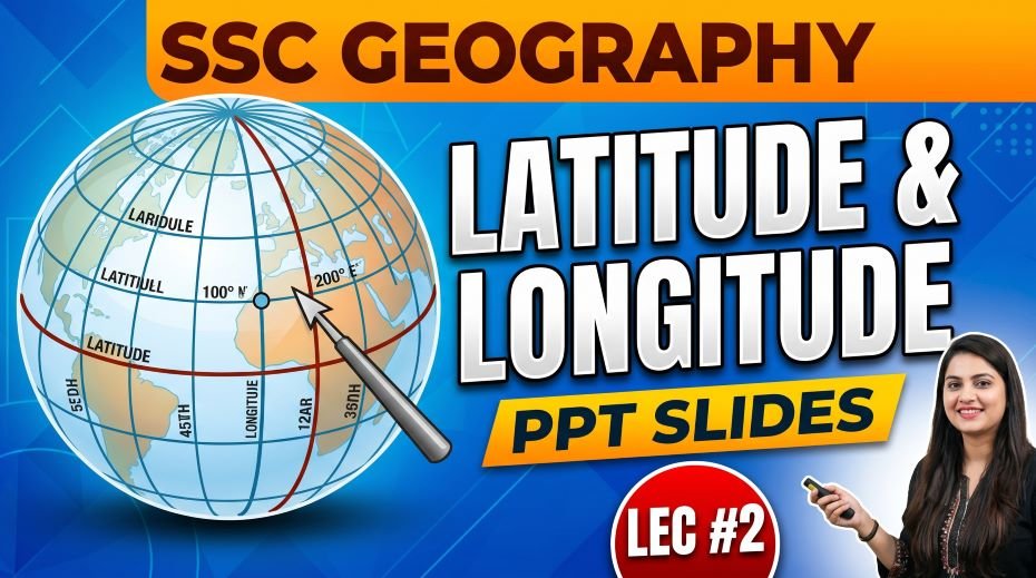
This article accompanies the SSC Geography Latitude and Longitude PPT Slides (LEC #2) – Serial #80 of the Complete Foundation Batch for All SSC Exams PPT Series on slideshareppt.net. With 91 slides, this is one of the most detailed lectures in the series, covering every concept from the basics of parallels and meridians to time zones, IST, the International Date Line, and India-specific latitude and longitude facts. Latitude and Longitude form the backbone of all geographical study and are among the most consistently and heavily tested topics in SSC CGL, SSC CHSL, SSC MTS, SSC GD Constable, and RRB Group D exams. This article gives you the complete theory, structured tables, MCQ practice, and a rapid revision cheat sheet – everything needed for a 100% score on this topic.
PPT Resource Overview
| Detail | Information |
| Lecture Number | LEC #2 (Geography Series) |
| Serial Number in Complete Batch | #80 |
| Subject | Geography – Latitude and Longitude (अक्षांश और देशांतर) |
| Series Name | Complete Foundation Batch for All SSC Exams (PPT Series) |
| Total Slides | 91 PPT Slides |
| File Size | 20 MB |
| Language | Hindi + English (Bilingual) |
| Format Available | Google Slides & Google Drive (PDF also available) |
| Website | www.slideshareppt.net |
| Target Exams | SSC CGL, SSC CHSL, SSC MTS, SSC GD Constable, RRB Group D |
| Suitable For | Students (self-study & marathon revision) and Teachers (classroom use) |
SSC Geography Latitude and Longitude PPT Slides (LEC #2)
Note: Above is PPT in GOOGLE SLIDES (HTML AND IFRAME COMBINATION) and if you wish to download the Complete SSC series (PPT slides), visit this Link – REDIRECT PAGE.
Master Timeline: Development of the Latitude-Longitude System
| Period | Milestone | Significance for SSC |
| ~600 BCE – Ancient Greece | Anaximander draws the first flat world map; no coordinate system yet | Origin of map-making concept |
| ~276–194 BCE | Eratosthenes divides the Earth into zones using parallel circles; calculates circumference | First scientific use of latitude concept |
| ~150 BCE – Hipparchus | Hipparchus proposes a grid of 360° for Earth – divides into latitudes and longitudes formally | First formal lat-long grid system |
| ~150 CE – Ptolemy | Ptolemy publishes Geographia – assigns coordinates to ~8,000 locations; introduces map projections | Foundation of coordinate-based cartography |
| 9th–13th Century | Arab geographers refine Ptolemy’s work; Al-Idrisi creates advanced coordinate-based world maps | Arab contribution to geography |
| 1569 – Mercator | Gerardus Mercator develops the Mercator Projection – straight lines for constant compass bearing | Most widely used map projection; SSC cartography topic |
| 1714 – Longitude Act (Britain) | British Parliament offers £20,000 prize for an accurate method to determine longitude at sea | Importance of longitude in navigation history |
| 1759 – Harrison’s Chronometer | John Harrison invents the marine chronometer H4 – accurate time-keeping solves the longitude problem at sea | How longitude and time are linked |
| 1851 | Greenwich Observatory established as the international reference for time (GMT – Greenwich Mean Time) | GMT origin – IST is derived from GMT |
| 1884 – Washington DC Conference | International Meridian Conference – Greenwich (0°) officially adopted as the Prime Meridian by 25 nations | Why Greenwich is 0° – most asked SSC fact |
| 1884 | The world is formally divided into 24 standard time zones of 15° each | Time zone concept – 1 hour per 15° longitude |
| 1947 – India Independence | India adopts IST at 82.5°E (GMT + 5:30) as its single national standard time | IST origin – very frequently tested |
| Post-1950s | GPS (Global Positioning System) uses latitude-longitude coordinates for satellite-based location | Modern application of lat-long |
| 1978 – GPS Launch | USA launches the first GPS satellites – lat-long becomes the global standard for navigation | GPS and lat-long for modern geography |
| Present Day | Google Maps, GIS platforms, ISRO Bhuvan, and mobile apps all use the lat-long coordinate system | Current Affairs + Geography |
What are Latitudes? – Complete Explanation
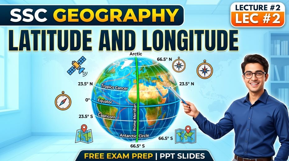
Latitudes are imaginary horizontal lines drawn on the Earth’s surface that run parallel to the Equator. They measure the angular distance of any point on Earth north or south of the Equator. The Equator itself is at 0° latitude, the North Pole is at 90°N, and the South Pole is at 90°S. Because all lines of latitude run parallel to each other, they are also called parallels.
Key Properties of Latitudes
- Direction: Run east-west (horizontal lines on a map)
- Shape: Circles parallel to the Equator – called parallels of latitude
- Range: 0° (Equator) to 90°N (North Pole) and 90°S (South Pole)
- Total number of latitudes: 181 (including 0° Equator, 90 in each hemisphere)
- Length: The Equator (0°) is the longest latitude; length decreases toward the poles
- Distance: Each degree of latitude = approximately 111 km on the ground
- Purpose: Used to measure north-south position and define climate zones
All Important Latitudes – Complete Reference Table
| Latitude | Degree | Also Known As | Key Facts & SSC Importance |
| Equator | 0° | Great Circle / 0° Parallel | Longest latitude line; divides Earth into N & S hemispheres; sun is directly overhead on equinoxes; 12-hour day year-round; maximum temperature zone |
| Tropic of Cancer | 23.5° N | Northern Tropic / Uttara Ayana Rekha | Sun directly overhead on June 21 (Summer Solstice); passes through India (8 states), Mexico, China, Egypt, Saudi Arabia; northern boundary of tropics |
| Tropic of Capricorn | 23.5° S | Southern Tropic / Dakshina Ayana Rekha | Sun directly overhead on December 22 (Winter Solstice); passes through Australia, Brazil, South Africa, Chile; southern boundary of tropics |
| Arctic Circle | 66.5° N | Northern Polar Circle | Midnight Sun in summer (June 21); Polar Night in winter; boundary of North Frigid Zone; passes through Norway, Sweden, Finland, Russia, Canada, Alaska, Greenland, Iceland |
| Antarctic Circle | 66.5° S | Southern Polar Circle | Midnight Sun in December 22; boundary of South Frigid Zone; encloses Antarctica |
| North Pole | 90° N | Boreal Pole | Northernmost point of Earth; 6 months continuous daylight (April–Sept); 6 months darkness (Oct–March); no landmass – Arctic Ocean |
| South Pole | 90° S | Austral Pole | Southernmost point; coldest place on Earth; located on Antarctic continent; Amundsen & Scott reached it in 1911 |
| 23.5°N to 23.5°S | Tropical Zone | Torrid Zone | Region receiving maximum solar energy; high temperatures year-round; tropical climate |
| 23.5° to 66.5° (both hemispheres) | Temperate Zone | Temperate Belt | Moderate climate; four distinct seasons; most populated zone on Earth |
| 66.5° to 90° (both hemispheres) | Frigid Zone | Polar Zone | Extreme cold; very long days and nights; sparse population |
Important Latitudes Passing Through India
| Latitude | Degree | States / Regions It Passes Through | Exam Importance |
| Tropic of Cancer | 23.5° N | Gujarat → Rajasthan → Madhya Pradesh → Chhattisgarh → Jharkhand → West Bengal → Tripura → Mizoram (8 states) | Very High – appears in almost every SSC paper |
| India’s Southern Tip | ~8° N | Indira Point (Great Nicobar Island) – southernmost point of India | High – extreme points of India |
| India’s Northern Tip | ~37° N | Indira Col (near Siachen, J&K) – northernmost point of India | High – extreme points of India |
| Latitudinal Extent | 8°4’N to 37°6’N | Entire span of India from south to north | High – frequently asked as MCQ |
Memory Trick: Tropic of Cancer Through 8 Indian States
Use this sentence to remember the 8 states from West to East:
“Gujarat Rajasthan Mein (MP) Chhattisgarh Jharkhand Wale Tukde Mein” – G R M C J W T M
- G – Gujarat
- R – Rajasthan
- M – Madhya Pradesh
- C – Chhattisgarh
- J – Jharkhand
- W – West Bengal
- T – Tripura
- M – Mizoram
What are Longitudes? – Complete Explanation
Longitudes are imaginary vertical lines drawn on the Earth’s surface that run from the North Pole to the South Pole. They measure the angular distance of any point east or west of the Prime Meridian (0°). Since all lines of longitude pass through both poles and meet at them, they are also called meridians. Unlike latitudes, all meridians are equal in length.
Key Properties of Longitudes
- Direction: Run north-south (vertical lines on a map)
- Shape: Semi-circles that meet at the North and South Poles – called meridians
- Range: 0° (Prime Meridian) to 180°E and 180°W (which are the same line – the IDL)
- Total number of longitudes: 360 (180 East + 180 West)
- Length: All meridians are equal in length (unlike latitudes which decrease toward poles)
- Distance: 1° of longitude = 111 km at the Equator; distance decreases toward the poles
- Purpose: Used to measure east-west position and calculate local time
- Key rule: Every 1° of longitude = 4 minutes difference in time; every 15° = 1 hour
All Important Longitudes – Complete Reference Table
| Longitude | Degree | Also Known As | Key Facts & SSC Importance |
| Prime Meridian | 0° | Greenwich Meridian / International Meridian | Passes through Greenwich, England; divides Earth into Eastern and Western Hemispheres; basis for all world time zones; established as global standard in 1884; also passes through France, Spain, Algeria, Mali, Burkina Faso, Ghana |
| International Date Line (IDL) | 180° | Anti-Meridian / Date Meridian | Opposite the Prime Meridian; zigzag path to avoid cutting through Russia, Kiribati, Fiji; crossing West to East removes a calendar day; crossing East to West adds a day; not a straight line – bends around Pacific island nations |
| Indian Standard Meridian | 82.5° E | IST Meridian / Mirzapur Meridian | Passes through Mirzapur, Uttar Pradesh; India’s standard time = GMT + 5 hours 30 minutes; chosen because 82.5° gives a clean offset (82.5 ÷ 15 = 5.5 hours); India uses a single time zone despite wide east-west extent |
| Eastern Hemisphere | 0° to 180° E | Eastern Half of Earth | Includes Asia, Australia, most of Africa, and Europe east of Greenwich |
| Western Hemisphere | 0° to 180° W | Western Half of Earth | Includes North America, South America, and western parts of Europe and Africa |
Time and Longitude – The Most Important Relationship
The relationship between time and longitude is one of the most tested concepts in SSC Geography. Every exam has at least one question on IST, time zones, or time calculation.
Core Rules
- Earth rotates 360° in 24 hours
- Therefore Earth rotates 15° per hour (360 ÷ 24 = 15)
- Therefore 1° of longitude = 4 minutes of time (60 min ÷ 15 = 4 min)
- Places east of the Prime Meridian are ahead in time (earlier sunrise)
- Places west of the Prime Meridian are behind in time (later sunrise)
- Every 15° east = 1 hour added to GMT; every 15° west = 1 hour subtracted from GMT
World Time Zones – Reference Table
| Country / Region | Longitude Used | Time Difference from GMT | Note |
| United Kingdom | 0° (Greenwich) | GMT / UTC (IST – 5:30) | Multiple time zones in overseas territories |
| India | 82.5° E | GMT + 5:30 (IST) | Single time zone for entire country |
| China | 120° E | GMT + 8:00 (CST) | Single time zone despite huge east-west spread |
| Japan | 135° E | GMT + 9:00 (JST) | East Asia – early morning sunrise |
| Russia | Multiple (30°E to 180°E) | GMT +2 to GMT +12 | 11 time zones – most in any single country |
| USA (Continental) | Multiple (75°W to 120°W) | GMT –5 to GMT –8 | 4 main time zones: Eastern, Central, Mountain, Pacific |
| Australia | 150° E (AEST) | GMT + 10:00 (AEST) | Multiple zones; half-hour offsets in some states |
| Pakistan | 67.5° E | GMT + 5:00 (PKT) | 30 minutes behind IST |
| Nepal | 82.5° E (approx.) | GMT + 5:45 (NPT) | Unique 45-minute offset; 15 min ahead of IST |
| Sri Lanka | 82.5° E | GMT + 5:30 (SLST) | Same time as IST |
| Bangladesh | 90° E | GMT + 6:00 (BST) | 30 minutes ahead of IST |
| Afghanistan | 67.5° E | GMT + 4:30 (AFT) | 45 minutes behind IST |
Indian Standard Time (IST) – Deep Dive
Why 82.5°E and Not 82° or 83°?
IST is based on 82.5°E longitude because this gives a clean, exact time offset. The calculation: 82.5° ÷ 15° per hour = 5.5 hours = 5 hours 30 minutes ahead of GMT. Using 82° would give 5 hours 28 minutes, and 83° would give 5 hours 32 minutes – neither is a clean round figure. The 82.5°E meridian was therefore selected to make IST exactly GMT + 5:30.
Which City/Place Does 82.5°E Pass Through?
The 82.5°E meridian passes through Mirzapur in Uttar Pradesh. This is the official reference point for Indian Standard Time. The National Physical Laboratory (NPL) in New Delhi is India’s official timekeeper and broadcasts IST signals.
Why Does India Have Only One Time Zone?
India spans from 68.7°E (Gujarat) to 97.25°E (Arunachal Pradesh) – a difference of about 28.5°, which theoretically means nearly 2 hours of natural time difference between east and west. Despite this, India has maintained a single time zone since independence for administrative simplicity and national unity. The eastern states (especially Assam and Arunachal Pradesh) experience sunrise much earlier than western states (Gujarat and Rajasthan), which is a frequently raised issue but has not resulted in a zone split.
| Parameter | Detail |
| IST Standard Meridian | 82.5°E longitude |
| Reference City | Mirzapur, Uttar Pradesh |
| Offset from GMT | GMT + 5 hours 30 minutes |
| India’s Westernmost Longitude | 68°7’E (Sir Creek, Gujarat) |
| India’s Easternmost Longitude | 97°25’E (Kibithu, Arunachal Pradesh) |
| Natural Time Difference (East vs West) | ~1 hour 54 minutes |
| Official Timekeeper of India | National Physical Laboratory (NPL), New Delhi |
| IST Adoption | 1947, at Indian Independence |
| Difference from Pakistan Time (PKT) | IST is 30 minutes ahead of PKT |
| Difference from Nepal Time (NPT) | IST is 15 minutes behind NPT |
| Difference from Bangladesh Time (BST) | IST is 30 minutes behind BST |
International Date Line (IDL) – Complete Explanation
The International Date Line (IDL) is an imaginary line that roughly follows the 180° meridian – the line exactly opposite the Prime Meridian on the globe. It marks the boundary between two consecutive calendar days. When you cross the IDL from east to west, you gain a day (move forward by one calendar day). When you cross from west to east, you lose a day (move back by one calendar day).
Why Does the IDL Zigzag?
The IDL does not follow the 180° meridian exactly because doing so would divide some countries, islands, and territories into two different calendar days. It bends significantly to ensure that Kiribati (Caroline Islands), Fiji, Tonga, Samoa, and parts of Russia all fall entirely on one side, avoiding the inconvenience of split dates within a single country or territory.
| Feature | Detail |
| Location | Approximately 180° longitude (in the Pacific Ocean) |
| Path | Zigzag – deviates from 180° to avoid splitting countries |
| Crossing West to East | Subtract one calendar day (traveller loses a day) |
| Crossing East to West | Add one calendar day (traveller gains a day) |
| Countries it avoids splitting | Kiribati, Fiji, Russia, Tonga, Samoa, New Zealand territories |
| Distance from Prime Meridian | Exactly opposite – 180° apart |
| Nature | Imaginary line – no physical existence on the ground |
| Legal Status | Not defined by any international treaty; agreed by convention |
| First country to see New Year | Kiribati (Line Islands) – westernmost side of IDL |
| Last country to see New Year | Baker Island and Howland Island (USA) – easternmost side of IDL |
Climate Zones Defined by Latitude
| Zone Name | Latitude Range | Climate Type | Key Features |
| Torrid Zone (Tropical) | 0° to 23.5° N & S | Hot and humid; tropical | Maximum solar radiation; tropical rainforests; monsoons; highest temperatures on Earth |
| North Temperate Zone | 23.5° N to 66.5° N | Moderate; four seasons | Most of Europe, USA, China, India (northern part); spring, summer, autumn, winter |
| South Temperate Zone | 23.5° S to 66.5° S | Moderate; four seasons | Southern South America, parts of Australia, New Zealand, South Africa |
| North Frigid Zone (Arctic) | 66.5° N to 90° N | Extremely cold; polar | Tundra climate; midnight sun; polar night; very sparse population |
| South Frigid Zone (Antarctic) | 66.5° S to 90° S | Extremely cold; polar | Antarctica; coldest and driest continent; ice sheets; scientific research stations |
The Coordinate System – Locating Any Point on Earth
Every point on Earth’s surface can be precisely located using its latitude and longitude coordinates together. This is the coordinate system that forms the basis of all modern maps, GPS navigation, GIS software, and satellite imagery.
How to Read Coordinates
- Latitude is always written first, followed by longitude
- Example: New Delhi is approximately 28.6°N, 77.2°E – 28.6° north of the Equator and 77.2° east of the Prime Meridian
- Mumbai: approximately 19.1°N, 72.9°E
- Chennai: approximately 13.1°N, 80.3°E
- Kolkata: approximately 22.6°N, 88.4°E
- Bangalore (Bengaluru): approximately 12.9°N, 77.6°E
also read: SSC Geography Introduction PPT Slides (LEC #1)
Coordinates of Important Indian and World Cities – SSC Reference Table
| City / Location | Latitude | Longitude | Country / State |
| New Delhi | 28.6° N | 77.2° E | India (National Capital) |
| Mumbai | 19.1° N | 72.9° E | India (Maharashtra) |
| Chennai | 13.1° N | 80.3° E | India (Tamil Nadu) |
| Kolkata | 22.6° N | 88.4° E | India (West Bengal) |
| Bengaluru | 12.9° N | 77.6° E | India (Karnataka) |
| Hyderabad | 17.4° N | 78.5° E | India (Telangana) |
| Mirzapur (IST Ref) | 25.1° N | 82.5° E | India (Uttar Pradesh) – Standard Meridian |
| Greenwich | 51.5° N | 0° | United Kingdom – Prime Meridian |
| Equator / 0°,0° | 0° | 0° | Point in Atlantic Ocean (Null Island) |
| Mt. Everest | 27.9° N | 86.9° E | Nepal–China border |
| Indira Point (Southernmost India) | ~6.7° N | ~93.8° E | Andaman & Nicobar Islands |
| Kibithu (Easternmost India) | ~28.0° N | ~97.4° E | Arunachal Pradesh |
| Sir Creek (Westernmost India) | ~23.6° N | ~68.2° E | Gujarat |
| London | 51.5° N | 0.1° W | United Kingdom |
| Beijing | 39.9° N | 116.4° E | China |
| Tokyo | 35.7° N | 139.7° E | Japan |
| Washington DC | 38.9° N | 77.0° W | United States |
| Sydney | 33.9° S | 151.2° E | Australia |
| Cairo | 30.1° N | 31.2° E | Egypt (near Tropic of Cancer) |
Difference Between Latitude and Longitude – Comparison Table
| Feature | Latitude | Longitude |
| Definition | Angular distance N or S of the Equator | Angular distance E or W of the Prime Meridian |
| Direction on map | Horizontal (east-west lines) | Vertical (north-south lines) |
| Other name | Parallels | Meridians |
| Reference line | Equator (0°) | Prime Meridian (0°) – Greenwich |
| Range | 0° to 90° (North and South) | 0° to 180° (East and West) |
| Total lines | 181 (including 0° Equator) | 360 (180 East + 180 West) |
| Length of lines | Decreases from Equator to poles | All equal in length (from pole to pole) |
| Shape of lines | Circles (parallel to each other) | Semi-circles (meet at poles) |
| Purpose | Determines N-S position and climate zone | Determines E-W position and local time |
| 1 degree distance | ~111 km (constant) | ~111 km at Equator; decreases toward poles |
| Key line (0°) | Equator | Prime Meridian (Greenwich) |
| Key line (23.5°) | Tropic of Cancer (N) / Capricorn (S) | No special significance at this longitude |
| Key line (66.5°) | Arctic / Antarctic Circle | No special significance at this longitude |
| Key line (90°) | North Pole / South Pole | No special significance (no special meridian) |
| Key line (180°) | Not applicable | International Date Line |
| Use in time calculation | No direct use | 1° = 4 min; 15° = 1 hour |
| SSC exam frequency | Very High – 3–5 questions per paper | Very High – 3–5 questions per paper |
Podcast-Style Q&A – Rapid Oral Revision
Q1: What is the Equator and why is it the most important latitude?
The Equator is the 0° latitude line that divides Earth equally into the Northern and Southern Hemispheres. It is the most important latitude because it is the longest parallel on Earth, receives the maximum solar energy year-round, and is the reference from which all other latitudes are measured. At the Equator, the length of day and night is always equal – 12 hours each – throughout the year.
Q2: What is the difference between the Tropic of Cancer and Tropic of Capricorn?
Both are at 23.5° from the Equator but in opposite hemispheres. The Tropic of Cancer is at 23.5°N and the Sun is directly overhead on June 21 (the Summer Solstice in the Northern Hemisphere). The Tropic of Capricorn is at 23.5°S and the Sun is directly overhead on December 22 (the Winter Solstice in the Northern Hemisphere, or Summer Solstice in the Southern Hemisphere). The area between these two lines is called the Tropics or Torrid Zone.
Q3: Why do all meridians of longitude meet at the poles?
Meridians are semi-circles that run from the North Pole to the South Pole. Because they all start at the North Pole and end at the South Pole, they physically converge and meet at these two points. This is why the distance represented by 1° of longitude is about 111 km at the Equator but becomes 0 km at the poles – all meridians are physically at the same point there.
Q4: Why was Greenwich chosen as the Prime Meridian?
Greenwich was chosen as the Prime Meridian at the International Meridian Conference held in Washington DC in 1884. At that time, Britain was the world’s dominant naval and colonial power, and Greenwich Observatory was already being used by a majority of the world’s ships for navigation. Adopting Greenwich as 0° was therefore the most practical global choice. 25 out of 41 nations voted in favour at the conference.
Q5: If IST is GMT + 5:30, and someone in London calls at 9:00 AM London time, what time is it in India?
If it is 9:00 AM GMT in London, then IST = 9:00 AM + 5 hours 30 minutes = 2:30 PM in India. This type of calculation is directly tested in SSC reasoning and GK sections. The formula is: IST = GMT + 5 hours 30 minutes. To convert IST to GMT: GMT = IST − 5 hours 30 minutes.
Q6: What happens when you cross the International Date Line?
The International Date Line at 180° marks the boundary between two consecutive calendar days. If you are travelling westward across the IDL (from the Americas toward Asia), you gain a calendar day – for example, you jump from Monday to Tuesday instantly. If you travel eastward across the IDL (from Asia toward the Americas), you lose a calendar day – for example, you go from Tuesday back to Monday. This is why Jules Verne’s character Phileas Fogg in Around the World in Eighty Days gained a day by travelling eastward.
Q7: Why does Nepal have a 45-minute offset from IST?
Nepal’s standard meridian is approximately 82.5°E to 87.5°E, and the Nepalese government chose GMT + 5:45 as its standard time. This gives Nepal a 15-minute difference from India (IST is GMT + 5:30). The unusual 45-minute offset exists because Nepal wanted a time distinct from both India and Bangladesh to assert its independent national identity, while still being close to Indian time for practical cross-border purposes.
30 MCQ Practice Questions – Latitude and Longitude
These questions are modelled on SSC CGL, CHSL, MTS, and GD Constable exam patterns. Answers follow at the end.
- Lines of latitude are also called:
A) Meridians B) Parallels C) Isobars D) Isotherms
- Lines of longitude are also called:
A) Parallels B) Isobars C) Meridians D) Isohalines
- The Equator is located at:
A) 23.5° N B) 66.5° N C) 0° D) 90° N
- The total number of latitudes on the globe is:
A) 90 B) 180 C) 181 D) 360
- The total number of longitudes on the globe is:
A) 90 B) 180 C) 181 D) 360
- Which is the longest latitude?
A) Tropic of Cancer B) Arctic Circle C) Equator D) Tropic of Capricorn
- All meridians of longitude are equal in:
A) Distance between them B) Length C) Width D) Temperature
- The Sun is directly overhead on the Tropic of Cancer on:
A) March 21 B) June 21 C) September 23 D) December 22
- The Sun is directly overhead on the Tropic of Capricorn on:
A) March 21 B) June 21 C) September 23 D) December 22
- The Prime Meridian passes through which observatory?
A) Paris B) Berlin C) Greenwich D) Cape Town
- The International Date Line is located at approximately:
A) 0° B) 90° E C) 180° D) 90° W
- Crossing the IDL from East to West results in:
A) Gaining a day B) Losing a day C) No change D) Gaining 12 hours
- India’s Standard Time is based on which meridian?
A) 75° E B) 80° E C) 82.5° E D) 90° E
- IST is ahead of GMT by:
A) 5 hours B) 5 hours 15 minutes C) 5 hours 30 minutes D) 6 hours
- The 82.5°E meridian passes through which city?
A) Varanasi B) Allahabad C) Mirzapur D) Lucknow
- How many degrees of longitude correspond to 1 hour of time?
A) 10° B) 12° C) 15° D) 20°
- How much time difference does 1° of longitude represent?
A) 1 minute B) 2 minutes C) 4 minutes D) 6 minutes
- The Tropic of Cancer passes through how many Indian states?
A) 6 B) 7 C) 8 D) 9
- Which of these states does the Tropic of Cancer NOT pass through?
A) Gujarat B) Bihar C) Jharkhand D) Mizoram
- The Arctic Circle is located at:
A) 23.5° N B) 45° N C) 66.5° N D) 90° N
- The region between the Tropic of Cancer and Tropic of Capricorn is called:
A) Frigid Zone B) Temperate Zone C) Torrid Zone D) Polar Zone
- Which country has the most time zones in the world?
A) USA B) Canada C) Russia D) China
- Nepal’s time zone (NPT) is ahead of GMT by:
A) 5:00 B) 5:15 C) 5:30 D) 5:45
- Bangladesh Standard Time (BST) is ahead of IST by:
A) 30 minutes B) 45 minutes C) 1 hour D) 15 minutes
- The International Meridian Conference that adopted Greenwich as 0° was held in:
A) 1851 B) 1884 C) 1900 D) 1920
- Which of the following is true about all meridians?
A) They are parallel to each other B) They are all equal in length C) They decrease in length toward the equator D) They run east-west
- Latitude measures distance:
A) East or West of Prime Meridian B) North or South of the Equator C) Above or below sea level D) East or West of IDL
- The Midnight Sun phenomenon is associated with which zone?
A) Torrid Zone B) Temperate Zone C) Frigid Zone (Polar) D) Equatorial Zone
- Which conference established the Prime Meridian at Greenwich?
A) Vienna Conference B) Paris Agreement C) International Meridian Conference D) London Accord
- The 0° longitude and 0° latitude intersect at a point in which ocean?
A) Pacific Ocean B) Indian Ocean C) Arctic Ocean D) Atlantic Ocean
Answer Key
| Q | Ans | Q | Ans | Q | Ans |
| 1 | B | 11 | C | 21 | C |
| 2 | C | 12 | A | 22 | C |
| 3 | C | 13 | C | 23 | D |
| 4 | C | 14 | C | 24 | A |
| 5 | D | 15 | C | 25 | B |
| 6 | C | 16 | C | 26 | B |
| 7 | B | 17 | C | 27 | B |
| 8 | B | 18 | C | 28 | C |
| 9 | D | 19 | B | 29 | C |
| 10 | C | 20 | C | 30 | D |
Rapid Revision Cheat Sheet – Latitude and Longitude
| Topic | Key Point to Remember |
| Latitudes (other name) | Parallels – run east-west, horizontal lines |
| Longitudes (other name) | Meridians – run north-south, vertical lines |
| Total latitudes | 181 (including 0° Equator) |
| Total longitudes | 360 (180E + 180W) |
| Equator | 0° – longest latitude – divides N & S hemispheres |
| Tropic of Cancer | 23.5°N – Sun overhead on June 21 – 8 Indian states |
| Tropic of Capricorn | 23.5°S – Sun overhead on December 22 |
| Arctic Circle | 66.5°N – Midnight Sun in summer |
| Antarctic Circle | 66.5°S – Southern equivalent |
| Torrid Zone | 0° to 23.5° N & S – maximum heat |
| Temperate Zone | 23.5° to 66.5° N & S – moderate climate, 4 seasons |
| Frigid Zone | 66.5° to 90° N & S – polar climate, extreme cold |
| Prime Meridian | 0° longitude – Greenwich, England – adopted 1884 |
| IDL | ~180° longitude – crossing W→E adds a day; E→W removes a day |
| IST Meridian | 82.5°E – Mirzapur, UP – IST = GMT + 5:30 |
| Time rule | 15° longitude = 1 hour; 1° longitude = 4 minutes |
| Tropic of Cancer states (W→E) | Gujarat, Rajasthan, MP, Chhattisgarh, Jharkhand, West Bengal, Tripura, Mizoram |
| Nepal time offset | GMT + 5:45 (NPT) – 15 min ahead of IST |
| Bangladesh time offset | GMT + 6:00 (BST) – 30 min ahead of IST |
| Pakistan time offset | GMT + 5:00 (PKT) – 30 min behind IST |
| 0°,0° intersection | Atlantic Ocean (called ‘Null Island’) |
| Length of 1° latitude | ~111 km (constant everywhere) |
| Length of 1° longitude | ~111 km at Equator; 0 km at poles |
| All meridians are | Equal in length (unlike parallels which decrease) |
| Hipparcus contribution | First to formally propose the 360° lat-long grid (~150 BCE) |
| Harrison’s Chronometer (1759) | Solved the problem of measuring longitude at sea using accurate time |
| Serial number of this PPT | #80 in the Complete Foundation Batch |
Conclusion
Latitude and Longitude is one of the most high-yield topics in SSC Geography and it rewards thorough preparation with direct marks. The 91-slide PPT (LEC #2, Serial #80) from the Complete Foundation Batch covers this topic in exceptional depth in bilingual Hindi + English format on slideshareppt.net.
From understanding the basic properties of parallels and meridians, to mastering IST calculations, IDL rules, climate zones, and the coordinates of important cities – every concept in this article directly maps to questions that appear in SSC CGL, CHSL, MTS, GD Constable, and RRB Group D exams. Study the comparison table between latitude and longitude, memorise the 8 states through which the Tropic of Cancer passes, and practice the 30 MCQs in this article to ensure complete command over this topic.
Bookmark this page alongside the PPT for your pre-exam revision. Use the Rapid Revision Cheat Sheet in the final days before your exam for a quick refresh of all key facts.