This article accompanies the SSC Geography Coastal Plains PPT (LEC #19) – Serial #98 of the Complete Foundation Batch for All SSC Exams PPT Series on slideshareppt.net. With 106 slides in bilingual Hindi + English format, this PPT covers India’s coastal geography in complete depth, from the Konkan and Malabar coasts to the Coromandel Coast, major ports, backwaters, deltas, and coastal lakes – all aligned to the SSC exam pattern.
India’s Coastal Plains are among the most economically and ecologically significant landforms in the country – supporting fishing, trade, agriculture, and dense populations along roughly 7,500 km of coastline. For SSC CGL, SSC CHSL, SSC MTS, SSC GD Constable, and RRB Group D exams, the Coastal Plains topic generates direct questions on sub-divisions, ports, lakes, lagoons, rivers, and the contrasts between the western and eastern coasts.
PPT Overview
| Detail | Information |
| Lecture Number | LEC #19 (Geography Series) |
| Serial Number in Complete Batch | #98 |
| Subject | Geography – Coastal Plains (तटीय मैदान) |
| Series Name | Complete Foundation Batch for All SSC Exams (PPT Series) |
| Total Slides | 106 PPT Slides |
| File Size | 30 MB |
| Language | Hindi + English (Bilingual) |
| Format Available | Google Slides & Google Drive (PDF also available) |
| Website | www.slideshareppt.net |
| Target Exams | SSC CGL, SSC CHSL, SSC MTS, SSC GD Constable, RRB Group D |
| Suitable For | Students (self-study & marathon revision) and Teachers (classroom use) |
SSC Geography Coastal Plains PPT (LEC #19)
Note: Above is PPT in GOOGLE SLIDES (HTML AND IFRAME COMBINATION) and if you wish to download the Complete SSC series (PPT slides), visit this Link – REDIRECT PAGE.
India’s Coastal Plains – Overview
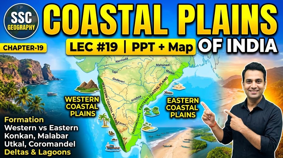
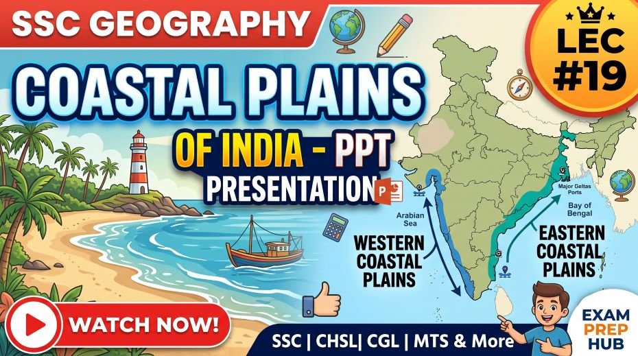
India’s coastal plains are narrow strips of low-lying land along both the eastern and western coasts, lying between the sea and the hills (Western or Eastern Ghats). India’s total coastline is 7,516.6 km including the islands. The mainland coastline alone is approximately 5,422 km. These plains are among the most densely populated regions of India and are crucial for agriculture, fishing, trade through major ports, and tourism. The western and eastern coastal plains differ markedly in width, river character, rainfall, and economic focus. The Western Coastal Plain is narrow and receives heavy orographic rainfall, while the Eastern Coastal Plain is broader and contains large river deltas.
Western vs Eastern Coastal Plains – Master Comparison Table
| Feature | Western Coastal Plain | Eastern Coastal Plain |
| Location | Between Western Ghats and Arabian Sea | Between Eastern Ghats and Bay of Bengal |
| Length | ~1,500 km (Gujarat to Kerala) | ~1,500 km (West Bengal to Tamil Nadu) |
| Width | Narrow – 10 to 25 km (widest in Gujarat) | Wider – 80 to 120 km in most places |
| Formation | Formed by faulting and submergence – the land dropped as the Western Ghats were uplifted | Formed by sediment deposition from eastward-flowing rivers (alluvial and deltaic plains) |
| Rivers | Short, fast, young rivers; no significant deltas; rivers flow directly into the Arabian Sea | Long, slow rivers forming large deltas: Mahanadi, Godavari, Krishna, Kaveri deltas |
| Rainfall | Very heavy – orographic rainfall from SW Monsoon on western slopes; Malabar Coast receives 3,000+ mm | Moderate – receives rainfall mainly from NE Monsoon (Oct–Dec); drier in summer |
| Coastal Lagoons | Kerala Backwaters – network of lagoons and brackish waterways; Vembanad Lake (longest lake in India) | Chilika Lake (Odisha) – largest coastal lagoon in India; Pulicat Lake (Andhra Pradesh-Tamil Nadu border) |
| Natural Harbours | Many natural harbours due to submerged coastline with inlets and rocky outcrops | Fewer natural harbours – coastline is straighter and sandy; mostly artificial/man-made ports |
| Major Ports | Mumbai (largest), Nhava Sheva (JNPT), Kandla, Kochi, Mangaluru, Mormugao (Goa), Marmagao | Chennai (Madras), Visakhapatnam, Paradip, Ennore (Kamarajar), Haldia, Tuticorin (V.O. Chidambaranar) |
| Agriculture | Coconut, spices (pepper, cardamom, cloves), rubber, rice, cashew; cash crops dominate | Rice (main crop), groundnut, tobacco, sugarcane; food crops dominate |
| Fisheries | Important fishing industry; Malabar Coast known for fish; sardines off Kerala coast | Large fishing industry; Chilika Lake supports inland fisheries; prawns and fish from Bay of Bengal |
| Economic Importance | Trade gateway to Middle East, Africa, and Europe; petroleum imports; container traffic | Trade gateway to SE Asia and East Asia; iron ore exports; industrial ports |
| Sub-divisions (N to S) | Gujarat Coast → Konkan (MH-Goa) → Kanara (Karnataka) → Malabar (Kerala) | Northern Circar (Odisha-AP) → Coromandel (AP-TN) |
Western Coastal Plain – Sub-divisions in Detail
| Sub-division | States | Extent | Key Features & SSC Facts |
| Gujarat Coast (Saurashtra-Kutch Coast) | Gujarat | Northern part of West Coast; Gulf of Kutch and Gulf of Khambhat | Longest coastline of any Indian state (~1,600 km); Rann of Kutch; Kandla Port (now renamed as Deendayal Port); widest part of the western coastal plain |
| Konkan Coast | Maharashtra and Goa | From Daman (Gujarat border) to Goa (~500 km) | Rocky coastline with inlets; well-defined sub-divisions; Mumbai – India’s largest port; Nhava Sheva (JNPT) – busiest container port in India; Goa’s Mormugao Port; narrow coastal strip |
| Kanara Coast (Karnataka Coast) | Karnataka | From Goa border to Mangaluru (~320 km) | Part of Western Ghats; important for fishing; Mangaluru (Mangalore) Port; laterite soils; cashew and coffee production |
| Malabar Coast | Kerala (mainly) + parts of Karnataka and Tamil Nadu | From Mangaluru to Kanyakumari (~550 km) | Heaviest rainfall on the west coast; Kerala Backwaters (lagoons and lakes); Kochi (Cochin) – major natural harbour; Vembanad Lake; coconut, rubber, spice cultivation; tourist area |
Eastern Coastal Plain – Sub-divisions in Detail
| Sub-division | States | Extent | Key Features & SSC Facts |
| Northern Circar (Coasts of Odisha and North AP) | Odisha, Northern Andhra Pradesh | From Ganga-Brahmaputra delta (West Bengal) to Krishna delta (~800 km) | Mahanadi and Godavari deltas; Paradip Port (Odisha); Chilika Lake (India’s largest coastal lagoon); Olive Ridley turtle nesting beaches at Rushikulya and Gahirmatha |
| Coromandel Coast (Southern Andhra Pradesh and Tamil Nadu) | Southern Andhra Pradesh, Tamil Nadu | From Krishna delta to Kanyakumari (~400 km) | Sandy coastline; Pulicat Lake; Chennai (Madras Port); Ennore (Kamarajar) Port; Tuticorin (V.O. Chidambaranar) Port; receives NE monsoon rainfall heavily in Oct-Nov |
Important Coastal Lakes and Lagoons of India
| Lake / Lagoon | Type | State | Area (approx.) | Key SSC Facts |
| Chilika Lake | Brackish water coastal lagoon | Odisha | ~1,100 sq km (varies seasonally) | Largest coastal lagoon in India; largest wetland in India; Ramsar Convention site; major fishery; habitat for Irrawaddy dolphins and migratory birds; drains into Bay of Bengal near Puri |
| Vembanad Lake | Brackish water lagoon / backwater lake | Kerala | ~2,033 sq km | Longest lake in India (~96 km long); part of Kerala Backwaters; Nehru Trophy Boat Race held on it; Kuttanad (below sea-level farming area) nearby; Kochi port is at its northern end |
| Pulicat Lake | Brackish water coastal lagoon | Andhra Pradesh and Tamil Nadu border | ~250–460 sq km (seasonal) | 2nd largest coastal lagoon in India; shared between Andhra Pradesh and Tamil Nadu; Sriharikota (ISRO launch centre) is the island separating it from the Bay of Bengal; flamingo habitat |
| Ashtamudi Lake | Backwater lake / estuary | Kerala | ~61 sq km | Second largest lake in Kerala (after Vembanad); Kollam (Quilon) district; important for backwater tourism; cashew nut processing |
| Kolleru Lake | Freshwater lake (between Godavari and Krishna deltas) | Andhra Pradesh | ~308 sq km | Largest freshwater lake in India (in terms of surface area); between Krishna and Godavari rivers; Ramsar Convention site; major bird sanctuary |
| Sasthamkotta Lake | Freshwater lake | Kerala | ~3.75 sq km | Largest freshwater lake in Kerala; Kollam district; source of drinking water |
| Loktak Lake | Freshwater lake with floating islands (phumdis) | Manipur | ~287 sq km (varies) | Largest freshwater lake in NE India; unique phumdis (floating biomass islands); Keibul Lamjao National Park (world’s only floating national park) is on it; Sangai deer (brow-antlered deer) found here |
Major Ports of India – Complete Reference Table
| Port | State | Coast | Type | Key SSC Facts |
| Mumbai Port | Maharashtra | West (Arabian Sea) | Natural harbour | Largest port by cargo in India; handles general cargo, petroleum; oldest major port on west coast |
| Jawaharlal Nehru Port (JNPT / Nhava Sheva) | Maharashtra | West (Arabian Sea) | Artificial (man-made) | Busiest container port in India; near Mumbai; handles most of India’s container traffic |
| Kandla Port (Deendayal Port) | Gujarat | West (Gulf of Kutch) | Natural harbour | Largest port by volume (cargo tonnage) – competes with JNPT; renamed Deendayal Port in 2017; important for import of petroleum and salt |
| Mormugao Port (Marmagao) | Goa | West (Arabian Sea) | Natural harbour | Major iron ore exporting port; handles Goan iron ore for export; historic port |
| Kochi Port (Cochin) | Kerala | West (Arabian Sea / Laccadive Sea) | Natural harbour (backwater inlet) | Best natural harbour on the west coast; major international container terminal; historic spice trade port |
| Mangaluru Port (New Mangalore) | Karnataka | West (Arabian Sea) | Artificial (man-made) | Handles petroleum products, fertilisers, granite |
| Chennai Port (Madras) | Tamil Nadu | East (Bay of Bengal) | Artificial (man-made) | 2nd busiest port by volume in India; oldest artificial port in India; handles automobiles, containers, coal |
| Kamarajar Port (Ennore) | Tamil Nadu | East (Bay of Bengal) | Corporate/Artificial | First corporate port in India; handles coal and petroleum; near Chennai; exclusive coal terminal |
| Visakhapatnam Port (Vizag) | Andhra Pradesh | East (Bay of Bengal) | Natural harbour | Deepest harbour in India; major port for iron ore, petroleum, coal; important naval base (Eastern Naval Command) |
| Paradip Port | Odisha | East (Bay of Bengal) | Artificial (man-made) | Major iron ore exporting port; at the mouth of Mahanadi River; handles coal imports |
| V.O. Chidambaranar Port (Tuticorin) | Tamil Nadu | East (Bay of Bengal / Gulf of Mannar) | Artificial (man-made) | Southern tip port; handles salt, coal, containers; close to Sri Lanka |
| Haldia Port (Syama Prasad Mookerjee Port) | West Bengal | East (Bay of Bengal / Hooghly River) | River port (satellite of Kolkata) | Handles petroleum, fertilisers, food grains; satellite port to Kolkata; Kolkata is India’s oldest and only major river port |
| Kolkata Port (Kolkata–Haldia) | West Bengal | East (Bay of Bengal / Hooghly River) | River port | India’s oldest major port; furthest inland major port (~150 km from sea); declining due to silting of Hooghly |
Kerala Backwaters – Special Topic
| Parameter | Detail |
| What are Backwaters? | Network of interconnected canals, rivers, lakes, and inlets formed parallel to the Arabian Sea coast in Kerala; mix of fresh and salt water (brackish water) |
| Length | ~900 km of backwater network |
| Formation | Formed by the accumulation of sand and sediment at the mouths of rivers, trapping seawater and creating lagoons and lakes behind the sand bars |
| Major Backwater Lakes | Vembanad Lake (longest lake in India – ~96 km), Ashtamudi Lake, Kayamkulam Lake, Paravur Lake |
| Economic Importance | Tourism (houseboat cruises); fishing; transport (boats); Kuttanad rice cultivation (below sea level – unique in India) |
| Nehru Trophy Boat Race | Famous snake boat race held annually on Vembanad Lake at Alappuzha (Alleppey) – major tourist attraction |
| Kuttanad | Area of paddy cultivation below sea level in Kerala – unique in India; part of the backwater region |
| Ramsar Sites in Kerala Backwaters | Vembanad-Kol Wetland and Ashtamudi Wetland are Ramsar Convention-listed wetlands |
| SSC Importance | Vembanad Lake as longest lake in India; Nehru Trophy Boat Race; Kuttanad below-sea-level farming; Kerala backwaters as major tourism destination |
Ramsar Wetland Sites on Indian Coastal Plains
| Ramsar Site | State | Type | Key SSC Fact |
| Chilika Lake | Odisha | Coastal lagoon / brackish | India’s first Ramsar site (1981); largest brackish water lagoon in India; Irrawaddy dolphin and flamingo habitat |
| Vembanad-Kol Wetland | Kerala | Backwater lake / lagoon | Largest Ramsar site in India by area; longest lake in India; includes Kuttanad below-sea-level farming |
| Kolleru Lake | Andhra Pradesh | Freshwater lake | Largest freshwater lake in India; between Krishna and Godavari delta; bird sanctuary |
| Ashtamudi Wetland | Kerala | Backwater estuary | Kollam district; backwater tourism; cashew region |
| Bhitarkanika Mangroves | Odisha | Mangrove forest / coastal wetland | Second largest mangrove ecosystem in India after Sundarbans; saltwater crocodile habitat |
| Pichavaram Mangroves | Tamil Nadu | Mangrove coastal wetland | Second largest mangrove forest in India by some measures; near Chidambaram; between two estuaries |
| Pulicat Lake | Andhra Pradesh-Tamil Nadu border | Coastal lagoon / brackish | 2nd largest brackish lagoon; flamingo habitat; Sriharikota island nearby |
also read: SSC Geography Physiographic Region of India PPT (LEC #18)
Major Deltas and Estuaries of India’s Coastal Plains
| River | Type of Mouth | Location | Key SSC Fact |
| Ganga-Brahmaputra | Delta (Sundarbans) | West Bengal (Bay of Bengal) | Largest delta in the world; Sundarbans – largest mangrove forest in the world; UNESCO World Heritage Site; Royal Bengal Tiger habitat |
| Mahanadi | Delta | Odisha (Bay of Bengal) | Forms a delta near Cuttack and Puri; Chilika Lake lies south of the Mahanadi delta |
| Godavari | Delta | Andhra Pradesh (Bay of Bengal) | Second largest river in peninsular India; large delta in AP; called ‘Dakshin Ganga’ (Ganga of the South) |
| Krishna | Delta | Andhra Pradesh (Bay of Bengal) | Forms a significant delta between Godavari and Kaveri deltas |
| Kaveri (Cauvery) | Delta | Tamil Nadu (Bay of Bengal) | Called ‘Dakshina Ganga’ or ‘Ganga of the South’; fertile Cauvery delta in Tamil Nadu; Kaveri water dispute between Karnataka and Tamil Nadu |
| Narmada | Estuary (not delta) | Gujarat (Gulf of Khambhat / Arabian Sea) | Flows through a rift valley; forms an estuary rather than a delta because it has a narrow steep-sided valley mouth; hard rock prevents delta formation |
| Tapi (Tapti) | Estuary | Gujarat (Gulf of Khambhat) | Like Narmada, flows westward through a rift valley; forms an estuary |
| Indus | Delta | Pakistan (Arabian Sea) | Most of the Indus delta is in Pakistan (Sindh province); only small part of the Indus system flows through India now |
Mangrove Forests on India’s Coastal Plains
| Parameter | Detail |
| What are Mangroves? | Salt-tolerant (halophytic) trees and shrubs that grow in coastal intertidal zones – between land and sea; can grow in both fresh and salt water |
| Location in India | Found along both coasts – mainly in deltas, estuaries, and tidal flats |
| Total Mangrove Cover in India | ~4,992 sq km (approx.); about 3% of world’s mangrove area |
| Largest Mangrove Forest | Sundarbans – West Bengal and Bangladesh – world’s largest mangrove forest; UNESCO World Heritage Site; Bengal Tiger habitat |
| 2nd Largest in India | Bhitarkanika (Odisha) – Ramsar site; saltwater crocodile habitat |
| Other Important Mangroves | Pichavaram (Tamil Nadu), Coringa (Andhra Pradesh), Malabar Coast (Kerala), Gujarat coast (Gulf of Kutch, Gulf of Khambhat) |
| Ecological Role | Protect coastline from erosion and storms; breeding ground for fish and shellfish; carbon sequestration; habitat for aquatic birds and animals |
| Threats | Land reclamation, pollution, aquaculture (prawn farming), climate change and sea-level rise |
| SSC Importance | Sundarbans as largest mangrove globally; Bhitarkanika as Ramsar site; mangroves as coastal protection |
Study Roadmap – Coastal Plains for SSC Exams
| Step | Topic | Key Points to Cover | SSC Priority |
| 1 | Basic Overview | India’s coastline = 7,516.6 km; mainland = 5,422 km; western vs eastern basic distinction | High |
| 2 | Western Coastal Plain | 4 sub-divisions (Gujarat, Konkan, Kanara, Malabar); narrow width; heavy rainfall; no deltas; natural harbours | Very High |
| 3 | Eastern Coastal Plain | 2 sub-divisions (Northern Circar, Coromandel); wider; river deltas; NE monsoon; fewer natural harbours | Very High |
| 4 | Coastal Lakes | Chilika (largest coastal lagoon), Vembanad (longest lake in India), Pulicat, Kolleru (largest freshwater lake) | Very High |
| 5 | Major Ports | West: Mumbai, JNPT (busiest container), Kandla (largest volume), Kochi; East: Chennai, Vizag (deepest), Paradip | Very High |
| 6 | Kerala Backwaters | Vembanad Lake, Nehru Trophy Boat Race, Kuttanad, backwater network, Ramsar sites | High |
| 7 | Deltas vs Estuaries | Deltas: Ganga-Brahmaputra (largest), Godavari, Krishna, Kaveri; Estuaries: Narmada, Tapi (rift valley rivers) | High |
| 8 | Mangroves | Sundarbans (largest world), Bhitarkanika (Ramsar), Pichavaram, Coringa | High |
| 9 | Ramsar Sites | Chilika (first Ramsar site in India, 1981), Vembanad-Kol (largest), Kolleru, Ashtamudi | Medium |
Quick Fact Table – Coastal Plains for SSC Exams
| Question / Fact | Answer |
| India’s total coastline length (with islands) | 7,516.6 km |
| India’s mainland coastline | ~5,422 km |
| State with longest coastline | Gujarat (~1,600 km) |
| State with shortest coastline | Goa (~101 km) |
| Largest coastal lagoon in India | Chilika Lake, Odisha (~1,100 sq km) |
| Longest lake in India | Vembanad Lake, Kerala (~96 km long) |
| Largest freshwater lake in India | Kolleru Lake, Andhra Pradesh |
| 2nd largest coastal lagoon in India | Pulicat Lake (AP-TN border) |
| India’s first Ramsar site (1981) | Chilika Lake, Odisha |
| Largest Ramsar site in India by area | Vembanad-Kol Wetland, Kerala |
| Largest mangrove forest in the world | Sundarbans (West Bengal and Bangladesh) |
| 2nd largest mangrove forest in India | Bhitarkanika, Odisha |
| World’s largest delta | Ganga-Brahmaputra (Sundarbans) delta |
| Rivers forming estuaries (not deltas) | Narmada and Tapi – flow through rift valleys; hard rock prevents delta formation |
| ‘Dakshin Ganga’ / ‘Ganga of the South’ | Godavari River (for peninsular rivers) |
| Largest port in India by cargo volume | Kandla (Deendayal Port), Gujarat |
| Busiest container port in India | Jawaharlal Nehru Port (JNPT / Nhava Sheva), Maharashtra |
| Deepest natural harbour in India | Visakhapatnam (Vizag), Andhra Pradesh |
| Best natural harbour on the west coast | Kochi (Cochin), Kerala |
| First corporate port in India | Kamarajar Port (Ennore), Tamil Nadu |
| Oldest artificial port in India | Chennai (Madras) Port |
| Only major river port in India | Kolkata Port (on Hooghly River, ~150 km from sea) |
| Nehru Trophy Boat Race location | Vembanad Lake, Alappuzha (Alleppey), Kerala |
| Kuttanad is famous for | Paddy cultivation below sea level – unique in India; Kerala backwaters |
| Sriharikota (ISRO launch centre) is on which island? | The island between Pulicat Lake and Bay of Bengal, Andhra Pradesh |
| Western Ghats passes connecting coast to Deccan | Thal Ghat, Bhor Ghat (Maharashtra), Pal Ghat Gap (Kerala-TN) |
| Coromandel Coast location | East coast – southern Andhra Pradesh and Tamil Nadu |
| Malabar Coast location | West coast – Kerala (and parts of Karnataka and Tamil Nadu) |
| Konkan Coast location | West coast – Maharashtra and Goa |
| Kanara Coast location | West coast – Karnataka |
Q&A:
Q1: Why is the Western Coastal Plain narrow while the Eastern Coastal Plain is wide?
The Western Coastal Plain is narrow – generally 10 to 25 km – because it was formed primarily by the faulting and submergence of land as the Western Ghats were uplifted, leaving a steep escarpment close to the coast with little room for plains development. The rivers on the west coast are short, fast, and directly discharge into the Arabian Sea without depositing much sediment to widen the plain. The Eastern Coastal Plain, in contrast, is much wider – 80 to 120 km in places – because it was formed primarily by the alluvial and deltaic deposition from the major eastward-flowing peninsular rivers (Mahanadi, Godavari, Krishna, Kaveri). These rivers carry enormous amounts of sediment and build wide deltas as they approach the Bay of Bengal, gradually widening the coastal plain over millions of years.
Q2: Why do the Narmada and Tapi form estuaries instead of deltas?
Most Indian rivers that empty into the sea form deltas – fan-shaped deposits of sediment at the river mouth. Narmada and Tapi are exceptions because they flow westward through rift valleys – fault-bounded valleys created by geological faulting where the land between the faults dropped. The rift valleys of the Narmada and Tapi are cut through hard Deccan Plateau rocks with steep, narrow valley sides that prevent the rivers from spreading their load sideways to build a delta. Instead, the rivers enter the sea (Gulf of Khambhat in Gujarat) in a narrow funnel shape, creating estuaries where tidal action and strong currents prevent sediment from building up. The hard rock floor of the valley further prevents the kind of lateral spreading needed for delta formation.
Q3: What makes Chilika Lake significant in Indian Geography?
Chilika Lake in Odisha is the largest coastal lagoon in India and the largest wetland ecosystem in India. It is a brackish water lagoon – a mix of salt and fresh water – separated from the Bay of Bengal by a narrow sand spit. It was India’s first Ramsar Convention site, designated in 1981, recognising its international importance as a wetland habitat. Chilika Lake is home to the Irrawaddy dolphin (a rare freshwater dolphin species), supports enormous populations of migratory birds during winter (hundreds of thousands of flamingos, pelicans, and other species), and provides livelihoods to thousands of fisherfolk. It is one of the most asked wetland facts in SSC Geography, particularly the question about India’s largest coastal lagoon and first Ramsar site.
Q4: Why is Visakhapatnam called India’s deepest natural harbour?
Visakhapatnam (Vizag) on the Andhra Pradesh coast is described as India’s deepest natural harbour because its port basin is naturally deep enough to accommodate very large oceangoing vessels including oil tankers and bulk carriers without the need for extensive dredging. The deep water close to shore is a result of the steep submarine topography off the Coromandel Coast at this location. This deep-water capability makes Visakhapatnam strategically valuable – it is also the headquarters of India’s Eastern Naval Command and handles large volumes of iron ore exports, petroleum imports, and naval vessel operations. By comparison, Kolkata’s port (also a natural harbour in historical terms) has become increasingly difficult to use for large ships due to silting of the Hooghly River.
Q5: What is the Sundarbans and why is it geographically unique?
The Sundarbans is the world’s largest mangrove forest, spanning the delta of the Ganga and Brahmaputra rivers across West Bengal (India) and Bangladesh. It is a UNESCO World Heritage Site and one of the most ecologically complex areas on Earth – a mosaic of tidal creeks, mudflats, and mangrove islands. The Sundarbans is geographically unique because it sits on the world’s largest delta – the Ganga-Brahmaputra-Meghna delta, sometimes called the Ganges Delta – formed by the combined deposition of three massive river systems. The mangrove ecosystem here protects the coast from cyclones and tidal surges from the Bay of Bengal, functions as a massive carbon sink, and provides habitat for the Royal Bengal Tiger, saltwater crocodile, estuarine dolphins, and hundreds of bird species.
Q6: What are the differences between the Konkan, Kanara, and Malabar coasts?
The Konkan Coast covers Maharashtra and Goa – roughly from Daman in the north to the Goa-Karnataka border. It is characterised by a rocky, irregular coastline with sea cliffs, small bays, and inlets, and receives heavy monsoon rainfall. Mumbai, JNPT, and Mormugao Port are on this stretch. The Kanara Coast (Karnataka) extends from the Goa border to Mangaluru, also receiving heavy rainfall but being somewhat less urbanised. The Malabar Coast covers Kerala from Mangaluru to Kanyakumari and is the most distinctive – it receives the heaviest rainfall on the entire Indian coast (over 3,000 mm in many areas), has the famous Kerala Backwaters (Vembanad Lake, Ashtamudi Lake), and Kochi’s natural harbour. The Malabar Coast is India’s spice coast historically, having attracted Arab, Chinese, and European traders for centuries.
Q7: Why is Kuttanad in Kerala geographically unique?
Kuttanad, located in Kerala’s backwater region around Alappuzha district, is known as the ‘Rice Bowl of Kerala’ and is geographically unique because it is one of the very few places in the world where farming is conducted below sea level. The paddy fields of Kuttanad lie approximately 1.2 to 3 metres below sea level – separated from the surrounding Vembanad Lake and backwaters by bunds (embankments) that keep the saltwater out during the growing season. Farmers pump water out of the fields to plant and harvest rice. This below-sea-level farming system has been practised for centuries and was recognised by the FAO (Food and Agriculture Organization) as a Globally Important Agricultural Heritage System (GIAHS). It is a frequently referenced unique geographical fact in SSC Environment and Geography questions.
Rapid Revision Cheat Sheet – Coastal Plains of India
| Topic | Key Point |
| Total coastline (with islands) | 7,516.6 km |
| Mainland coastline | ~5,422 km |
| Longest coastline state | Gujarat (~1,600 km) |
| Shortest coastline state | Goa (~101 km) |
| Western coast: width | Narrow (10–25 km); no major deltas; natural harbours |
| Eastern coast: width | Wider (80–120 km); major river deltas; fewer natural harbours |
| West coast sub-divisions (N to S) | Gujarat → Konkan (MH-Goa) → Kanara (Karnataka) → Malabar (Kerala) |
| East coast sub-divisions (N to S) | Northern Circar (Odisha-AP) → Coromandel (AP-TN) |
| Largest coastal lagoon in India | Chilika Lake, Odisha (~1,100 sq km) |
| Longest lake in India | Vembanad Lake, Kerala (~96 km long) |
| Largest freshwater lake in India | Kolleru Lake, Andhra Pradesh |
| 2nd largest coastal lagoon | Pulicat Lake (AP-TN border) |
| India’s first Ramsar site (1981) | Chilika Lake, Odisha |
| Largest Ramsar site in India | Vembanad-Kol Wetland, Kerala |
| Largest mangrove forest (world) | Sundarbans – West Bengal and Bangladesh |
| 2nd largest mangrove in India | Bhitarkanika, Odisha |
| World’s largest delta | Ganga-Brahmaputra delta (Sundarbans) |
| Rivers forming estuaries not deltas | Narmada and Tapi (rift valley rivers; hard rock) |
| Dakshin Ganga | Godavari River |
| Largest port (cargo volume) | Kandla (Deendayal Port), Gujarat |
| Busiest container port | JNPT (Nhava Sheva), Maharashtra |
| Deepest natural harbour | Visakhapatnam, Andhra Pradesh |
| Best natural harbour (west coast) | Kochi, Kerala |
| First corporate port | Kamarajar Port (Ennore), Tamil Nadu |
| Oldest artificial port | Chennai (Madras) Port |
| Only major river port in India | Kolkata Port (Hooghly River) |
| Nehru Trophy Boat Race | Vembanad Lake, Alappuzha, Kerala |
| Kuttanad | Below-sea-level paddy farming – Kerala – GIAHS recognition |
| Sriharikota (ISRO) | Island between Pulicat Lake and Bay of Bengal, AP |
| Serial number of this PPT | #98 in the Complete Foundation Batch |
Conclusion
Coastal Plains of India is a topic that rewards focused, specific preparation – knowing which lake is the largest, which port is the deepest, why certain rivers form estuaries instead of deltas, and the exact sub-division names of the western and eastern coasts directly translates into marks in SSC and RRB exams. The combination of coastal geography, major ports, backwaters, deltas, lagoons, Ramsar sites, and mangroves makes this one of the most fact-dense chapters in Indian Geography.
The SSC Geography Coastal Plains PPT (LEC #19), Serial #98, available at slideshareppt.net in bilingual Hindi + English format across 106 slides, is the complete visual companion to this article. Study the master comparison table, the ports table, and the coastal lakes table carefully. Use the Rapid Revision Cheat Sheet in your final week before the exam to ensure every key fact is locked in for reliable scoring.