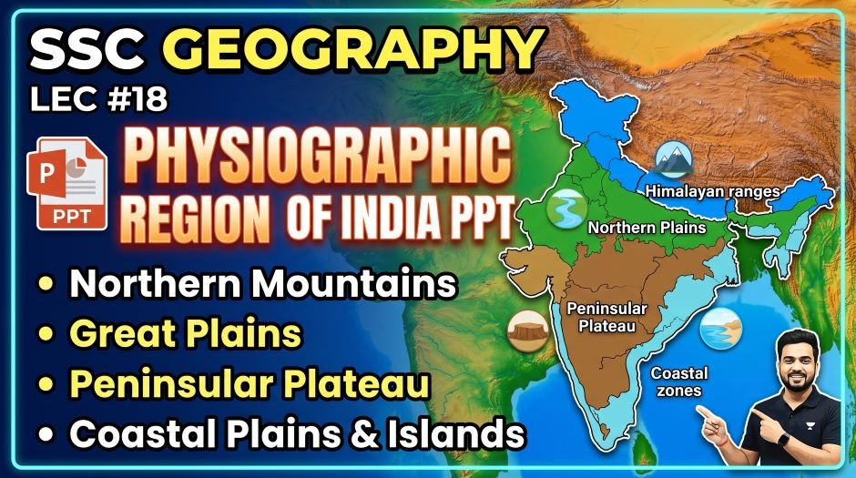
This article accompanies the SSC Geography Physiographic Region of India PPT (LEC #18) – Serial #97 of the Complete Foundation Batch for All SSC Exams PPT Series on slideshareppt.net. With 176 slides – the largest lecture in the series – and 64 MB in bilingual Hindi + English format, this PPT covers India’s physical geography in extraordinary depth. This article provides the complete structured theory for all six physiographic divisions, aligned to the SSC exam pattern.
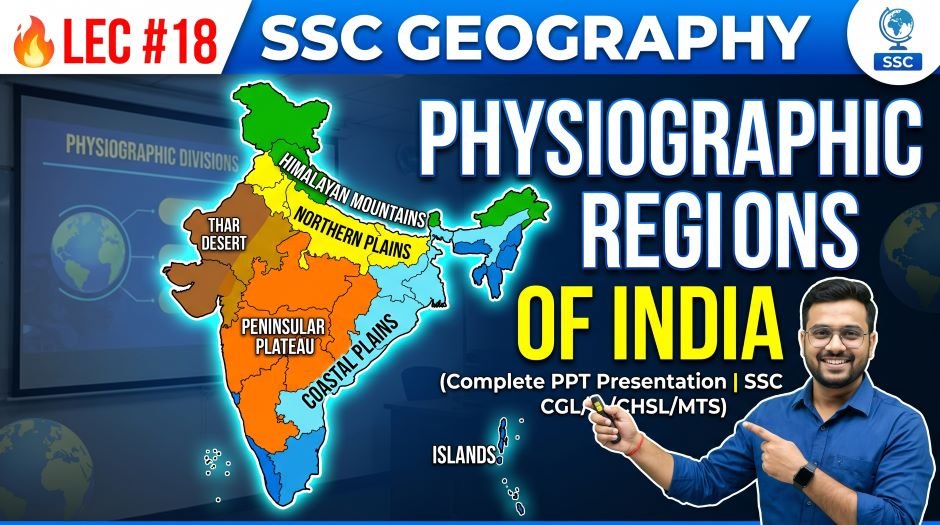
India’s physical landscape is divided into six major physiographic regions – each with a unique geological origin, landform character, economic significance, and set of SSC exam facts. From the towering Himalayas and the vast Northern Plains to the ancient Peninsular Plateau and the dynamic Coastal Plains, the physiographic divisions of India underpin almost every other topic in Indian Geography including rivers, climate, soil, agriculture, and natural disasters.
PPT Resource Overview
| Detail | Information |
| Lecture Number | LEC #18 (Geography Series) |
| Serial Number in Complete Batch | #97 |
| Subject | Geography – Physiographic Region of India (भारत का भौगोलिक क्षेत्र) |
| Series Name | Complete Foundation Batch for All SSC Exams (PPT Series) |
| Total Slides | 176 PPT Slides (largest lecture in the series) |
| File Size | 64 MB |
| Language | Hindi + English (Bilingual) |
| Format Available | Google Slides & Google Drive (PDF also available) |
| Website | www.slideshareppt.net |
| Target Exams | SSC CGL, SSC CHSL, SSC MTS, SSC GD Constable, RRB Group D |
| Suitable For | Students (self-study & marathon revision) and Teachers (classroom use) |
SSC Geography Physiographic Region of India PPT (LEC #18)
Note: Above is PPT in GOOGLE SLIDES (HTML AND IFRAME COMBINATION) and if you wish to download the Complete SSC series (PPT slides), visit this Link – REDIRECT PAGE.
Six Major Physiographic Divisions of India – Master Overview Table
India’s physical landscape is traditionally classified into six physiographic divisions. Each division has a distinct geological origin, terrain character, climate, and resource profile. Together they cover the entire subcontinent from the high Himalayas in the north to the island territories in the south.
| Division | Area (approx.) | % of India’s Area | Location | Key Character |
| The Himalayan Mountains | ~5,00,000 sq km | ~15% | Northern and northeastern boundary | Youngest fold mountains; highest peaks; source of major rivers; perennial snow |
| The Northern Plains (Indo-Gangetic Plain) | ~7,00,000 sq km | ~21% | North-central India | Most fertile agricultural land; alluvial deposits; densely populated; cradle of civilisation |
| The Peninsular Plateau | ~16,00,000 sq km | ~48% | South and central India | Oldest landmass; hard crystalline rocks; rich in minerals; Deccan Traps in parts |
| The Thar Desert (Indian Desert) | ~1,75,000 sq km | ~5% | Northwestern India (Rajasthan, Gujarat) | |
| The Coastal Plains | ~3,00,000 sq km | ~9% | Eastern and western coastlines | |
| The Islands | ~8,249 sq km | ~0.2% | Bay of Bengal and Arabian Sea | Andaman & Nicobar (Bay of Bengal); Lakshadweep (Arabian Sea) |
Division 1: The Himalayan Mountains
The Himalayas are the youngest, highest, and most active mountain system on Earth. They were formed by the collision of the Indian Plate with the Eurasian Plate approximately 50 million years ago – a process that continues today, causing the Himalayas to still be rising. The Himalayas stretch approximately 2,500 km from Nanga Parbat in the west (Pakistan-administered Kashmir) to Namcha Barwa in the east (Arunachal Pradesh), and are approximately 250–300 km wide.
Three Parallel Ranges of the Himalayas
| Range | Hindi Name | Altitude | Key Features | Highest Peaks |
| Greater Himalayas (Himadri) | महान हिमालय | Average 6,000 m; max 8,848.86 m | Perennial snow and glaciers; all peaks above 8,000 m are here; highest and northernmost range | Everest (8,848.86 m), K2 (8,611 m), Kangchenjunga (8,586 m), Lhotse, Makalu, Dhaulagiri, Manaslu, Cho Oyu, Nanga Parbat, Annapurna |
| Lesser Himalayas (Himachal) | हिमाचल / मध्य हिमालय | 1,000–4,500 m | Hill stations; fruit cultivation; major passes; forests; middle range | Mussoorie, Shimla, Darjeeling, Nainital, Ooty (hill stations here); Pirpanjal Range, Dhauladhar Range, Mahabharat Range |
| Outer Himalayas (Shivalik) | शिवालिक / उप हिमालय | 300–1,500 m | Southernmost range; terai belt at foothills; formed by erosional deposits; duns (valleys) between Shivalik and Middle Himalayas | Siwaliks are low hills; Dehradun (capital of Uttarakhand) is in Doon Valley (a dun) |
Important Himalayan Passes
| Pass | State / Region | Connects | Key SSC Fact |
| Nathu La | Sikkim | India and China (Tibet) | Reopened for trade in 2006; important Indo-China trade route; at ~4,310 m elevation |
| Bum La | Arunachal Pradesh | India and China (Tibet) | Near Tawang; strategic border pass |
| Shipki La | Himachal Pradesh | India and China (Tibet); Sutlej River flows through | Sutlej enters India through this pass |
| Rohtang Pass | Himachal Pradesh | Manali to Lahaul-Spiti valley | ~3,978 m; on Manali-Leh Highway; Atal Tunnel (Rohtang Tunnel) now bypasses it |
| Baralacha La | Himachal Pradesh / Ladakh | Manali–Leh Highway across Himalayan crest | ~4,890 m; on main Leh highway |
| Chang La | Ladakh | Near Pangong Lake – Leh to Pangong Tso | ~5,360 m; one of the world’s highest motorable roads |
| Khardung La | Ladakh | Leh to Siachen Glacier region and Nubra Valley | ~5,359 m; claimed to be one of the world’s highest motorable roads |
| Zoji La | J&K / Ladakh border | Srinagar to Leh (Kashmir Valley to Ladakh) | ~3,528 m; critical gateway between Kashmir and Ladakh; often blocked in winter |
| Banihal Pass / Jawahar Tunnel | J&K | Jammu to Srinagar | ~2,832 m; Jawahar Tunnel allows year-round access |
| Lipulekh Pass | Uttarakhand | India and China (Tibet); Kailash-Mansarovar yatra route | Source of Kali River; Kalapani territorial dispute |
| Mana Pass | Uttarakhand | India and China (Tibet); near Badrinath | Near the source of Saraswati River (tributary of Alaknanda) |
| Jelep La | Sikkim | India and China (Tibet); Chumbi Valley route | Historical trade route |
| Diphu Pass | Arunachal Pradesh | India, China, and Myanmar trijunction area | Near the eastern extremity of India |
Himalayan Sub-regions from West to East
| Sub-region | States / Territory | Key Features |
| Punjab Himalaya | Himachal Pradesh, J&K, Ladakh | Between Indus and Sutlej rivers; includes Pirpanjal, Dhauladhar ranges; Rohtang Pass |
| Kumaon Himalaya | Uttarakhand | Between Sutlej and Kali rivers; Nanda Devi (2nd highest peak in India at 7,816 m); Milam and Gangotri glaciers; Corbett National Park |
| Nepal Himalaya | Shared with Nepal | Largest section; contains Everest (8,848.86 m), Annapurna, Dhaulagiri; Mount Kanchenjunga partly on India-Nepal border |
| Assam Himalaya | Sikkim and Arunachal Pradesh | Between Kosi and Dihang rivers; Kangchenjunga (8,586 m, on India-Nepal border); Nathu La, Bum La passes |
Division 2: The Northern Plains (Indo-Gangetic Plain)
The Northern Plains are the most fertile and densely populated region of India, formed by the alluvial deposits of three major river systems – the Indus (and its tributaries), the Ganga (and its tributaries), and the Brahmaputra. These plains extend about 3,200 km from east to west and are approximately 150–300 km wide. They lie between the Himalayas to the north and the Peninsular Plateau to the south.
| Sub-division | States | Key Features | SSC Importance |
| Punjab Plain (Indus Plain) | Punjab, Haryana (India); Punjab (Pakistan) | Irrigated by 5 tributaries of the Indus (Jhelum, Chenab, Ravi, Beas, Sutlej); Doab regions; highly fertile; ‘Granary of India’ | Punjab = ‘Land of Five Rivers’; doab means land between two rivers; Green Revolution centred here |
| Ganga Plain | Uttar Pradesh, Bihar, West Bengal, parts of Haryana, Rajasthan | Largest part of the plains; Ganga-Yamuna Doab is the most fertile; Terai belt at Himalayan foothills; highest density of population | UP has most of the Gangetic plain; Prayagraj (Sangam of Ganga+Yamuna+Saraswati); densest agricultural region |
| Brahmaputra Plain (Assam Valley) | Assam | Brahmaputra River valley; wide floodplain; frequent floods; fertile but difficult terrain; Kaziranga National Park | One-horned rhino habitat; Majuli – world’s largest river island; vulnerable to floods and earthquakes |
Types of Alluvial Deposits in the Northern Plains
| Type | Description | Location | SSC Key Fact |
| Bhabar | Narrow belt (8–16 km wide) at the foothills of the Himalayas; coarse pebbles and boulders; streams disappear underground here | At the base of the Shivalik Hills | Rivers sink underground; tree roots can reach water; not suitable for cultivation |
| Terai | Marshy, forested belt south of Bhabar; rivers reappear from underground; dense vegetation; high rainfall | South of Bhabar; north UP, Bihar, West Bengal foothills | Dense forests; wildlife sanctuaries (Jim Corbett, Dudhwa); once a malarial zone; now cleared for agriculture |
| Bangar (Old Alluvium) | Older alluvium on higher ground above flood plains; well-drained; contains nodules of calcium carbonate called Kankar | Upland terraces away from river channels | Less fertile than Khadar; Kankar nodules; reddish colour in some areas |
| Khadar (New Alluvium) | Newer alluvium deposited annually by river floods; highly fertile; renewed soil nutrients every year | Floodplains and lower terraces close to river channels | Most fertile type; renewed regularly; grey-yellowish colour; ideal for agriculture |
Division 3: The Peninsular Plateau
The Peninsular Plateau is the oldest and most stable landmass in India – part of the ancient Gondwana supercontinent. It is composed of hard, crystalline rocks (granite, gneiss, basalt) and covers approximately 48% of India’s total area. The plateau is broadly triangular, with its apex pointing southward toward Cape Comorin (Kanyakumari). It is bounded by the Aravalli Range in the northwest, the Vindhya and Satpura ranges in the north, the Eastern Ghats in the east, and the Western Ghats in the west.
Major Sub-divisions of the Peninsular Plateau
| Sub-division | Location | Key Features | SSC Importance |
| Central Highlands | North of the Narmada river; south of the Indo-Gangetic plain | Includes Malwa Plateau, Bundelkhand, Baghelkhand; rivers flow northward into the Ganga system | Malwa Plateau in MP/Rajasthan; Chambal ravines; black cotton soil in parts |
| Deccan Plateau | South of the Narmada; triangular; between Western and Eastern Ghats | Formed by ancient lava flows (Deccan Traps basalt); slopes eastward; peninsular rivers flow eastward into Bay of Bengal | Deccan Traps formed 65 million years ago; fertile Regur (black cotton) soil; richest mineral-bearing region |
| Chota Nagpur Plateau | Jharkhand, Chhattisgarh, Odisha, West Bengal | Part of the Deccan Plateau; rich in coal, iron ore, manganese, bauxite, mica; Damodar river basin | Called ‘Ruhr of India’; richest mineral region; heavy industries (Jamshedpur, Bokaro, Rourkela) |
| Northeast Highlands (Shillong Plateau) | Meghalaya, Assam, Mizoram | Separate from main plateau; Shillong Plateau; Garo, Khasi, Jaintia hills; Cherrapunji/Mawsynram – highest rainfall | Distinctly separated from Deccan Plateau by Brahmaputra Valley |
also read: SSC Geography Location of India PPT Slides (LEC #17)
The Western Ghats (Sahyadri)
| Parameter | Detail |
| Other Name | Sahyadri Mountains |
| Extent | From the Tapti River (Gujarat-Maharashtra border) in the north to Kanyakumari in the south – ~1,600 km |
| States | Gujarat, Maharashtra, Goa, Karnataka, Kerala, Tamil Nadu |
| Average Height | 900–1,600 m; highest point is Anamudi (2,695 m) in Kerala |
| Highest Peak | Anamudi (2,695 m) – Kerala – highest peak in peninsular India and south of the Himalayas |
| UNESCO Status | UNESCO World Heritage Site (2012) – one of world’s 8 ‘hottest biodiversity hotspots’ |
| Rainfall | Western slopes receive very heavy rainfall (orographic rainfall from the SW Monsoon); eastern slopes (leeward) are dry – rain shadow effect |
| Passes | Thal Ghat (Mumbai-Nashik), Bhor Ghat (Pune-Mumbai), Pal Ghat Gap (Kerala-Tamil Nadu) |
| Rivers originating | Godavari, Krishna, Kaveri (flow eastward to Bay of Bengal); Narmada and Tapi flow westward |
| SSC Importance | Anamudi as highest peninsular peak; biodiversity hotspot; orographic rainfall; passes connecting Deccan to coast |
The Eastern Ghats
| Parameter | Detail |
| Extent | From Mahanadi delta (Odisha) in the north to Nilgiri Hills (Tamil Nadu) in the south – ~1,750 km (discontinuous) |
| States | Odisha, Andhra Pradesh, Tamil Nadu (mostly) |
| Average Height | ~600 m; lower and more eroded than Western Ghats |
| Highest Peak | Mahendragiri (1,501 m) in Odisha/Andhra Pradesh |
| Key Feature | Discontinuous; cut by rivers (Mahanadi, Godavari, Krishna, Kaveri) flowing eastward; coastal plain between Ghats and sea |
| Rainfall | Receive rainfall from the Northeast Monsoon; drier than Western Ghats |
| SSC Importance | Discontinuous vs Western Ghats continuous; much lower; Eastern Ghats cut by rivers |
Comparison: Western Ghats vs Eastern Ghats
| Feature | Western Ghats | Eastern Ghats |
| Continuity | Continuous (unbroken) mountain wall | Discontinuous – cut by rivers |
| Height | Higher (avg 900–1,600 m) | Lower (avg ~600 m) |
| Highest peak | Anamudi (2,695 m) | Mahendragiri (1,501 m) |
| Rainfall pattern | Western slopes – very heavy monsoon rain; Eastern slopes – rain shadow (dry) | Receive rain from NE Monsoon |
| Location relative to peninsula | Western edge of Deccan Plateau | Eastern edge of Deccan Plateau |
| UNESCO status | World Heritage Site (2012) | Not a UNESCO World Heritage Site |
| Direction of rivers | Short rivers flowing west to Arabian Sea from Western Ghats; main rivers flow east from plateau | Major rivers cut through and flow to Bay of Bengal |
Division 4: The Thar Desert (Indian Desert)
| Parameter | Detail |
| Other Name | Great Indian Desert; Marusthali (‘Land of Death’ in Rajasthani) |
| Location | Rajasthan (mainly); parts of Gujarat, Punjab, and Haryana |
| Area | ~1,75,000 sq km (approx); extends into Pakistan (Cholistan Desert) |
| Type | Hot desert; hot and arid; extreme temperatures |
| Rainfall | Less than 250 mm annually; some parts under 100 mm |
| Sand Dunes | Extensive sand dunes (locally called ‘Dhoro’); parabolic, barchan, and longitudinal dunes |
| Rivers | Luni River – only significant river; seasonal; drains into the Rann of Kutch |
| Lake | Sambhar Lake – India’s largest inland saltwater lake; Rajasthan |
| Rock Desert | Rocky areas (Hamada) mixed with sandy (Erg) regions; not uniformly sandy |
| Vegetation | Sparse; thorny shrubs, cacti, khejri tree (Rajasthan’s state tree), grasses |
| Wildlife | Great Indian Bustard (critically endangered; Rajasthan’s state bird), Blackbuck, Indian Wolf, Desert Fox |
| Aravalli Range | The Aravalli Mountains (NW-SE direction) separate the Thar from the Gangetic plains; act as barrier to further desert spread |
| Economic Significance | Solar energy potential (Rajasthan leads India in solar power); Canal Irrigation (Indira Gandhi Canal / Rajasthan Canal from Harike Barrage) |
| SSC Importance | Largest hot desert in India; Sambhar Lake; Luni River; Indira Gandhi Canal; Great Indian Bustard |
Division 5: The Coastal Plains
India’s coastal plains are narrow strips of land between the sea and the Western Ghats/Eastern Ghats. They differ significantly between the western and eastern coasts in terms of width, rainfall, river character, and economic importance.
| Feature | Western Coastal Plain | Eastern Coastal Plain |
| Location | Between Western Ghats and Arabian Sea | Between Eastern Ghats and Bay of Bengal |
| States | Gujarat, Maharashtra, Goa, Karnataka, Kerala | Odisha, Andhra Pradesh, Tamil Nadu |
| Width | Narrow (10–25 km) | Wider (100–120 km); broader and more even |
| River type | Short, fast, young rivers – no deltas; mainly flow directly into the sea | Long, slow rivers forming large deltas (Mahanadi, Godavari, Krishna, Kaveri) |
| Rainfall | Very heavy (orographic) on western slope; Malabar Coast receives 3,000+ mm | Receives NE monsoon rain; less overall than west coast |
| Backwaters (Lagoons) | Kerala Backwaters (Vembanad Lake etc.) – extensive network of lagoons and waterways | Chilika Lake (Odisha) – India’s largest coastal lagoon; Pulicat Lake (AP-TN border) |
| Ports | Mumbai, Kandla, Kochi, Nhava Sheva, Mormugao (Goa), Mangaluru, Marmagao | Chennai, Visakhapatnam, Paradip, Ennore (Kamarajar), Haldia |
| Sub-divisions | Konkan Coast (MH-Goa), Kanara Coast (Karnataka), Malabar Coast (Kerala) | Northern Circar (Odisha-AP), Coromandel Coast (AP-TN) |
| Agriculture | Coconut, spices, rice, rubber, cashew; fishing important | Rice (major), groundnut, tobacco, fishing |
Division 6: The Islands
| Feature | Andaman & Nicobar Islands | Lakshadweep Islands |
| Location | Bay of Bengal (northeast Indian Ocean) | Arabian Sea (southwest off Kerala coast) |
| Capital / HQ | Port Blair | Kavaratti |
| Number of Islands | ~572 (only ~38 inhabited) | 36 islands (all small; only ~10 inhabited) |
| Total Area | ~8,249 sq km (largest island group) | ~32 sq km (smallest UT by area) |
| Type of Islands | Continental origin – part of a submerged mountain range (Myanmar-Andaman fold mountains); mainly forested hills | Coral origin – coral atolls and reefs built on undersea volcanic platform |
| Active Volcano | Barren Island – India’s only active volcano; in the Andaman Sea | No volcanoes |
| Dormant Volcano | Narcondam Island | Not applicable |
| Southernmost point of India | Indira Point (Great Nicobar) – ~6°45’N | Not India’s southernmost |
| Northernmost island | Landfall Island (North Andaman) | Amini (northernmost of Lakshadweep) |
| Separation | Ten Degree Channel separates the Andaman Islands from the Nicobar Islands | Eight Degree Channel separates Lakshadweep from Maldives |
| Religion majority | Hinduism (majority in Andaman); indigenous Jarawa, Onge, Sentinelese tribes | Islam (majority in Lakshadweep) – India’s only Muslim-majority UT |
| Ecosystem | Tropical rainforest; mangroves; coral reefs; rich biodiversity | Coral reefs; lagoons; no freshwater rivers; coconut palms |
| Key Wildlife | Saltwater crocodile, Dugong, Leatherback turtle, Nicobar Megapode | Green sea turtle, Coral fish varieties |
| SSC Importance | Indira Point; Barren Island (active volcano); Cellular Jail (Port Blair); 10 Degree Channel | Smallest UT; coral islands; 8 Degree Channel; Muslim majority |
Quick Fact Table – Physiographic Regions of India for SSC
| Question / Fact | Answer |
| How many physiographic divisions does India have? | Six – Himalayas, Northern Plains, Peninsular Plateau, Thar Desert, Coastal Plains, Islands |
| Which division covers the largest area? | Peninsular Plateau (~48% of India’s total area) |
| Most fertile division | Northern Plains (Indo-Gangetic Plain) |
| Youngest mountain range in India | The Himalayas – still rising due to ongoing plate collision |
| Oldest landmass in India | Peninsular Plateau – part of the ancient Gondwana supercontinent |
| Three ranges of the Himalayas (N to S) | Himadri (Greater) → Himachal (Lesser) → Shivalik (Outer) |
| Highest peak in India | Kangchenjunga (8,586 m) – on India-Nepal border – in Sikkim |
| Highest peak in India entirely within Indian territory | Kangchenjunga is on the border; Nanda Devi (7,816 m, Uttarakhand) is highest peak entirely in India |
| Highest peak in Peninsular India (south of Himalayas) | Anamudi (2,695 m) – Kerala – in Western Ghats |
| Western Ghats highest peak | Anamudi (2,695 m) – Kerala |
| Eastern Ghats highest peak | Mahendragiri (1,501 m) – Odisha/Andhra Pradesh |
| Duns are associated with which Himalayan range? | Shivalik (Outer Himalayas) – valleys between Shivalik and Lesser Himalayas |
| Dehradun (Doon Valley) is an example of | A ‘dun’ – valley between Shivalik and Himachal ranges |
| Types of alluvium in Northern Plains (new to old) | Bhabar → Terai → Bangar → Khadar |
| Most fertile alluvial deposit | Khadar (new alluvium) – renewed annually by flood deposits |
| Kankar nodules are found in which alluvium? | Bangar (old alluvium) – calcium carbonate nodules |
| Chota Nagpur Plateau is called | ‘Ruhr of India’ – richest mineral region |
| Regur soil is derived from | Deccan Traps basaltic lava – highly fertile; ideal for cotton |
| India’s largest inland saltwater lake | Sambhar Lake – Rajasthan – in the Thar Desert |
| Luni River drains into | Rann of Kutch – it is a seasonal river of the Thar Desert |
| India’s largest coastal lagoon | Chilika Lake – Odisha – in Eastern Coastal Plain |
| Western coastal plain sub-divisions (N to S) | Konkan (MH-Goa) → Kanara (Karnataka) → Malabar (Kerala) |
| Eastern coastal plain sub-divisions (N to S) | Northern Circar (Odisha-AP) → Coromandel (AP-TN) |
| Pal Ghat Gap significance | A major pass/break in the Western Ghats; connects Kerala with Tamil Nadu |
| India’s only active volcano | Barren Island – Andaman & Nicobar Islands |
| Ten Degree Channel separates | Andaman Islands from the Nicobar Islands |
| Eight Degree Channel separates | Lakshadweep Islands from Maldives |
| Origin of Andaman & Nicobar Islands | Continental origin – submerged fold mountains |
| Origin of Lakshadweep Islands | Coral origin – coral atolls built on volcanic platform |
| UNESCO heritage status of Western Ghats | UNESCO World Heritage Site since 2012 – one of world’s biodiversity hotspots |
| Indira Gandhi Canal (Rajasthan Canal) originates from | Harike Barrage, Punjab – irrigates Thar Desert region of Rajasthan |
Q&A:
Q1: Why is the Peninsular Plateau called the oldest landmass of India?
The Peninsular Plateau is part of the ancient Gondwana supercontinent – the massive southern supercontinent that began breaking apart approximately 200 million years ago. The rocks of the plateau are among the oldest on Earth, composed of hard crystalline formations like granite and gneiss that have remained relatively stable and undisturbed for hundreds of millions of years. Unlike the Himalayas, which are geologically very young and still rising, the Peninsular Plateau is geologically stable – it has no active tectonic uplift and its rocks are ancient remnants of some of Earth’s earliest crustal formations. This stability makes it rich in minerals including coal, iron ore, bauxite, and manganese, all of which have accumulated over geological time without being disrupted by tectonic activity.
Q2: What is the difference between Khadar and Bangar alluvium in the Northern Plains?
Khadar and Bangar are two types of alluvial deposits in the Northern Plains distinguished by their age and fertility. Khadar is the newer alluvium deposited annually by rivers during flood season – it occupies the active floodplains and lower terraces close to river channels, and because it is replenished with fresh mineral-rich sediment every year, it is the most fertile soil in India. Bangar is the older alluvium found on slightly higher ground above the floodplains – it is not regularly renewed by floods, is better drained, and contains hardened calcium carbonate nodules called Kankar, which reduce its fertility compared to Khadar. Most of the most productive agricultural land in Uttar Pradesh and Bihar occupies Khadar zones.
Q3: Why is the Western Ghats called a continuous range while the Eastern Ghats are discontinuous?
The Western Ghats form an almost unbroken escarpment running approximately 1,600 km along the western edge of the Deccan Plateau from the Tapti River in the north to Kanyakumari in the south. This continuity creates a nearly unbroken barrier that forces the southwest monsoon winds to rise and deposit heavy orographic rainfall on the western slopes, while the eastern slopes remain in the rain shadow. The Eastern Ghats, by contrast, have been cut through and broken into discontinuous sections by the major eastward-flowing peninsular rivers – the Mahanadi, Godavari, Krishna, and Kaveri – which cross through the Ghats creating wide valleys and gaps. This is why the Eastern Ghats appear as a series of isolated hill ranges rather than a continuous wall.
Q4: What makes the Chota Nagpur Plateau the ‘Ruhr of India’?
The Chota Nagpur Plateau, covering parts of Jharkhand, Chhattisgarh, Odisha, and West Bengal, is called the ‘Ruhr of India’ in reference to Germany’s Ruhr Valley – Europe’s most important industrial region. The Chota Nagpur Plateau is the richest mineral-bearing region in India, with massive deposits of coal (Jharia, Dhanbad), iron ore (Singhbhum), manganese, bauxite, mica, and copper all concentrated in a relatively small area. This mineral wealth supported the development of major heavy industries including Tata Steel in Jamshedpur (India’s first steel plant), Bokaro Steel Plant, and Rourkela Steel Plant, making this region the industrial heartland of India – directly comparable to Germany’s Ruhr Valley in terms of its role in national industrial output.
Q5: What are Himalayan Passes and why are they strategically important?
Himalayan Passes are natural gaps or routes through the Himalayan mountain wall that allow movement between India and its northern neighbours – China (Tibet), Nepal, and Bhutan. Because the Himalayas form an almost impenetrable barrier along India’s northern frontier, these passes are of enormous strategic, military, and trade importance. Nathu La in Sikkim, reopened for trade in 2006, is a key India-China trade route. Zoji La in J&K is the lifeline connecting the Kashmir Valley to Ladakh and must be defended for national security. Khardung La and Chang La in Ladakh provide access to the Siachen Glacier region and the Line of Actual Control (LAC) with China. Historically, many of these passes were used for ancient Silk Road trade and for pilgrimages (Kailash-Mansarovar through Lipulekh Pass in Uttarakhand).
Q6: How does the Thar Desert affect India’s climate and what holds it in place?
The Thar Desert in northwestern India (mainly Rajasthan) receives less than 250 mm of rainfall annually in most parts, making it one of the world’s most populated desert regions. The desert’s extreme heat during summer (temperatures exceeding 50°C) creates a strong low-pressure zone that actually helps draw the southwest monsoon northward into India – the thermal low over Rajasthan effectively acts as a magnet that pulls moisture-laden Arabian Sea air deep into the subcontinent. The Aravalli Range, running northwest-to-southeast across Rajasthan, acts as a natural barrier that prevents the desert from spreading eastward into the Gangetic plain. Without the Aravallis, much of Uttar Pradesh and Madhya Pradesh might be vulnerable to desertification – making this ancient, highly eroded mountain range ecologically critical despite its modest height.
Q7: What is the difference between Andaman & Nicobar Islands and Lakshadweep in terms of their physical origin?
The Andaman and Nicobar Islands are continental islands – they are the exposed peaks of a submerged mountain range that extends southward from Myanmar’s Arakan Mountains through the Andaman Sea. They are composed of sedimentary and volcanic rocks, have hilly terrain with dense tropical rainforest, and include Barren Island (India’s only active volcano). The Lakshadweep Islands, in contrast, are coral islands – atolls built up over millions of years by coral organisms growing on a shallow submarine volcanic platform. They are very low-lying (highest point only about 4–5 m above sea level), composed of coral sand and rock, and are extremely vulnerable to sea-level rise from climate change. This fundamental geological difference – continental mountain origin vs coral atoll origin – determines everything from their terrain and ecology to their vulnerability to climate change.
Rapid Revision Cheat Sheet – Physiographic Regions of India
| Topic | Key Point |
| Six physiographic divisions | Himalayas, Northern Plains, Peninsular Plateau, Thar Desert, Coastal Plains, Islands |
| Largest division by area | Peninsular Plateau (~48% of India’s area) |
| Youngest mountain range | Himalayas – still rising; formed ~50 million years ago |
| Oldest landmass | Peninsular Plateau – Gondwana origin; stable ancient rocks |
| Three Himalayan ranges (N to S) | Himadri (Greater) → Himachal (Lesser) → Shivalik (Outer) |
| Duns | Valleys between Shivalik and Himachal ranges; e.g. Dehradun (Doon Valley) |
| Highest peak in India (overall) | K2 (8,611 m) is in Pakistan-administered territory; Kangchenjunga (8,586 m) on India-Nepal border |
| Highest peak entirely in India | Nanda Devi (7,816 m) – Uttarakhand |
| Highest peninsular peak | Anamudi (2,695 m) – Kerala – Western Ghats |
| Alluvium types (foothills to plains) | Bhabar → Terai → Bangar (old alluvium, Kankar) → Khadar (new, most fertile) |
| Most fertile alluvium | Khadar – renewed annually by floods |
| Chota Nagpur Plateau | ‘Ruhr of India’ – richest mineral region – coal, iron, bauxite, mica |
| Deccan Traps | Ancient basaltic lava – formed ~65 million years ago – source of Regur soil |
| Western Ghats | Continuous; 1,600 km; Anamudi (2,695 m); UNESCO Heritage 2012 |
| Eastern Ghats | Discontinuous; cut by rivers; Mahendragiri (1,501 m) |
| Thar Desert rivers | Luni River (seasonal) → Rann of Kutch |
| Sambhar Lake | India’s largest inland saltwater lake – Rajasthan (Thar Desert) |
| Indira Gandhi Canal | Irrigates Thar Desert – originates from Harike Barrage, Punjab |
| Western Coastal plain divisions | Konkan (MH-Goa) → Kanara (Karnataka) → Malabar (Kerala) |
| Eastern Coastal plain divisions | Northern Circar (Odisha-AP) → Coromandel (AP-TN) |
| India’s largest coastal lagoon | Chilika Lake – Odisha |
| Kerala backwaters (Vembanad Lake) | Western coastal lagoon – largest lagoon in India by area |
| Andaman origin | Continental – submerged fold mountains; hilly and forested |
| Lakshadweep origin | Coral atolls – low-lying; vulnerable to sea-level rise |
| Ten Degree Channel | Separates Andaman Islands from Nicobar Islands |
| Eight Degree Channel | Separates Lakshadweep from Maldives |
| India’s only active volcano | Barren Island – A&N Islands |
| Lakshadweep religion majority | Islam – only Muslim-majority UT in India |
| Great Indian Bustard | State bird of Rajasthan; critically endangered; found in Thar Desert |
| Serial number of this PPT | #97 in the Complete Foundation Batch |
Conclusion
Physiographic Regions of India is the most comprehensive single topic in Indian Geography – and this lecture (176 slides, Serial #97) reflects that scope. Every SSC and RRB paper draws from this topic repeatedly: the Himalayan passes, the alluvium types of the Northern Plains, the mineral wealth of Chota Nagpur Plateau, Anamudi as the highest peninsular peak, the contrast between Western and Eastern Ghats, Sambhar Lake, and the island origin types are all direct, predictable exam questions.
The SSC Geography Physiographic Region of India PPT (LEC #18), available at slideshareppt.net in bilingual Hindi + English format, is the most detailed resource in the Foundation Batch. Pair this article with the PPT, focus on the comparison tables (Western vs Eastern Ghats, Khadar vs Bangar, Andaman vs Lakshadweep), and use the Rapid Revision Cheat Sheet in the final days before your exam to lock in these facts for reliable scoring.