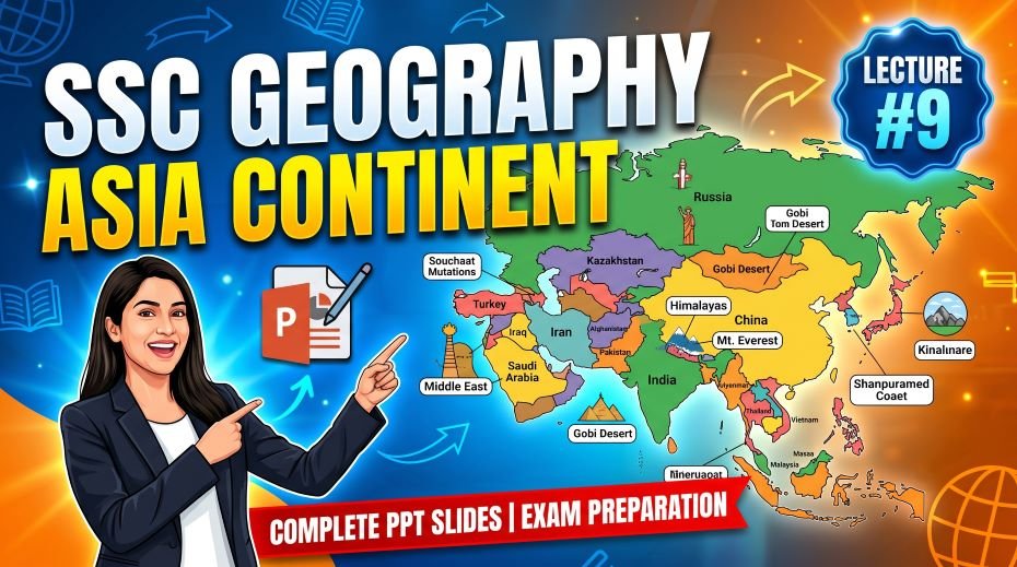
This article accompanies the SSC Geography Asia Continent PPT Slides (LEC #9) – Serial #87 of the Complete Foundation Batch for All SSC Exams PPT Series on slideshareppt.net. With 80 slides in bilingual Hindi + English format, this PPT covers Asia in complete depth. This article provides the full structured theory, timeline, comparison tables, MCQs, and a rapid revision cheat sheet, all aligned to the SSC exam pattern. Asia is the largest and most populous continent on Earth, home to Mount Everest, the Himalayas, and over half of the world’s population – making it the single most important continent for SSC CGL, SSC CHSL, SSC MTS, SSC GD Constable, and RRB Group D General Awareness sections, especially since India itself is part of Asia. From the world’s highest mountains and largest countries to the most populous nations and major rivers, Asia offers the densest concentration of high-yield geography facts in the entire syllabus.
PPT Resource Overview
| Detail | Information |
| Lecture Number | LEC #9 (Geography Series) |
| Serial Number in Complete Batch | #87 |
| Subject | Geography – Asia Continent (एशिया महाद्वीप) |
| Series Name | Complete Foundation Batch for All SSC Exams (PPT Series) |
| Total Slides | 80 PPT Slides |
| File Size | 20 MB |
| Language | Hindi + English (Bilingual) |
| Format Available | Google Slides & Google Drive (PDF also available) |
| Website | www.slideshareppt.net |
| Target Exams | SSC CGL, SSC CHSL, SSC MTS, SSC GD Constable, RRB Group D |
| Suitable For | Students (self-study & marathon revision) and Teachers (classroom use) |
SSC Geography Asia Continent PPT Slides (LEC #9)
Note: Above is PPT in GOOGLE SLIDES (HTML AND IFRAME COMBINATION) and if you wish to download the Complete SSC series (PPT slides), visit this Link – REDIRECT PAGE.
Master Timeline: Asia – Civilizations, Empire, and Modern Nations
| Period | Event / Milestone | SSC Exam Relevance |
| ~3300 BCE | Indus Valley Civilisation emerges in present-day Pakistan and northwest India | Earliest South Asian civilisation |
| ~2070 BCE | Xia Dynasty traditionally marks the beginning of Chinese dynastic history | Origin of Chinese civilisation |
| ~1500 BCE | Vedic Period begins in India – Vedas composed; foundation of Hindu philosophy | Vedic civilisation in India |
| 563 BCE | Gautama Buddha born in Lumbini (modern Nepal) – founder of Buddhism | Buddhism origin – very frequently asked |
| 6th century BCE | Confucius born in China – founder of Confucianism, shapes East Asian philosophy | Confucianism origin |
| 330 BCE | Alexander the Great’s campaigns reach into Central and South Asia | Alexander’s eastern campaigns |
| 7th century CE | Islam spreads rapidly across the Middle East, Persia, and Central Asia | Spread of Islam in Asia |
| 1206–1526 | Delhi Sultanate rules large parts of the Indian subcontinent | Delhi Sultanate – Indian medieval history |
| 1526 | Mughal Empire founded by Babur in India | Mughal Empire origin |
| 1206–1368 | Mongol Empire under Genghis Khan and successors becomes largest contiguous land empire in history | Mongol Empire – largest land empire fact |
| 1600 | British East India Company established, begins trade and later colonial control in India | Origin of British presence in India |
| 1853 | Commodore Perry forces Japan to open to foreign trade, ending centuries of isolation | Japan’s opening to the world |
| 1947 | India and Pakistan gain independence from British rule; Partition occurs | Indian independence – most asked SSC date |
| 1949 | People’s Republic of China established under Mao Zedong | Modern China founding |
| 1950–1953 | Korean War leads to division of Korea into North and South | Korean division origin |
| 1991 | Soviet Union dissolves, creating several new independent Central Asian nations | Origin of modern Central Asian states |
| Present Day | Asia comprises 48–50 countries (varies by classification); home to over 4.7 billion people | Current scale of Asia |
Asia – Overview of the Continent
Asia is the largest continent on Earth both by area and population, comprising roughly 30% of the world’s total land area and nearly 60% of its population. It is bordered by the Arctic Ocean to the north, the Pacific Ocean to the east, the Indian Ocean to the south, and is conventionally separated from Europe by the Ural Mountains and from Africa by the Suez Canal. Asia hosts Mount Everest (the highest point on Earth), the Dead Sea (the lowest point on land), the world’s two most populous countries (China and India), and a vast diversity of climates, cultures, and languages.
Asia – Complete Key Facts Table
Major Sub-Regions of Asia – Reference Table
| Parameter | Detail |
| Continent Rank by Area | 1st – largest continent on Earth |
| Total Area | 44.6 million sq km – ~30% of world’s land area |
| Population (approx.) | ~4.7 billion – ~60% of world’s population |
| Number of Countries | 48–50 countries (varies by classification of transcontinental nations) |
| Largest Country by Area | Russia (Asian part) – Russia overall is world’s largest; China is largest fully-Asian country |
| Most Populous Country | India (~1.45 billion, surpassed China in 2023) |
| 2nd Most Populous Country | China (~1.41 billion) |
| Highest Point on Earth | Mount Everest – 8,848.86 m (Nepal-China border) |
| Lowest Point on Land on Earth | Dead Sea shore – approximately 430 m below sea level (Israel-Jordan border) |
| Longest River | Yangtze River – ~6,300 km (China); longest river in Asia and 3rd longest in the world |
| Largest Desert | Gobi Desert – Mongolia/China; largest desert in Asia |
| Largest Lake | Caspian Sea – world’s largest inland body of water (technically a lake) |
| Major Mountain System | The Himalayas – contains all 14 of the world’s peaks above 8,000 m |
| Religion Origins | Hinduism, Buddhism, Islam, Christianity (West Asia), Judaism, Sikhism, Jainism – all originated in Asia |
| Largest Economy | China (by nominal GDP); India is among the fastest-growing major economies |
| Region | Sample Countries | Capital (Example) | Key Geographic Fact |
| South Asia | India, Pakistan, Bangladesh, Nepal, Sri Lanka, Bhutan | New Delhi (India) | Home to the Himalayas, Indus and Ganga river systems; over 1.9 billion people |
| East Asia | China, Japan, South Korea, North Korea, Mongolia | Beijing (China) | Major global economic powers; Gobi Desert; ancient Chinese civilisation |
| Southeast Asia | Indonesia, Thailand, Vietnam, Philippines, Malaysia | Jakarta (Indonesia) | Largest archipelagic nations in the world; tropical climate; ASEAN bloc |
| Central Asia | Kazakhstan, Uzbekistan, Turkmenistan, Kyrgyzstan, Tajikistan | Astana (Kazakhstan) | Former Soviet republics; historic Silk Road region; landlocked nations |
| West Asia (Middle East) | Saudi Arabia, Iran, Iraq, Israel, Turkey, UAE | Riyadh (Saudi Arabia) | Major oil reserves; birthplace of major world religions; Dead Sea |
Physical Geography of Asia
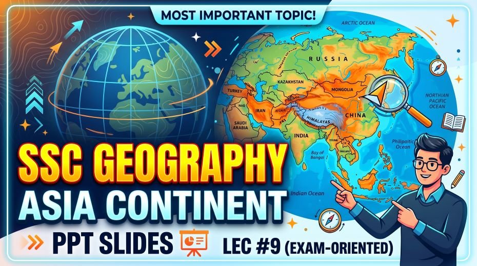
Mountains of Asia
| Mountain / Peak | Location | Height | Key Facts for SSC |
| Mount Everest | Nepal-China (Tibet) border | 8,848.86 m | Highest mountain on Earth; part of the Himalayas; first climbed by Edmund Hillary and Tenzing Norgay in 1953 |
| K2 (Mount Godwin-Austen) | Pakistan-China border | 8,611 m | 2nd highest mountain in the world; considered more technically difficult to climb than Everest |
| Kangchenjunga | India-Nepal border | 8,586 m | 3rd highest mountain in the world; highest peak entirely within India |
| The Himalayas | Spans India, Nepal, Bhutan, China, Pakistan | Contains all 14 peaks above 8,000 m | Youngest and highest mountain range in the world; still rising due to tectonic activity |
| Ural Mountains | Russia | Highest peak: ~1,895 m | Conventional boundary between Europe and Asia |
Rivers of Asia
| River | Length | Countries | Key Facts for SSC |
| Yangtze River | ~6,300 km | China (entirely) | Longest river in Asia and China; 3rd longest in the world; site of the Three Gorges Dam |
| Yellow River (Huang He) | ~5,464 km | China (entirely) | Known as “China’s Sorrow” due to historic devastating floods; cradle of Chinese civilisation |
| Ob River | ~5,410 km | Russia, Kazakhstan | One of the longest rivers in Asia; flows into the Arctic Ocean |
| Mekong River | ~4,909 km | China, Myanmar, Laos, Thailand, Cambodia, Vietnam | Flows through 6 countries; vital for Southeast Asian agriculture and fishing |
| Ganga River | ~2,525 km | India, Bangladesh | Most sacred river in Hinduism; supports one of the world’s most densely populated river basins |
| Indus River | ~3,180 km | China, India, Pakistan | Gave its name to India and the Indus Valley Civilisation; vital for Pakistan’s agriculture |
Deserts, Seas, and Natural Wonders
| Feature | Type | Location | Key SSC Facts |
| Gobi Desert | Cold Desert | Mongolia and China | Largest desert in Asia; one of the few cold deserts in the world |
| Arabian Desert | Hot Desert | Saudi Arabia and surrounding nations | 2nd largest desert in Asia; covers most of the Arabian Peninsula |
| Thar Desert | Hot Desert | India-Pakistan border | Largest hot desert in South Asia; located mainly in Rajasthan, India |
| Caspian Sea | World’s Largest Lake | Borders Russia, Kazakhstan, Iran, Azerbaijan, Turkmenistan | Technically a lake; world’s largest inland body of water by area |
| Dead Sea | Salt Lake | Israel-Jordan border | Lowest point on land on Earth (~430 m below sea level); extremely high salinity allows easy floating |
| Lake Baikal | Freshwater Lake | Russia (Siberia) | Deepest lake in the world (over 1,600 m); contains ~20% of world’s unfrozen freshwater |
| Mariana Trench | Ocean Trench | Western Pacific, near Philippines | Deepest point in the world’s oceans (~11,034 m); part of Asia-Pacific region |
Climate of Asia
| Climate Zone | Region | Key Characteristics |
| Tropical | South and Southeast Asia (India, Indonesia, Thailand) | Hot and humid; monsoon rainfall patterns |
| Arid / Desert | West Asia, Central Asia, Gobi Desert | Very low rainfall; extreme temperature variation |
| Temperate | China, Japan, Korea | Four distinct seasons; moderate rainfall |
| Subarctic / Polar | Siberia, Northern Russia | Extremely cold winters; short summers |
| Highland / Alpine | Himalayas, Tibetan Plateau | Cold temperatures due to elevation; thin air; permanent snow at high altitudes |
Major Countries of Asia – Reference Table
| Country | Capital | Key Geographic / SSC Fact |
| China | Beijing | Largest fully-Asian country by area; 2nd most populous; world’s 2nd largest economy |
| India | New Delhi | Most populous country in the world (2023 onward); 7th largest country by area |
| Russia (Asian part) | Moscow (in European Russia) | World’s largest country overall; majority of its territory lies in Asia (Siberia) |
| Japan | Tokyo | Major economic power; island nation; frequent earthquakes due to Pacific Ring of Fire |
| Indonesia | Jakarta | Largest archipelagic country in the world (over 17,000 islands); most populous Muslim-majority nation |
| Saudi Arabia | Riyadh | Largest country on the Arabian Peninsula; home to Mecca and Medina, Islam’s holiest cities |
| Pakistan | Islamabad | Shares the Indus River system with India; formed in 1947 Partition |
| Kazakhstan | Astana | Largest landlocked country in the world; largest Central Asian nation |
Asia Compared to All 7 Continents – Reference Table
| Continent | Area (sq km) | Population | Highest Point | Key Fact |
| Asia | 44.6 million | ~4.7 billion | Mt. Everest (8,848.86 m) | Largest and most populous continent; home to India and China |
| Africa | 30.4 million | ~1.4 billion | Mt. Kilimanjaro (5,895 m) | 2nd largest; 54 countries |
| North America | 24.7 million | ~600 million | Denali (6,194 m) | 3rd largest; Great Lakes |
| South America | 17.8 million | ~436 million | Aconcagua (6,961 m) | 4th largest; Amazon Rainforest |
| Antarctica | 14.2 million | ~1,000 (researchers) | Vinson Massif (4,892 m) | 5th largest; no permanent population |
| Europe | 10.5 million | ~746 million | Mount Elbrus (5,642 m) | 6th largest; European Union |
| Australia | 7.7 million | ~26 million | Mt. Kosciuszko (2,228 m) | Smallest continent; only country-continent |
Quick Fact Table – Asia for SSC Exams
| Question / Fact | Answer |
| Asia’s rank by area among continents | 1st – largest continent |
| Asia’s total area | 44.6 million sq km |
| Asia’s approximate share of world population | ~60% |
| Most populous country in the world | India (~1.45 billion, since 2023) |
| 2nd most populous country in the world | China |
| Highest point on Earth | Mount Everest (8,848.86 m) – Nepal-China border |
| Lowest point on land on Earth | Dead Sea shore (~430 m below sea level) |
| Longest river in Asia | Yangtze River (~6,300 km) – China |
| Largest desert in Asia | Gobi Desert – Mongolia/China |
| World’s largest inland body of water | Caspian Sea |
| Deepest lake in the world | Lake Baikal – Russia (over 1,600 m) |
| Deepest point in the world’s oceans | Mariana Trench (~11,034 m) – Pacific |
| Largest archipelagic country in the world | Indonesia (over 17,000 islands) |
| Largest landlocked country in the world | Kazakhstan |
| Who first climbed Mount Everest and when? | Edmund Hillary and Tenzing Norgay, 1953 |
| Where was Gautama Buddha born? | Lumbini, Nepal (563 BCE) |
| Largest contiguous land empire in history | Mongol Empire (under Genghis Khan and successors) |
| When did India and Pakistan gain independence? | 1947 |
| When was the People’s Republic of China established? | 1949 |
| River known as “China’s Sorrow” | Yellow River (Huang He) |
| Highest peak entirely within India | Kangchenjunga (8,586 m) |
Podcast-Style Q&A – Asia Continent
Q1: Why is Asia considered the most important continent for SSC exams?
Asia is the most important continent for SSC and RRB exams primarily because India itself is part of Asia, meaning Asian geography questions often directly overlap with Indian geography, history, and current affairs topics. Additionally, Asia contains the world’s two most populous countries (India and China), the highest mountain (Everest), the largest desert variety, and the origins of most major world religions, making it the single richest source of high-frequency exam facts across the entire Geography syllabus.
Q2: Why does the Dead Sea allow people to float so easily?
The Dead Sea, located on the border between Israel and Jordan, has a salinity level of approximately 34%, roughly ten times saltier than typical ocean water. This extremely high salt concentration dramatically increases the water’s density, which in turn increases its buoyancy, making it physically very difficult for a person to sink – hence the well-known phenomenon of effortlessly floating in the Dead Sea. At approximately 430 metres below sea level, the Dead Sea shore is also the lowest point on dry land anywhere on Earth, making it a frequently tested superlative fact.
Q3: What makes the Himalayas unique compared to other mountain ranges?
The Himalayas are geologically the youngest major mountain range on Earth, formed by the ongoing collision between the Indian and Eurasian tectonic plates that began around 50 million years ago and continues today, meaning the range is still slowly rising. Unlike older, more eroded ranges like the Appalachians, the Himalayas contain all fourteen of the world’s mountains exceeding 8,000 metres in elevation, including Mount Everest, K2, and Kangchenjunga, earning the region the nickname ‘roof of the world’ and making it one of the most frequently tested topics in both Indian and Asian Geography.
Q4: How did the Mongol Empire become the largest contiguous land empire in history?
Founded by Genghis Khan in 1206, the Mongol Empire expanded rapidly through highly mobile cavalry warfare, superior logistics, and effective administration of conquered territories, eventually stretching from Korea and China in the east to Eastern Europe and Persia in the west – covering approximately 24 million square kilometres at its peak under Genghis Khan’s successors. This made it the largest contiguous (unbroken, connected) land empire in recorded history, though the British Empire later became larger in total area when including non-contiguous overseas colonies. This distinction between ‘contiguous’ and ‘total’ empire size is a useful detail for SSC history questions.
Q5: Why is the Caspian Sea classified as a lake despite its enormous size?
The Caspian Sea is technically classified as the world’s largest lake rather than a true sea because it is a landlocked body of water with no natural connection to the global ocean system, fitting the basic geographic definition of a lake regardless of its massive size (larger than Germany). It retains the word ‘Sea’ in its name for largely historical and cultural reasons, as ancient civilisations around its shores perceived it as sea-like due to its size and slight salinity. This naming quirk is a popular trick question in SSC Geography exams testing students’ understanding of geographic classification versus common naming conventions.
Q6: What was the significance of the 1947 Partition of India?
In 1947, British India gained independence and was simultaneously partitioned into two separate nations: India and Pakistan, divided largely along religious lines, with Pakistan created as a homeland for Muslims and India remaining a secular state with a Hindu majority. This Partition triggered one of the largest mass migrations in human history, with an estimated 10-15 million people crossing borders and significant communal violence resulting in hundreds of thousands of deaths. The event remains foundational to South Asian political geography and is one of the most consistently referenced historical dates in SSC General Awareness sections.
Q7: Why do all major world religions trace their origins to Asia?
Asia’s role as the birthplace of most major world religions – Hinduism and Buddhism in South Asia, Christianity and Judaism in West Asia, Islam in the Arabian Peninsula, and Sikhism and Jainism in India – stems from the continent’s position as the crossroads of early human civilisation, where dense populations, trade routes, and philosophical traditions converged over thousands of years along major river valleys like the Indus, Ganga, Tigris, and Euphrates. This concentration of religious origin points makes Asia a critical region for understanding global cultural and religious geography, frequently tested in SSC exams through questions about founders, birthplaces, and founding dates of major religions.
also read: SSC Geography Europe Continent PPT Slides (LEC #8)
30 MCQ Practice Questions – Asia Continent
All questions follow SSC CGL, CHSL, MTS, and GD Constable exam patterns. Answers follow at the end.
- Asia is the ___ largest continent by area.
A) 1st B) 2nd C) 3rd D) 4th
- What percentage of the world’s population approximately lives in Asia?
A) 40% B) 50% C) 60% D) 70%
- Which is the most populous country in the world (since 2023)?
A) China B) India C) Indonesia D) Pakistan
- What is the highest mountain on Earth?
A) K2 B) Kangchenjunga C) Mount Everest D) Lhotse
- Mount Everest is located on the border of which two countries?
A) India-Nepal B) Nepal-China C) Pakistan-China D) India-China
- The lowest point on land on Earth is:
A) Death Valley B) Lake Baikal C) Dead Sea shore D) Caspian Sea
- Which is the longest river in Asia?
A) Yellow River B) Mekong River C) Yangtze River D) Ganga River
- Which desert is the largest in Asia?
A) Thar Desert B) Arabian Desert C) Gobi Desert D) Karakum Desert
- The Caspian Sea is technically classified as a:
A) Ocean B) Lake C) Gulf D) Bay
- Which is the deepest lake in the world?
A) Caspian Sea B) Lake Baikal C) Dead Sea D) Lake Victoria
- The deepest point in the world’s oceans is:
A) Java Trench B) Mariana Trench C) Tonga Trench D) Puerto Rico Trench
- Which is the largest archipelagic country in the world?
A) Philippines B) Japan C) Indonesia D) Malaysia
- Which is the largest landlocked country in the world?
A) Mongolia B) Kazakhstan C) Afghanistan D) Uzbekistan
- Who first successfully climbed Mount Everest?
A) George Mallory B) Edmund Hillary and Tenzing Norgay C) Reinhold Messner D) Junko Tabei
- In which year was Mount Everest first climbed?
A) 1947 B) 1953 C) 1960 D) 1965
- Where was Gautama Buddha born?
A) Varanasi, India B) Lumbini, Nepal C) Bodh Gaya, India D) Kathmandu, Nepal
- The Mongol Empire is considered the largest:
A) Maritime empire in history B) Contiguous land empire in history C) Trading empire in history D) Religious empire in history
- Who founded the Mongol Empire?
A) Kublai Khan B) Timur C) Genghis Khan D) Babur
- India and Pakistan gained independence in:
A) 1945 B) 1947 C) 1950 D) 1962
- The People’s Republic of China was established in:
A) 1945 B) 1947 C) 1949 D) 1951
- The Yellow River is also known as:
A) China’s Pride B) China’s Sorrow C) China’s Glory D) China’s Lifeline
- Which mountain range contains all 14 peaks above 8,000 m?
A) Andes B) Rocky Mountains C) Himalayas D) Alps
- K2, the world’s 2nd highest mountain, is located on the border of:
A) India-Nepal B) Nepal-China C) Pakistan-China D) India-Pakistan
- Which is the highest peak located entirely within India?
A) Nanda Devi B) Kangchenjunga C) K2 D) Annapurna
- Indus Valley Civilisation emerged primarily in present-day:
A) India only B) Pakistan and northwest India C) Bangladesh D) Nepal
- Mecca and Medina, Islam’s holiest cities, are located in:
A) Iraq B) Iran C) Saudi Arabia D) UAE
- The Mekong River flows through how many countries?
A) 3 B) 4 C) 5 D) 6
- Which river is most sacred in Hinduism?
A) Yamuna B) Indus C) Ganga D) Brahmaputra
- The Ural Mountains form the conventional boundary between:
A) Asia and Africa B) Europe and Asia C) Asia and Australia D) Europe and Africa
- China’s 2nd longest river, known for catastrophic floods, is the:
A) Yangtze River B) Mekong River C) Yellow River D) Pearl River
Answer Key
| Q | Ans | Q | Ans | Q | Ans |
| 1 | A | 11 | B | 21 | B |
| 2 | C | 12 | C | 22 | C |
| 3 | B | 13 | B | 23 | C |
| 4 | C | 14 | B | 24 | B |
| 5 | B | 15 | B | 25 | B |
| 6 | C | 16 | B | 26 | C |
| 7 | C | 17 | C | 27 | D |
| 8 | C | 18 | C | 28 | C |
| 9 | B | 19 | B | 29 | B |
| 10 | B | 20 | C | 30 | C |
Rapid Revision Cheat Sheet – Asia Continent
| Topic | Key Point |
| Continent rank | 1st – largest by area and population (44.6 million sq km) |
| Population share | ~60% of world’s population (~4.7 billion) |
| Most populous country | India – ~1.45 billion (since 2023) |
| 2nd most populous | China |
| Highest point on Earth | Mount Everest – 8,848.86 m, Nepal-China border |
| First Everest summit | Edmund Hillary and Tenzing Norgay, 1953 |
| Lowest point on land | Dead Sea shore – ~430 m below sea level |
| Longest river in Asia | Yangtze River – ~6,300 km, China |
| China’s Sorrow | Yellow River – historic flooding |
| Largest desert in Asia | Gobi Desert – Mongolia/China |
| World’s largest lake | Caspian Sea |
| Deepest lake in world | Lake Baikal – Russia |
| Deepest ocean point | Mariana Trench – ~11,034 m |
| All 14 peaks above 8,000 m | Found in the Himalayas |
| Largest archipelagic country | Indonesia – 17,000+ islands |
| Largest landlocked country | Kazakhstan |
| Buddha’s birthplace | Lumbini, Nepal – 563 BCE |
| Largest contiguous land empire | Mongol Empire – founded by Genghis Khan |
| India-Pakistan independence | 1947 |
| China (PRC) established | 1949 |
| Indus Valley Civilisation | ~3300 BCE – Pakistan and NW India |
| Serial number of this PPT | #87 in the Complete Foundation Batch |
Conclusion
Asia Continent is the single most exam-critical topic in SSC Geography, given India’s place within it and the continent’s unmatched density of superlative facts – the highest mountain, the most populous nations, the largest lake, and the origins of the world’s major religions. From the Indus Valley Civilisation to the founding of modern India, China, and the Central Asian republics, Asia’s geography and history are inseparable from the broader SSC syllabus.
The SSC Geography Asia Continent PPT Slides (LEC #9), Serial #87, available at slideshareppt.net in bilingual Hindi + English format across 80 slides, gives you a complete visual companion to this article. Study the sub-region and country tables carefully, memorise the key superlatives (Everest, Yangtze, Gobi, Caspian, Baikal), and complete all 30 MCQs to strengthen your command of this topic.
Whether preparing for SSC CGL, CHSL, MTS, GD Constable, or RRB Group D, mastering Asia’s geography ensures consistent marks across both the World Geography and India Geography sections, since the two overlap so heavily. Bookmark this article alongside the PPT, and revisit the Rapid Revision Cheat Sheet during your final week before the exam.