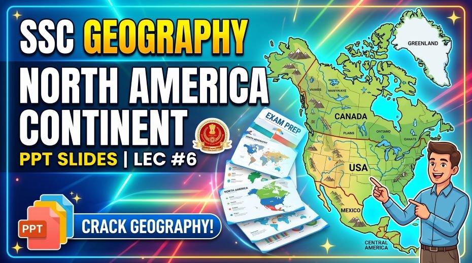
This article accompanies the SSC Geography North America Continent PPT Slides (LEC #6) – Serial #84 of the Complete Foundation Batch for All SSC Exams PPT Series on slideshareppt.net. With 95 slides in bilingual Hindi + English format, this PPT covers North America in complete depth. North America is home to the world’s largest economy, the longest river system in many rankings, the Great Lakes, and a vast diversity of landscapes from Arctic tundra to tropical coastlines – making it a consistently important topic in SSC CGL, SSC CHSL, SSC MTS, SSC GD Constable, and RRB Group D General Awareness sections. From the Rocky Mountains and Mississippi River to the Grand Canyon and Niagara Falls, North America offers a wide range of high-yield geography facts frequently tested in competitive exams. This article provides the full structured theory, timeline, comparison tables, MCQs, and a rapid revision cheat sheet – all aligned to the SSC exam pattern.
PPT Resource Overview
| Detail | Information |
| Lecture Number | LEC #6 (Geography Series) |
| Serial Number in Complete Batch | #84 |
| Subject | Geography – North America Continent (उत्तरी अमेरिका महाद्वीप) |
| Series Name | Complete Foundation Batch for All SSC Exams (PPT Series) |
| Total Slides | 95 PPT Slides |
| File Size | 29 MB |
| Language | Hindi + English (Bilingual) |
| Format Available | Google Slides & Google Drive (PDF also available) |
| Website | www.slideshareppt.net |
| Target Exams | SSC CGL, SSC CHSL, SSC MTS, SSC GD Constable, RRB Group D |
| Suitable For | Students (self-study & marathon revision) and Teachers (classroom use) |
SSC Geography North America Continent PPT Slides (LEC #6)
Note: Above is PPT in GOOGLE SLIDES (HTML AND IFRAME COMBINATION) and if you wish to download the Complete SSC series (PPT slides), visit this Link – REDIRECT PAGE.
Master Timeline: North America – Civilisations, Colonisation, and Nation-Building
| Period | Event / Milestone | SSC Exam Relevance |
| ~13,000 BCE | Earliest evidence of human migration into North America via the Bering Land Bridge from Asia | Origin of indigenous peoples of North America |
| ~2000 BCE–1500 CE | Rise of major civilisations: Maya (Mexico/Central America), later influencing the region | Maya civilisation – pre-Columbian history |
| 1325 CE | Aztec civilisation founds Tenochtitlan (modern Mexico City) as its capital | Aztec civilisation and Tenochtitlan |
| 1492 | Christopher Columbus reaches the Caribbean (Bahamas), opening the era of European contact with the Americas | Columbus’s voyage – most asked discovery fact |
| 1497 | John Cabot (Italian, sailing for England) reaches the coast of present-day Canada | Early English claim to North America |
| 1521 | Hernán Cortés (Spain) conquers the Aztec Empire, capturing Tenochtitlan | Fall of Aztec Empire to Spanish conquest |
| 1607 | Jamestown, Virginia founded – first permanent English settlement in North America | First English colony in North America |
| 1620 | Pilgrims arrive at Plymouth aboard the Mayflower, establishing Plymouth Colony | Mayflower and Plymouth – early colonial history |
| 1776 (4 July) | United States Declaration of Independence signed – USA declares independence from Britain | US Independence Day – most frequently asked date |
| 1783 | Treaty of Paris formally ends the American Revolutionary War; Britain recognises US independence | End of American Revolution |
| 1791 | Canada divided into Upper and Lower Canada under British colonial administration | Early Canadian colonial structure |
| 1803 | Louisiana Purchase – USA buys vast French territory, doubling its size | Louisiana Purchase – major US territorial expansion |
| 1846 | Oregon Treaty settles the US-Canada border along the 49th parallel in the west | US-Canada border establishment |
| 1 July 1867 | Canada becomes a self-governing dominion within the British Empire (Canadian Confederation) | Canada’s Confederation Day – frequently asked |
| 1867 | USA purchases Alaska from Russia (“Alaska Purchase”) | Alaska Purchase – territorial history fact |
| 1959 | Alaska and Hawaii become the 49th and 50th US states | USA reaches 50 states |
| 1994 | NAFTA (North American Free Trade Agreement) comes into effect among USA, Canada, Mexico | NAFTA – major North American trade agreement |
| 2020 | NAFTA replaced by USMCA (United States-Mexico-Canada Agreement) | Current North American trade framework |
| Present Day | North America comprises 23 sovereign countries (including Caribbean and Central America) and numerous territories | Current political geography of North America |
North America – Overview of the Continent
North America is the third-largest continent by area and the fourth most populous. It stretches from the Arctic Ocean in the north to the Caribbean Sea and the Isthmus of Panama in the south, bordered by the Pacific Ocean to the west and the Atlantic Ocean to the east. The continent includes Canada and the United States in the north, Mexico and Central America in the south-central region, and the Caribbean island nations. North America hosts the Rocky Mountains, the Great Lakes, the Mississippi-Missouri river system, and a vast range of climates from Arctic tundra to tropical rainforest.
North America – Complete Key Facts Table
| Parameter | Detail |
| Continent Rank by Area | 3rd largest continent (after Asia and Africa) |
| Total Area | 24.7 million sq km |
| Population (approx.) | ~600 million |
| Number of Countries | 23 sovereign countries (including Caribbean and Central America) |
| Largest Country by Area | Canada (9.98 million sq km – 2nd largest country in the world) |
| Most Populous Country | United States of America (~335 million) |
| Highest Peak | Denali (Mount McKinley) – 6,194 m, Alaska, USA |
| Lowest Point | Death Valley – 86 m below sea level, California, USA |
| Longest River System | Mississippi-Missouri River system – ~6,275 km (one of the longest in the world) |
| Largest Lake System | The Great Lakes (5 lakes: Superior, Michigan, Huron, Erie, Ontario) – largest group of freshwater lakes by area in the world |
| Largest Freshwater Lake by Area | Lake Superior – largest of the Great Lakes; largest freshwater lake by surface area in the world |
| Largest Canyon | Grand Canyon – Arizona, USA; carved by the Colorado River |
| Major Mountain Range | Rocky Mountains – runs from Canada through the western USA (~4,800 km) |
| Famous Waterfall | Niagara Falls – on the USA-Canada border, one of the most powerful waterfalls in the world by flow rate |
| Largest Island | Greenland – world’s largest island (geographically part of North America, governed by Denmark) |
| Languages | English (USA, Canada), Spanish (Mexico, most of Central America), French (Quebec, Canada), Haitian Creole (Haiti) |
| Currency Examples | US Dollar, Canadian Dollar, Mexican Peso |
| Major Trade Agreement | USMCA (United States-Mexico-Canada Agreement, replaced NAFTA in 2020) |
| Time Zones | Multiple – ranging from GMT−4 to GMT−10 across the continent |
Major Countries of North America – Reference Table
| Country | Capital | Official / Main Language | Key Geographic Fact |
| United States of America | Washington D.C. | English (de facto) | World’s largest economy; 3rd largest country by area; 50 states including Alaska and Hawaii |
| Canada | Ottawa | English, French | 2nd largest country in the world by area; vast Arctic territory; bilingual nation |
| Mexico | Mexico City | Spanish | Most populous Spanish-speaking country in the world; site of ancient Aztec and Maya civilisations |
| Guatemala | Guatemala City | Spanish | Most populous Central American country; Maya heritage sites |
| Cuba | Havana | Spanish | Largest island nation in the Caribbean; communist governance |
| Honduras | Tegucigalpa | Spanish | Central American nation; Caribbean and Pacific coastlines |
| Panama | Panama City | Spanish | Home to the Panama Canal connecting Atlantic and Pacific Oceans |
| Jamaica | Kingston | English | Caribbean island nation; famous for reggae music and Bob Marley |
| Costa Rica | San José | Spanish | Known for biodiversity and ecological conservation; no standing army |
| Greenland (territory) | Nuuk | Greenlandic, Danish | World’s largest island; autonomous territory of Denmark; mostly ice-covered |
Physical Geography of North America
Mountains of North America
| Mountain Range / Peak | Location | Height / Length | Key Facts for SSC |
| Rocky Mountains | Western Canada and USA | ~4,800 km long | Major mountain range running from British Columbia (Canada) to New Mexico (USA); source of many major rivers |
| Denali (Mount McKinley) | Alaska, USA | 6,194 m | Highest peak in North America; 3rd most topographically prominent peak in the world |
| Appalachian Mountains | Eastern USA and Canada | ~2,400 km long | Older, more eroded mountain range; runs along eastern North America |
| Sierra Madre | Mexico | Multiple ranges | Divided into Sierra Madre Occidental and Oriental; significant for Mexican geography |
| Mexicans Volcanic Belt | Central Mexico | Contains Pico de Orizaba (5,636 m) | Pico de Orizaba is Mexico’s highest peak and North America’s 3rd highest |
Rivers of North America
| River | Length | Countries | Key Facts for SSC |
| Mississippi-Missouri System | ~6,275 km | USA (entirely) | Combined system is one of the longest in the world; Mississippi alone is ~3,766 km; drains 31 US states |
| Mackenzie River | ~4,241 km | Canada | Longest river in Canada; flows into the Arctic Ocean |
| Rio Grande | ~3,051 km | USA, Mexico | Forms much of the border between USA and Mexico |
| Yukon River | ~3,190 km | USA (Alaska), Canada | Major river of the northwest; historically important for gold rush era transport |
| Colorado River | ~2,330 km | USA, Mexico | Carved the Grand Canyon; critical water source for southwestern USA |
| St. Lawrence River | ~3,058 km (with Great Lakes) | Canada, USA | Connects the Great Lakes to the Atlantic Ocean; major shipping route |
Lakes, Canyons, and Natural Wonders
| Feature | Type | Location | Key SSC Facts |
| The Great Lakes | Freshwater Lake System | USA-Canada border | 5 lakes (Superior, Michigan, Huron, Erie, Ontario) – largest group of freshwater lakes by total area in the world; contain ~21% of world’s surface freshwater |
| Lake Superior | Freshwater Lake | USA-Canada border | Largest of the Great Lakes; largest freshwater lake in the world by surface area |
| Grand Canyon | Canyon | Arizona, USA | Carved by the Colorado River over millions of years; up to 1,857 m deep; UNESCO World Heritage Site |
| Niagara Falls | Waterfall | USA-Canada border | One of the most powerful waterfalls in the world by flow rate; major tourist and hydroelectric site |
| Death Valley | Desert / Lowest Point | California, USA | Lowest point in North America at 86 m below sea level; one of the hottest places on Earth |
| Greenland Ice Sheet | Ice Sheet | Greenland | Covers ~80% of Greenland; 2nd largest ice body in the world after Antarctica |
| Yellowstone National Park | National Park | Wyoming, USA (mainly) | World’s first national park (established 1872); home to Old Faithful geyser and a supervolcano |
Climate of North America
| Climate Zone | Region | Key Characteristics |
| Arctic / Polar | Northern Canada, Alaska, Greenland | Extremely cold; tundra vegetation; permafrost |
| Subarctic | Central and northern Canada, Alaska | Long cold winters; short summers; boreal forest (taiga) |
| Temperate Continental | Central and eastern USA, southern Canada | Four distinct seasons; moderate rainfall |
| Mediterranean | California coast, USA | Hot dry summers, mild wet winters |
| Desert / Arid | Southwestern USA (Nevada, Arizona), northern Mexico | Very low rainfall; extreme heat in summer; includes Death Valley and Sonoran Desert |
| Tropical | Southern Mexico, Central America, Caribbean | Hot and humid year-round; hurricane-prone regions |
| Highland / Alpine | Rocky Mountains, Sierra Madre | Cold temperatures at elevation regardless of latitude |
Wildlife of North America – SSC GK Facts
| Category | Key Species | SSC Fact |
| Mammals | Grizzly Bear, Bison (American Buffalo), Moose, Bald Eagle (bird, listed separately), Wolf | American Bison is the national mammal of the USA; once nearly extinct, now recovering through conservation |
| Birds | Bald Eagle, Canada Goose, Hummingbird species | Bald Eagle is the national bird and symbol of the USA |
| Reptiles | American Alligator, Rattlesnake, Gila Monster | American Alligator found mainly in the southeastern USA wetlands like the Everglades |
| Marine Life | Orca, Humpback Whale, Sea Otter | Pacific Northwest coast is a key habitat for orcas and humpback whales |
| Unique Ecosystem | Everglades (Florida, USA) | Largest tropical wetland in the USA; UNESCO World Heritage Site; unique mix of fresh and saltwater species |
Pre-Columbian Civilisations – Maya and Aztec
| Civilisation | Region | Period | Key Facts for SSC |
| Maya Civilisation | Southern Mexico, Guatemala, Belize, Honduras | ~2000 BCE – 1500 CE (peak ~250–900 CE) | Advanced writing system, astronomy, and the Maya calendar; famous sites include Chichen Itza and Tikal |
| Aztec Civilisation | Central Mexico | ~1325 – 1521 CE | Capital at Tenochtitlan (modern Mexico City); conquered by Hernán Cortés in 1521; known for advanced agriculture (chinampas) and complex social structure |
North America Compared to All 7 Continents – Reference Table
| Continent | Area (sq km) | Population | Highest Point | Key Fact |
| Asia | 44.6 million | 4.7 billion | Mt. Everest (8,848 m) | Largest and most populous continent |
| Africa | 30.4 million | 1.4 billion | Mt. Kilimanjaro (5,895 m) | 2nd largest; Sahara Desert |
| North America | 24.7 million | ~600 million | Denali (6,194 m) | 3rd largest; includes Greenland; Great Lakes and Rocky Mountains |
| South America | 17.8 million | ~436 million | Aconcagua (6,961 m) | 4th largest; Amazon Rainforest, Andes |
| Antarctica | 14.2 million | ~1,000 (researchers) | Vinson Massif (4,892 m) | 5th largest; no permanent population |
| Europe | 10.5 million | 746 million | Mont Blanc (4,808 m) | 6th largest; most developed |
| Australia | 7.7 million | ~26 million | Mt. Kosciuszko (2,228 m) | Smallest continent; only country-continent |
Quick Fact Table – North America for SSC Exams
| Question / Fact | Answer |
| North America’s rank by area among continents | 3rd largest |
| North America’s total area | 24.7 million sq km |
| Number of countries in North America | 23 sovereign countries |
| Largest country in North America | Canada (9.98 million sq km – 2nd largest in world) |
| Most populous country in North America | United States of America |
| Highest peak in North America | Denali (Mount McKinley) – 6,194 m, Alaska |
| Lowest point in North America | Death Valley – 86 m below sea level, California |
| Longest river system in North America | Mississippi-Missouri River system (~6,275 km) |
| Largest group of freshwater lakes in the world | The Great Lakes (5 lakes) |
| Largest freshwater lake by surface area in world | Lake Superior |
| Famous canyon carved by Colorado River | Grand Canyon – Arizona, USA |
| Famous waterfall on USA-Canada border | Niagara Falls |
| World’s largest island | Greenland (territory of Denmark, part of North America) |
| When did USA declare independence? | 4 July 1776 |
| When did Canada become a confederation? | 1 July 1867 |
| Capital of USA | Washington D.C. |
| Capital of Canada | Ottawa |
| Capital of Mexico | Mexico City |
| Major North American trade agreement (current) | USMCA (replaced NAFTA in 2020) |
| National mammal of the USA | American Bison (Buffalo) |
| National bird of the USA | Bald Eagle |
| Aztec civilisation’s capital | Tenochtitlan (modern Mexico City) |
| Who conquered the Aztec Empire? | Hernán Cortés (Spain), 1521 |
| World’s first national park | Yellowstone National Park (established 1872) |
| Mountain range running from Canada to New Mexico (USA) | Rocky Mountains |
| Mexico’s highest peak | Pico de Orizaba – 5,636 m |
| Largest tropical wetland in the USA | The Everglades, Florida |
Podcast-Style Q&A – North America Continent
Q1: Why is Canada the second largest country in the world but has a relatively small population?
Canada spans approximately 9.98 million sq km, making it the second largest country in the world after Russia. However, large portions of northern Canada lie within the Arctic and subarctic climate zones, with extremely cold temperatures, permafrost, and limited agricultural land, making them largely uninhabitable for dense settlement. As a result, most of Canada’s roughly 39 million people are concentrated in a narrow band along the southern border with the United States, where the climate is more temperate. This combination of vast area and concentrated population makes Canada one of the most sparsely populated large countries in the world.
Q2: What makes the Great Lakes significant in world geography?
The Great Lakes – Superior, Michigan, Huron, Erie, and Ontario – straddle the border between the United States and Canada and together form the largest group of freshwater lakes by total surface area in the world, containing approximately 21% of the world’s surface freshwater. Lake Superior alone is the largest freshwater lake in the world by surface area. The Great Lakes are connected by a network of rivers and canals leading to the Atlantic Ocean via the St. Lawrence River, making them a critical shipping and trade route as well as a major source of drinking water for tens of millions of people.
Q3: How did the Grand Canyon form and why is it geologically significant?
The Grand Canyon in Arizona, USA, was carved over millions of years by the Colorado River cutting through layers of rock, exposing nearly two billion years of Earth’s geological history in its canyon walls. At its deepest, the canyon reaches approximately 1,857 metres, and it stretches about 446 km in length. It is a UNESCO World Heritage Site and one of the most visited natural landmarks in the world, frequently referenced in SSC Geography questions about erosional landforms and river-carved features.
Q4: What was the significance of the Aztec and Maya civilisations before European contact?
The Maya civilisation, flourishing primarily between 250 and 900 CE in present-day southern Mexico, Guatemala, Belize, and Honduras, developed an advanced writing system, sophisticated astronomy, and the famous Maya calendar, along with monumental cities like Chichen Itza and Tikal. The Aztec civilisation arose later, founding their capital Tenochtitlan (on the site of modern Mexico City) around 1325 CE, and built a powerful empire based on tribute from conquered neighbouring states, along with advanced agricultural techniques like floating gardens called chinampas. Both civilisations were eventually conquered by Spanish forces – the Aztecs by Hernán Cortés in 1521 – fundamentally reshaping the region’s culture, language, and religion.
Q5: Why is the 4th of July significant in North American history?
4 July 1776 marks the date the Second Continental Congress formally adopted the Declaration of Independence, in which the thirteen American colonies declared their independence from Great Britain, founding the United States of America. This date is celebrated annually as Independence Day in the USA and is one of the most frequently asked historical dates in SSC General Awareness sections, often appearing alongside other independence dates from different countries for comparison-based questions.
Q6: What is the difference between NAFTA and USMCA?
NAFTA (North American Free Trade Agreement), which came into effect in 1994 between the United States, Canada, and Mexico, eliminated most tariffs and trade barriers among the three countries, creating one of the largest free trade zones in the world at the time. In 2020, NAFTA was replaced by USMCA (United States-Mexico-Canada Agreement), which updated provisions related to labour standards, digital trade, and automotive manufacturing rules of origin, while largely preserving the free trade relationship. This shift from NAFTA to USMCA is an important Current Affairs and Economic Geography crossover topic for SSC exams.
Q7: Why does Greenland belong to North America geographically but is governed by Denmark?
Greenland is geographically considered part of North America because it lies on the North American tectonic plate and is geologically connected to the Canadian Arctic. However, politically, Greenland has been associated with Denmark since the colonial era and remains an autonomous territory within the Kingdom of Denmark today, with its own local government handling most domestic affairs while Denmark retains authority over foreign policy and defence. This distinction between geographic continent and political sovereignty is a useful and frequently tested concept, similar to how French Guiana is geographically in South America but politically part of France.
also read: SSC Geography South America Continent PPT Slides (LEC #5)
30 MCQ Practice Questions – North America Continent
All questions follow SSC CGL, CHSL, MTS, and GD Constable exam patterns. Answers follow at the end.
- North America is the ___ largest continent by area.
A) 2nd B) 3rd C) 4th D) 5th
- Which is the largest country in North America by area?
A) USA B) Mexico C) Canada D) Greenland
- Canada is the ___ largest country in the world by area.
A) 1st B) 2nd C) 3rd D) 4th
- What is the highest peak in North America?
A) Mount Logan B) Pico de Orizaba C) Denali D) Mount Whitney
- The lowest point in North America is:
A) Salton Sea B) Death Valley C) Grand Canyon D) Mississippi Delta
- Which river system is the longest in North America?
A) Colorado River B) Rio Grande C) Mississippi-Missouri D) Mackenzie River
- The Great Lakes are located on the border of which two countries?
A) USA-Mexico B) USA-Canada C) Canada-Greenland D) Mexico-Guatemala
- Which is the largest freshwater lake in the world by surface area?
A) Lake Michigan B) Lake Erie C) Lake Superior D) Lake Ontario
- The Grand Canyon was carved by which river?
A) Rio Grande B) Mississippi River C) Colorado River D) Yukon River
- Niagara Falls is located on the border of:
A) USA-Mexico B) USA-Canada C) Canada-Greenland D) USA only
- The world’s largest island is:
A) Madagascar B) Borneo C) Greenland D) New Guinea
- The United States declared independence on:
A) 4 July 1776 B) 1 July 1867 C) 15 August 1947 D) 14 July 1789
- Canada became a confederation (self-governing dominion) in:
A) 1776 B) 1812 C) 1867 D) 1901
- The capital of the United States is:
A) New York B) Washington D.C. C) Los Angeles D) Chicago
- The capital of Canada is:
A) Toronto B) Vancouver C) Ottawa D) Montreal
- The capital of Mexico is:
A) Cancun B) Guadalajara C) Mexico City D) Monterrey
- Which trade agreement currently governs USA-Canada-Mexico trade?
A) NAFTA B) USMCA C) TPP D) CAFTA
- The Aztec civilisation’s capital city was:
A) Chichen Itza B) Tikal C) Tenochtitlan D) Teotihuacan
- Who conquered the Aztec Empire in 1521?
A) Francisco Pizarro B) Hernán Cortés C) Christopher Columbus D) John Cabot
- The Maya civilisation is most associated with which region?
A) Northern USA B) Canada C) Southern Mexico and Central America D) Caribbean islands
- The national mammal of the USA is:
A) Grizzly Bear B) American Bison C) Moose D) Wolf
- The national bird of the USA is:
A) Eagle (generic) B) Bald Eagle C) Hawk D) Falcon
- The world’s first national park, established in 1872, is:
A) Banff National Park B) Yosemite C) Yellowstone National Park D) Grand Canyon National Park
- Which mountain range runs from Canada through the western USA?
A) Appalachian Mountains B) Sierra Madre C) Rocky Mountains D) Andes
- Greenland is politically governed by:
A) Canada B) USA C) Denmark D) Norway
- The Rio Grande forms a border between which two countries?
A) USA-Canada B) USA-Mexico C) Mexico-Guatemala D) Canada-Greenland
- The Mackenzie River, longest in Canada, flows into:
A) Pacific Ocean B) Atlantic Ocean C) Arctic Ocean D) Hudson Bay
- Pico de Orizaba, Mexico’s highest peak, has a height of approximately:
A) 4,500 m B) 5,000 m C) 5,636 m D) 6,000 m
- The Everglades, a famous wetland ecosystem, is located in:
A) California B) Texas C) Florida D) Louisiana
- The Panama Canal connects which two oceans?
A) Atlantic and Indian B) Pacific and Indian C) Atlantic and Pacific D) Arctic and Pacific
Answer Key
| Q | Ans | Q | Ans | Q | Ans |
| 1 | B | 11 | C | 21 | B |
| 2 | C | 12 | A | 22 | B |
| 3 | B | 13 | C | 23 | C |
| 4 | C | 14 | B | 24 | C |
| 5 | B | 15 | C | 25 | C |
| 6 | C | 16 | C | 26 | B |
| 7 | B | 17 | B | 27 | C |
| 8 | C | 18 | C | 28 | C |
| 9 | C | 19 | B | 29 | C |
| 10 | B | 20 | C | 30 | C |
Rapid Revision Cheat Sheet – North America Continent
| Topic | Key Point |
| Continent rank | 3rd largest – 24.7 million sq km |
| Countries | 23 sovereign countries |
| Largest country | Canada – 9.98 million sq km, 2nd largest in world |
| Most populous country | USA – ~335 million |
| Highest peak | Denali (Mount McKinley) – 6,194 m, Alaska |
| Lowest point | Death Valley – 86 m below sea level, California |
| Longest river system | Mississippi-Missouri – ~6,275 km |
| Largest freshwater lake system | The Great Lakes – 5 lakes, ~21% of world’s surface freshwater |
| Largest freshwater lake (area) | Lake Superior |
| Famous canyon | Grand Canyon – carved by Colorado River, Arizona |
| Famous waterfall | Niagara Falls – USA-Canada border |
| World’s largest island | Greenland – governed by Denmark |
| US independence date | 4 July 1776 |
| Canada Confederation date | 1 July 1867 |
| Current trade agreement | USMCA – replaced NAFTA in 2020 |
| Aztec capital | Tenochtitlan – modern Mexico City |
| Aztec fall | Conquered by Hernán Cortés, 1521 |
| Maya civilisation region | Southern Mexico, Guatemala, Belize, Honduras |
| National mammal of USA | American Bison |
| National bird of USA | Bald Eagle |
| First national park in the world | Yellowstone – established 1872 |
| Rocky Mountains span | Canada to New Mexico, USA – ~4,800 km |
| Mexico’s highest peak | Pico de Orizaba – 5,636 m |
| Panama Canal connects | Atlantic and Pacific Oceans |
| Serial number of this PPT | #84 in the Complete Foundation Batch |
Conclusion
North America Continent brings together physical geography (Rocky Mountains, Great Lakes, Grand Canyon), pre-Columbian history (Aztec and Maya civilisations), and modern political and economic geography (USA, Canada, USMCA) into one of the most comprehensive topics in SSC General Awareness. From Denali’s towering height to Death Valley’s extreme depth, and from the Declaration of Independence to Canada’s Confederation, this continent offers an extensive range of exam-ready facts.
The SSC Geography North America Continent PPT Slides (LEC #6), Serial #84, available at slideshareppt.net in bilingual Hindi + English format across 95 slides, provides a complete visual companion to this article. Study the country and physical geography tables carefully, memorise key superlatives and dates, and practice all 30 MCQs to strengthen your command of this topic.
Whether preparing for SSC CGL, CHSL, MTS, GD Constable, or RRB Group D, a strong grasp of North America’s geography, history, and current trade relationships ensures consistent scoring in this section. Bookmark this article alongside the PPT and revisit the Rapid Revision Cheat Sheet in your final week of preparation.