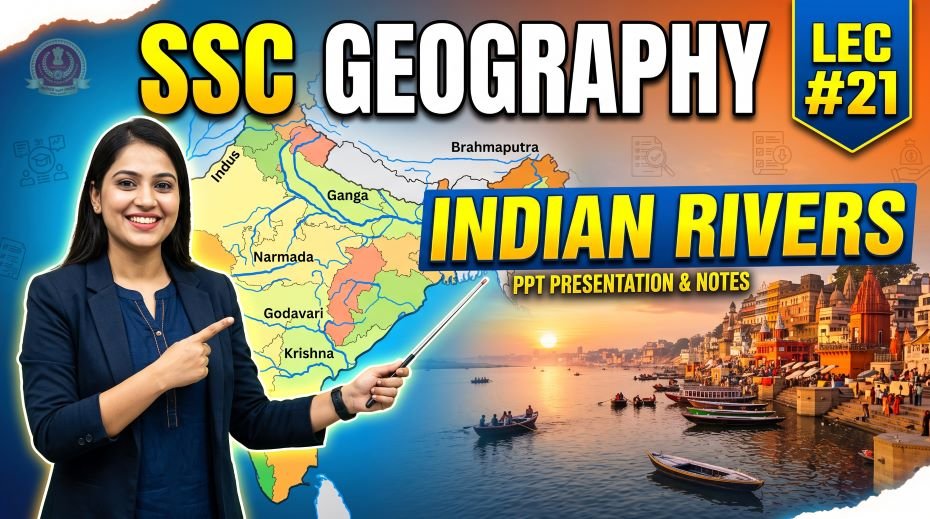
This article accompanies the SSC Geography Indian Rivers PPT (LEC #21) – Serial #100 of the Complete Foundation Batch for All SSC Exams PPT Series on slideshareppt.net. With 216 slides – the largest lecture in this entire series – and 97 MB in bilingual Hindi + English format, this PPT covers Indian rivers in extraordinary depth. This article provides complete reference tables on all major Himalayan and Peninsular rivers, their tributaries, sources, lengths, dams, disputes, and SSC exam facts – all aligned to the exam pattern.
Indian Rivers is one of the single most important chapters in SSC Geography – generating more direct exam questions than almost any other India-specific topic. From the sources and tributaries of the Ganga and Indus systems to the eastward-flowing peninsular rivers, hydroelectric projects, river disputes, and the difference between Himalayan and peninsular rivers, this topic demands thorough and systematic preparation.
PPT Resource Overview
| Detail | Information |
| Lecture Number | LEC #21 (Geography Series) |
| Serial Number in Complete Batch | #100 |
| Subject | Geography – Indian Rivers (भारतीय नदियाँ) |
| Series Name | Complete Foundation Batch for All SSC Exams (PPT Series) |
| Total Slides | 216 PPT Slides (largest lecture in the entire series) |
| File Size | 97 MB |
| Language | Hindi + English (Bilingual) |
| Format Available | Google Slides & Google Drive (PDF also available) |
| Website | www.slideshareppt.net |
| Target Exams | SSC CGL, SSC CHSL, SSC MTS, SSC GD Constable, RRB Group D |
| Suitable For | Students (self-study & marathon revision) and Teachers (classroom use) |
SSC Geography Indian Rivers PPT (LEC #21)
Note: Above is PPT in GOOGLE SLIDES (HTML AND IFRAME COMBINATION) and if you wish to download the Complete SSC series (PPT slides), visit this Link – REDIRECT PAGE.
Indian Rivers – Overview and Classification
India has an extensive river network that can be broadly classified into two types based on their origin and character: Himalayan Rivers (perennial – fed by glaciers and monsoon) and Peninsular Rivers (seasonal – fed mainly by monsoon rainfall). The major river systems of India drain into either the Arabian Sea (westward-flowing rivers) or the Bay of Bengal (eastward-flowing rivers). The Ganga River basin is the largest river basin in India, covering about 26% of the country’s total land area and supporting the most densely populated agricultural plains on Earth.
Himalayan Rivers vs Peninsular Rivers – Comparison Table
| Feature | Himalayan Rivers | Peninsular Rivers |
| Source | Glaciers, snowfields, and springs in the Himalayas | Springs, lakes, and rainfall in the Peninsular Plateau and Vindhya-Satpura ranges |
| Nature | Perennial (flow year-round) | Mostly seasonal (flow mainly during and after monsoon) |
| Why perennial? | Fed by glacial meltwater in summer and monsoon rainfall in rainy season | No glacial source; depend entirely on monsoon rainfall |
| Valley type | Young, V-shaped, deep gorges; highly active erosion | Mature, wide, shallow valleys; less erosion |
| Age | Young rivers – geologically recent; form gorges and waterfalls | Old rivers – ancient; flowing over stable Gondwana rock |
| Sediment load | Very high – carry massive amounts of silt; build deltas | Lower – ancient, hard rock basins; some form deltas, others estuaries |
| Course length | Generally longer; drain large catchment areas | Generally shorter |
| Delta/Estuary | Form large deltas (Ganga-Brahmaputra, Mahanadi, Godavari, Krishna, Kaveri) | Narmada and Tapi form estuaries; others form deltas |
| Drainage direction | Flow south/southeast into the Bay of Bengal (mainly) | Flow mainly east to Bay of Bengal; Narmada and Tapi flow west |
| Antecedent drainage | Himalayan rivers are antecedent – older than the mountains they cross (they cut through rising Himalayas) | Not antecedent – rivers follow the slope of the plateau |
| Economic use | Irrigation (year-round); hydroelectric power (steep gradient) | Irrigation (seasonal); hydropower on plateau edges and Western Ghats |
| Key rivers | Ganga, Yamuna, Brahmaputra, Indus, Sutlej, Beas, Ravi, Chenab, Jhelum | Narmada, Tapi, Mahanadi, Godavari, Krishna, Kaveri, Damodar, Luni |
The Ganga River System – Complete Reference
| Parameter | Detail |
| Source | Gangotri Glacier (Gaumukh), Uttarakhand – at ~3,892 m altitude |
| Length | ~2,525 km (India only); one of the longest rivers in India |
| Length in India | ~2,525 km from Gangotri to Bay of Bengal |
| Origin name change | River is called Bhagirathi from Gangotri to Devprayag; becomes Ganga at Devprayag (confluence with Alaknanda) |
| Five Prayags (holy confluences) | Vishnuprayag (Dhauliganga+Alaknanda), Nandaprayag (Nandakini+Alaknanda), Karnaprayag (Pindar+Alaknanda), Rudraprayag (Mandakini+Alaknanda), Devprayag (Bhagirathi+Alaknanda) |
| Empties into | Bay of Bengal at Sagar Island (Ganga Sagar), West Bengal |
| Basin area | ~8,61,404 sq km – largest river basin in India (~26% of India’s area) |
| States | Uttarakhand, UP, Bihar, Jharkhand (briefly), West Bengal |
| Major tributaries (right bank) | Yamuna, Son, Ghaghra, Gandak, Kosi (Left bank actually – correction: Yamuna is right bank) |
| Right bank tributaries | Son River (from Chota Nagpur Plateau); Punpun |
| Left bank tributaries | Ramganga, Ghaghra (Sarayu), Gandak, Kosi, Mahananda, Damodar |
| Yamuna | Largest tributary of Ganga; source: Yamunotri, Uttarakhand; joins Ganga at Prayagraj (Sangam/Triveni Sangam) |
| Sangam at Prayagraj | Triveni Sangam – confluence of Ganga, Yamuna, and the mythical Saraswati; site of Kumbh Mela |
| Kosi River | Known as ‘Sorrow of Bihar’ – causes devastating annual floods; source: Nepal Himalayas; most flood-prone tributary |
| Ganga in Bangladesh | Padma (in Bangladesh); joins Brahmaputra (Jamuna) and Meghna to form massive delta |
| Delta | Ganga-Brahmaputra-Meghna delta (Sundarbans) – world’s largest delta; ~50,000 sq km |
| Sacred Importance | Holiest river in Hinduism; Haridwar, Varanasi (Kashi), Prayagraj are major pilgrimage cities on its banks |
| Namami Gange | Government of India’s flagship river cleaning and conservation programme |
Major Tributaries of the Ganga – Reference Table
| Tributary | Bank (L/R) | Source | Joins Ganga At | Key SSC Fact |
| Yamuna | Right Bank | Yamunotri Glacier, Uttarakhand | Prayagraj (Sangam) | Longest tributary of Ganga; Delhi, Agra, Mathura on its banks; Taj Mahal is on Yamuna |
| Ramganga | Left Bank | Kumaon Himalayas, Uttarakhand | Near Kannauj, UP | Jim Corbett National Park is in the Ramganga catchment |
| Ghaghra (Sarayu) | Left Bank | Tibetan Plateau; Nepal Himalayas (Karnali) | Chhapra, Bihar | Ayodhya is on the Sarayu (Ghaghra system); longest left-bank tributary of Ganga |
| Gandak (Narayani) | Left Bank | Nepal Himalayas (Mustang) | Sonpur/Hajipur, Bihar | Narayani in Nepal; Gandak in India; joins Ganga opposite Patna |
| Kosi | Left Bank | Nepal Himalayas (7 streams forming Saptakoshi) | Near Kursela, Bihar | ‘Sorrow of Bihar’ – most destructive river due to annual flooding and channel shifting |
| Son | Right Bank | Amarkantak Plateau, MP | Patna, Bihar | Largest right-bank tributary of Ganga; flows from Gondwana/Deccan Plateau region |
| Damodar | Left Bank (via Hugli) | Chota Nagpur Plateau, Jharkhand | Joins Hugli (Ganga arm) in WB | ‘Sorrow of Bengal’ – flood-prone; Damodar Valley Corporation (DVC) – India’s first multi-purpose river valley project |
The Yamuna River – Complete Reference
| Parameter | Detail |
| Source | Yamunotri Glacier, Uttarkashi district, Uttarakhand (~6,387 m) |
| Length | ~1,376 km |
| Empties into | Ganga at Prayagraj (Triveni Sangam) |
| States | Uttarakhand, Himachal Pradesh (briefly), Haryana, Delhi, UP |
| Major cities on banks | Yamunotri (source), Delhi, Mathura (birthplace of Krishna), Agra (Taj Mahal), Etawah, Prayagraj |
| Tributaries | Chambal, Betwa, Ken, Tons, Hindon |
| Chambal River | Largest tributary of Yamuna; source: Vindhyan Escarpment, MP; flows through MP and Rajasthan; famous ravines |
| Taj Mahal | Built on the banks of Yamuna at Agra; one of the world’s most iconic monuments |
| SSC Key Facts | Longest tributary of Ganga; joins Ganga at Prayagraj; Delhi is on Yamuna; Taj Mahal on Yamuna; Chambal is its major tributary |
The Brahmaputra River System – Complete Reference
| Parameter | Detail |
| Source | Chemayungdung Glacier in the Kailash range, Tibet – known as Yarlung Tsangpo in Tibet |
| Total Length | ~2,900 km (one of the longest rivers in Asia); in India: ~916 km |
| Names by country | Tibet: Yarlung Tsangpo / Tsangpo; India (Arunachal Pradesh): Dihang / Siang; India (Assam): Brahmaputra; Bangladesh: Jamuna |
| Entry into India | Enters Arunachal Pradesh at Tuting/Geling through the Dihang gorge – one of the world’s deepest gorges (~5,000 m deep) |
| Empties into | Bay of Bengal (as part of the Padma-Meghna delta in Bangladesh) |
| Drainage area in India | ~1,94,413 sq km (mainly Assam) |
| States in India | Arunachal Pradesh, Assam, West Bengal (briefly) |
| Major tributaries | Left bank: Subansiri, Kameng, Manas, Sankosh, Tista; Right bank: Dihang, Lohit, Dibang |
| Tista River | Major left-bank tributary; flows through Sikkim and West Bengal; Tista water sharing dispute between India and Bangladesh |
| Majuli Island | World’s largest river island (freshwater); located in the Brahmaputra in Assam; ~880 sq km; Vaishnava culture centre |
| Kaziranga | Kaziranga National Park on Brahmaputra floodplains in Assam; habitat of the one-horned rhinoceros (UNESCO World Heritage) |
| Flood proneness | Brahmaputra is one of the most flood-prone rivers in the world; annual floods devastate Assam |
| Tsangpo-Brahmaputra Canyon | Yarlung Tsangpo Grand Canyon – world’s deepest gorge (~5,300 m) where river bends around Namcha Barwa peak in Tibet |
The Indus River System – Complete Reference
| Parameter | Detail |
| Source | Near Lake Mansarovar, Tibet (Sengge Zangbo river) |
| Total Length | ~3,180 km (entire river); ~1,114 km in India |
| Names | Sindhu (Sanskrit); Indus (Latin/English); gave name to India and Hinduism |
| Flow in India | Flows through Ladakh (J&K) before entering Pakistan |
| Empties into | Arabian Sea in Pakistan (Sindh province) |
| Tributaries in India | Five major Punjab rivers: Jhelum, Chenab, Ravi, Beas, Sutlej (all in Pakistan/India Punjab region) |
| Indus Waters Treaty (1960) | Signed between India and Pakistan; mediated by World Bank; divides the Indus system between India (eastern rivers: Sutlej, Beas, Ravi) and Pakistan (western rivers: Indus, Jhelum, Chenab) |
| Shyok River | Major tributary of Indus in Ladakh; Siachen Glacier meltwater flows into it |
| Significance | Indus Valley Civilisation (~3300–1300 BCE) – one of the world’s earliest civilisations – flourished along the Indus and its tributaries |
| Punjab rivers | Jhelum, Chenab, Ravi, Beas, Sutlej – ‘Punjab’ means ‘Land of Five Rivers’ |
| Jhelum | Flows through J&K valley (Srinagar); Dal Lake drains into it; enters Pakistan; Wular Lake (India’s largest freshwater lake) on its banks |
| SSC Importance | Indus Waters Treaty 1960; Punjab = land of 5 rivers; Wular Lake on Jhelum; Indus gave name to India |
Major Himalayan Rivers – Master Reference Table
| River | Source | Length (India) | Drains Into | States | Key SSC Fact |
| Ganga | Gangotri Glacier, Uttarakhand | ~2,525 km | Bay of Bengal | UK, UP, Bihar, WB | Longest river in India; holiest; largest basin (26% of India); Kumbh Mela cities on its banks |
| Yamuna | Yamunotri, Uttarakhand | ~1,376 km | Ganga at Prayagraj | UK, HP, HR, Delhi, UP | Longest tributary of Ganga; Taj Mahal; Delhi; Mathura; Agra |
| Brahmaputra | Chemayungdung, Tibet (Yarlung Tsangpo) | ~916 km (India) | Bay of Bengal (Bangladesh) | AP, Assam, WB | Majuli – world’s largest river island; Kaziranga; most flood-prone; deepest gorge on Earth |
| Indus (Sindhu) | Lake Mansarovar area, Tibet | ~1,114 km (India) | Arabian Sea (Pakistan) | Ladakh (J&K) | Gave name to India; Indus Waters Treaty 1960; flows mainly through Pakistan |
| Jhelum | Verinag spring, J&K valley | ~725 km | Chenab (then Indus) | J&K | Dal Lake and Wular Lake on its banks; flows through Srinagar |
| Chenab | Bara Lacha La, Himachal Pradesh | ~1,180 km | Indus (Pakistan) | HP, J&K | Largest river of the Punjab system by volume; Baglihar Dam (J&K) |
| Ravi | Rohtang Pass, HP | ~720 km | Chenab (Pakistan) | HP, Punjab | Lahore (Pakistan) is on Ravi; flows through Chamba, HP |
| Beas | Beas Kund, near Rohtang Pass, HP | ~470 km | Sutlej at Harike, Punjab | HP, Punjab | Kullu Valley on Beas; Pandoh Dam; joins Sutlej at Harike |
| Sutlej | Rakas Lake (near Mansarovar), Tibet | ~1,450 km | Chenab (Pakistan) | HP, Punjab | Longest Punjab river; Bhakra Nangal Dam (Gobind Sagar reservoir); Shipki La entry into India |
| Ghaghra (Sarayu) | Tibetan Plateau (Karnali) | ~1,080 km | Ganga at Chhapra, Bihar | UP, Bihar | Ayodhya is on Sarayu; ‘Sorrow of Bihar’ floods; Ghaghra in lower course |
| Gandak | Nepal Himalayas (Mustang) | ~630 km | Ganga at Sonpur/Hajipur | UP, Bihar | Narayani in Nepal; joins Ganga opposite Patna |
| Kosi | Nepal Himalayas (Saptakoshi) | ~730 km | Ganga near Kursela, Bihar | Bihar | ‘Sorrow of Bihar’; most flood-prone; shifts channel frequently |
| Tista | Tso Lhamo Lake, Sikkim (near Kangchenjunga) | ~315 km (India) | Brahmaputra (Assam) | Sikkim, WB | Major tributary of Brahmaputra; flows through Sikkim and North Bengal; water dispute with Bangladesh |
Peninsular Rivers of India – Overview
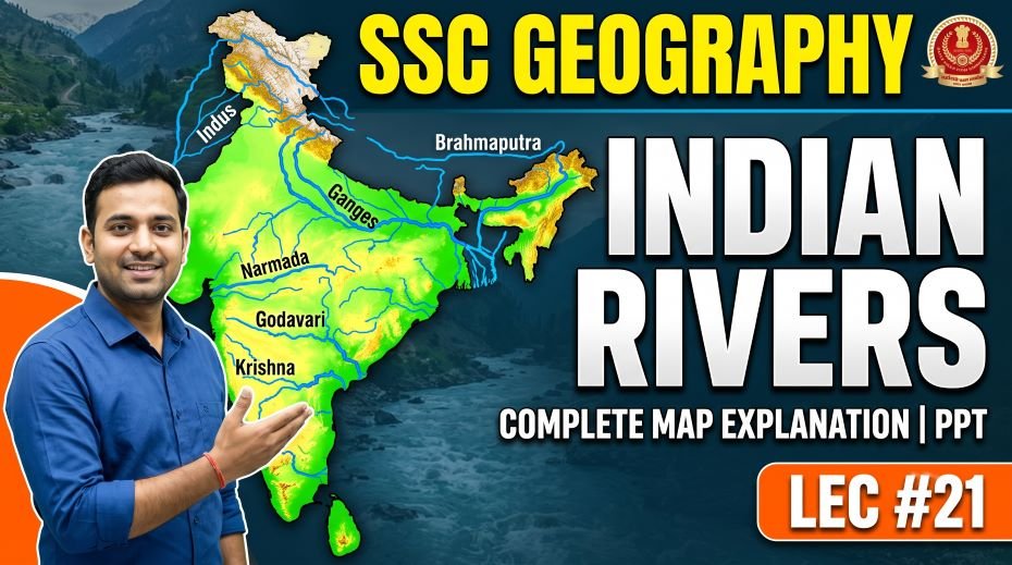
The peninsular rivers of India originate in the Peninsular Plateau or the Western Ghats and flow across ancient, hard Gondwana rock. They are seasonal rivers, dependent on monsoon rainfall, and most of them flow eastward into the Bay of Bengal. The two exceptions – Narmada and Tapi – flow westward through rift valleys into the Gulf of Khambhat (Arabian Sea).
Major Eastward-Flowing Peninsular Rivers
| River | Source | Length | States | Empties Into | Key SSC Fact |
| Mahanadi | Sihawa hills, Chhattisgarh (near Raipur) | ~858 km | CG, Odisha | Bay of Bengal (near Cuttack/Paradip) | Hirakud Dam (Odisha) – longest dam in India; Chilika Lake is south of its delta |
| Godavari | Trimbakeshwar, Nashik district, Maharashtra | ~1,465 km | MH, CG, Telangana, AP | Bay of Bengal (AP delta) | Longest and largest peninsular river; called ‘Dakshin Ganga’ (Ganga of the South); Dhupgarh is not its source (Trimbakeshwar is) |
| Krishna | Mahabaleshwar, Western Ghats, Maharashtra | ~1,400 km | MH, Karnataka, AP, Telangana | Bay of Bengal (AP) | 2nd largest peninsular river by length; Nagarjuna Sagar Dam; water dispute (Andhra-Karnataka-Maharashtra-Telangana) |
| Kaveri (Cauvery) | Talakaveri, Coorg (Kodagu), Karnataka | ~800 km | Karnataka, Tamil Nadu, Puducherry | Bay of Bengal (Tamil Nadu delta) | Called ‘Dakshin Ganga’ and ‘Ganga of the South’ (also shared with Godavari); Kaveri water dispute (Karnataka vs Tamil Nadu) – most famous water dispute in India; KRS Dam (Krishnarajasagara) |
| Tungabhadra | Confluence of Tunga and Bhadra rivers, Karnataka | ~531 km | Karnataka, AP | Joins Krishna in AP | Tungabhadra Dam – major irrigation project; Hampi (Vijayanagara Empire) on its banks |
| Damodar | Chota Nagpur Plateau, Jharkhand | ~592 km | Jharkhand, WB | Hugli (Ganga arm) | ‘Sorrow of Bengal’; Damodar Valley Corporation (DVC) – first multi-purpose river valley project in independent India (1948); coal belt |
| Subarnarekha | Near Ranchi, Jharkhand | ~395 km | Jharkhand, WB, Odisha | Bay of Bengal | Flows through Jharkhand and Odisha; Jamshedpur is near it |
| Brahmani | Confluence of Sankh and South Koel rivers, Jharkhand | ~799 km | Jharkhand, Odisha | Bay of Bengal (Odisha) | Flows through Odisha; industrial region |
Major Westward-Flowing Peninsular Rivers
| River | Source | Length | States | Empties Into | Key SSC Fact |
| Narmada | Amarkantak, Anuppur district, MP | ~1,312 km | MP, Maharashtra, Gujarat | Gulf of Khambhat (Arabian Sea) – estuary | Longest westward-flowing river in India; flows through a rift valley between Vindhya (north) and Satpura (south) ranges; Marble Rocks at Jabalpur (Bhedaghat); Sardar Sarovar Dam (Gujarat) – largest dam project in India by irrigation coverage |
| Tapi (Tapti) | Multai, Betul district, MP (Satpura range) | ~724 km | MP, Maharashtra, Gujarat | Gulf of Khambhat (Arabian Sea) – estuary | Flows parallel to Narmada through a rift valley; Surat is on Tapi; also forms an estuary like Narmada |
| Luni | Pushkar hills (Aravalli), near Ajmer, Rajasthan | ~495 km | Rajasthan, Gujarat | Rann of Kutch (not the sea directly) | Only significant river of the Thar Desert; seasonal/saline in lower course; saline – not potable in lower reaches |
| Mahi | Vindhya Range, near Dhar, MP | ~583 km | MP, Rajasthan, Gujarat | Gulf of Khambhat (Arabian Sea) | Flows through the Tropic of Cancer twice – unique feature; Kadana Dam (Gujarat) |
| Sabarmati | Aravallis, near Udaipur, Rajasthan | ~371 km | Rajasthan, Gujarat | Gulf of Khambhat (Arabian Sea) | Ahmedabad and Gandhinagar (Gujarat’s capital) on its banks; Gandhi Ashram (Sabarmati Ashram) on Sabarmati |
| Periyar | Sivagiri hills, Western Ghats, Kerala | ~244 km | Kerala | Arabian Sea (Laccadive Sea) | Largest river in Kerala; Idukki Dam; Periyar Wildlife Sanctuary |
| Bharathapuzha (Nila) | Palakkad district, Kerala (Silent Valley area) | ~209 km | Kerala | Arabian Sea | Longest river entirely within Kerala; flows through Palakkad Gap |
Major Dams and River Valley Projects of India
| Dam / Project | River | State | Purpose | Key SSC Fact |
| Sardar Sarovar Dam | Narmada | Gujarat (near Kevadia) | Irrigation, Power, Drinking water | Largest dam project in India by irrigation coverage; Statue of Unity nearby; Narmada Bachao Andolan against it |
| Bhakra Nangal Dam | Sutlej | Himachal Pradesh (Nangal, Punjab for power station) | Irrigation, Power (Gobind Sagar Reservoir) | Largest gravity dam in Asia (often called); Gobind Sagar reservoir; ‘Temple of Resurgent India’ – Nehru’s description |
| Hirakud Dam | Mahanadi | Odisha (near Sambalpur) | Flood control, Irrigation, Power | Longest dam in India (~26 km across including dykes); one of the first major multi-purpose projects after independence |
| Damodar Valley Corporation (DVC) | Damodar | Jharkhand and West Bengal | Flood control, Power, Irrigation | First multi-purpose river valley project of independent India (1948); modelled on the Tennessee Valley Authority (USA) |
| Nagarjuna Sagar Dam | Krishna | Telangana (Nalgonda district) | Irrigation, Power | One of the largest masonry dams in the world; Nagarjunakonda historical island submerged by its reservoir |
| Idukki Dam (Arch Dam) | Periyar | Kerala | Hydroelectric power | Largest arch dam in Asia; thin curved concrete wall; Kerala’s major power source |
| Tehri Dam | Bhagirathi (Ganga) | Uttarakhand | Irrigation, Power, Water supply | Highest dam in India (~260 m); highest dam in Asia (when built); controversial – submerged old Tehri town |
| Tungabhadra Dam | Tungabhadra | Karnataka (Hospet) | Irrigation, Power | Shared between Karnataka and AP; near Hampi; major irrigation for cotton-growing areas |
| Krishnarajasagara (KRS) | Kaveri | Karnataka (Mandya district) | Irrigation, Power | Brindavan Gardens nearby; feeds irrigation in Mysuru district |
| Farakka Barrage | Ganga | West Bengal (near Bangladesh border) | Navigation, Diversion of water to Hugli | Diverts Ganga water to Hugli to keep Kolkata Port navigable; cause of India-Bangladesh water dispute |
| Polavaram Dam | Godavari | Andhra Pradesh | Irrigation, Power, Drinking water | Largest project under construction in AP; designated as National Project |
| Koyna Dam | Koyna (tributary of Krishna) | Maharashtra (Sahyadri) | Hydroelectric power | Largest hydroelectric project in Maharashtra; caused the Koyna Earthquake (1967) – India’s worst reservoir-triggered quake |
Major Inter-State River Water Disputes in India
| Dispute | River | States Involved | Key SSC Fact |
| Kaveri (Cauvery) Water Dispute | Kaveri | Karnataka, Tamil Nadu, Kerala, Puducherry | Most famous inter-state water dispute; Tamil Nadu wants more water from Karnataka; Supreme Court and Kaveri Water Disputes Tribunal involved; Cauvery Water Management Authority established |
| Krishna Water Dispute | Krishna | Maharashtra, Karnataka, Andhra Pradesh, Telangana | Bachawat Tribunal (1969); Brijesh Kumar Tribunal (2010); water allocation among four states after Telangana’s formation |
| Godavari Water Dispute | Godavari | Maharashtra, Andhra Pradesh, Telangana, Chhattisgarh, Odisha | One of the earlier inter-state tribunals; allocation among states of the river’s large basin |
| Narmada Water Dispute | Narmada | Gujarat, Madhya Pradesh, Maharashtra, Rajasthan | Narmada Waters Dispute Tribunal (1969–1979); Sardar Sarovar Dam height controversy; Narmada Bachao Andolan (Medha Patkar) opposed dam |
| Ravi and Beas Water Dispute | Ravi and Beas | Punjab, Haryana, Rajasthan, Himachal Pradesh | Punjab Reorganisation Act 1966; SYL (Sutlej-Yamuna Link Canal) – incomplete canal meant to share Punjab waters with Haryana; long-standing dispute |
| Mahadayi (Mandovi) Water Dispute | Mahadayi | Goa, Karnataka, Maharashtra | Karnataka wants diversion; Goa opposes as river is lifeline of Goa; Mahadayi Water Disputes Tribunal award (2018) |
| Vansadhara Water Dispute | Vansadhara | Odisha, Andhra Pradesh | Vansadhara Water Disputes Tribunal established |
| Tista Water Sharing | Tista | India and Bangladesh (international) | Bangladesh wants more Tista water; India (West Bengal) reluctant; unresolved; affects India-Bangladesh relations |
Indian Rivers – Superlatives and Most Asked SSC Facts
| Superlative | River | Key Detail |
| Longest river in India | Ganga | ~2,525 km (within India); includes tributaries Yamuna, Ghaghra, etc. |
| Largest river basin in India | Ganga basin | ~8,61,404 sq km – 26% of India’s total area |
| Longest peninsular river | Godavari | ~1,465 km – ‘Dakshin Ganga’ |
| Largest peninsular river basin | Godavari | Largest basin among peninsular rivers |
| Longest westward-flowing river | Narmada | ~1,312 km – flows through rift valley |
| Longest tributary of Ganga | Yamuna | ~1,376 km |
| River called ‘Sorrow of Bihar’ | Kosi | Floods annually; shifts its channel frequently |
| River called ‘Sorrow of Bengal’ | Damodar | Floods; also Hugli/Ganga sometimes used |
| River giving name to India | Indus (Sindhu) | India derives from Indus/Hindu from Sindhu |
| River with India’s largest freshwater lake on its banks | Jhelum | Wular Lake – largest freshwater lake in India |
| River famous for Sangam | Ganga + Yamuna | Triveni Sangam at Prayagraj |
| World’s largest river island on | Brahmaputra | Majuli Island – largest freshwater river island |
| Longest dam in India | Mahanadi | Hirakud Dam (~26 km) |
| Highest dam in India | Bhagirathi/Ganga | Tehri Dam (~260 m), Uttarakhand |
| First multi-purpose project in independent India | Damodar | Damodar Valley Corporation (DVC) – 1948 |
| River flowing through Tropic of Cancer twice | Mahi | Flows out and back across 23.5°N – unique |
| River called ‘Dakshin Ganga’ | Godavari (primary) / Kaveri | Both called this; Godavari more commonly |
| River with longest rift valley course | Narmada | Flows between Vindhya and Satpura ranges |
| Deepest gorge river entry point | Brahmaputra (Tsangpo/Dihang) | Enters India through deepest gorge in the world |
Quick Fact Table – Indian Rivers for SSC Exams
| Question / Fact | Answer |
| Longest river in India | Ganga (~2,525 km in India) |
| Largest river basin in India | Ganga basin (~8,61,404 sq km – 26% of India) |
| Longest peninsular river | Godavari (~1,465 km) |
| Longest westward-flowing river | Narmada (~1,312 km) |
| Longest tributary of Ganga | Yamuna (~1,376 km) |
| Source of Ganga | Gangotri Glacier (Gaumukh), Uttarakhand |
| Ganga becomes Ganga at | Devprayag – confluence of Bhagirathi and Alaknanda |
| Ganga empties into | Bay of Bengal at Sagar Island, West Bengal |
| Sangam / Triveni at Prayagraj | Ganga + Yamuna + (mythical) Saraswati |
| ‘Sorrow of Bihar’ | Kosi River |
| ‘Sorrow of Bengal’ | Damodar River |
| ‘Dakshin Ganga’ | Godavari (also Kaveri) |
| River giving India its name | Indus (Sindhu in Sanskrit) |
| Brahmaputra’s name in Tibet | Yarlung Tsangpo (Tsangpo) |
| World’s largest river island | Majuli Island, Assam (on Brahmaputra) |
| Indus Waters Treaty year | 1960 – between India and Pakistan |
| Largest freshwater lake in India | Wular Lake, J&K – on Jhelum River |
| Narmada and Tapi form | Estuaries (not deltas) – rift valley rivers |
| Longest dam in India | Hirakud Dam, Odisha (on Mahanadi) – ~26 km |
| Highest dam in India | Tehri Dam, Uttarakhand (~260 m, on Bhagirathi/Ganga) |
| First multi-purpose river valley project | Damodar Valley Corporation (DVC) – 1948 |
| Bhakra Nangal Dam reservoir name | Gobind Sagar (on Sutlej, HP) |
| Sardar Sarovar Dam river | Narmada, Gujarat – near Statue of Unity |
| Most famous water dispute in India | Kaveri (Cauvery) – Karnataka vs Tamil Nadu |
| River flowing through Tropic of Cancer twice | Mahi River |
| Sabarmati Ashram (Gandhi) is on | Sabarmati River, Ahmedabad, Gujarat |
| Ayodhya is on which river? | Sarayu (Ghaghra system) |
| Taj Mahal is on which river? | Yamuna, at Agra |
| Delhi is on which river? | Yamuna |
| Koyna Earthquake (1967) was caused by | Koyna Dam (reservoir-triggered earthquake) – Maharashtra |
also read: SSC Geography Islands PPT Slides (LEC #20)
Q&A:
Q1: What is the difference between a perennial river and a seasonal river, and which Indian rivers are perennial?
A perennial river flows throughout the year, even during the dry season, because it has a permanent source of water beyond monsoon rainfall – typically a glacier, permanent snowfield, or large spring. The Himalayan rivers – including the Ganga, Yamuna, Indus, Brahmaputra, and their major tributaries – are perennial because they receive glacial meltwater during summer (when glaciers melt) in addition to monsoon rainfall during the rainy season, ensuring year-round flow. Seasonal rivers, by contrast, flow only during and shortly after the monsoon season. Most peninsular rivers – the Godavari, Krishna, Kaveri, Mahanadi – are seasonal because they originate in the non-glaciated Peninsular Plateau and depend entirely on monsoon rainfall. This perennial-versus-seasonal distinction is one of the most frequently tested river classification facts in SSC papers.
Q2: What is antecedent drainage and which Indian rivers demonstrate it?
Antecedent drainage refers to a pattern where a river is older than the mountain range it flows through – the river maintained its course as the mountains slowly rose around it, cutting through the range rather than being diverted by it. The Himalayan rivers – Ganga (via its upper tributaries), Indus, Sutlej, Brahmaputra, and Tista – are classic examples of antecedent drainage. These rivers were flowing in their approximate courses before the Himalayas began rising approximately 50 million years ago, and as the mountains slowly uplifted, the rivers cut downward just as fast, creating the spectacular gorges and narrow valleys seen in the Himalayas today. This explains why the Brahmaputra flows through the world’s deepest gorge at Namcha Barwa – it was cutting down as the peak was rising around it.
Q3: Why do Narmada and Tapi form estuaries instead of deltas like other peninsular rivers?
Narmada and Tapi are the only major westward-flowing peninsular rivers, and they form estuaries at their mouths rather than the deltas built by eastward-flowing rivers like the Godavari, Krishna, and Kaveri. Both rivers flow through rift valleys – structurally depressed basins between fault lines – bounded by the Vindhya Range to the north and the Satpura Range to the south (for Narmada) and the Satpura Range to the north and Ajanta/Sahyadri ranges to the south (for Tapi). The hard, resistant Deccan Plateau bedrock at their mouths, combined with the strong tidal action in the Gulf of Khambhat, prevents sediment accumulation needed for delta formation. Instead, the river mouths remain as funnel-shaped estuaries where tides push back the sediment.
Q4: What is the Indus Waters Treaty of 1960 and why is it significant?
The Indus Waters Treaty of 1960 is a water-sharing agreement signed between India and Pakistan, brokered by the World Bank, to divide the use of the six rivers of the Indus river system. Under the treaty, India received the three eastern rivers – Sutlej, Beas, and Ravi – for unrestricted use, while Pakistan received the three western rivers – Indus, Jhelum, and Chenab – for its use, with India allowed limited use. This treaty has survived multiple India-Pakistan wars and decades of tensions, making it one of the most durable international water-sharing agreements in the world. It became contested again after the 2016 Uri attack and 2019 Pulwama attack, when India raised the possibility of reviewing the treaty.
Q5: What makes the Kaveri water dispute the most famous river conflict in India?
The Kaveri water dispute between Karnataka and Tamil Nadu is considered India’s most contentious and longest-running inter-state water dispute. The Kaveri originates in Coorg (Karnataka) and is the lifeline of Tamil Nadu’s agriculture, particularly in the Cauvery delta which produces significant paddy crops. Karnataka has built large reservoirs (Krishnarajasagara and others) upstream, reducing downstream flow to Tamil Nadu, especially during deficit monsoon years. The dispute involves constitutional questions about federal water rights, economic survival of farmers in both states, and the political sensitivity of river water in agriculture-dependent regions. Multiple tribunals (Bachawat Tribunal for Krishna, Cauvery Water Disputes Tribunal) and the Supreme Court have been involved. The Cauvery Water Management Authority was established in 2018 to manage day-to-day water releases.
Q6: Why is the Brahmaputra such a unique river geographically?
The Brahmaputra is unique in several ways. It is one of the few major rivers in the world that flows in both east and west directions – it flows east as the Yarlung Tsangpo across Tibet for over 1,600 km before making a dramatic U-turn (hairpin bend) around Namcha Barwa peak and entering India through the world’s deepest gorge. It then flows westward through Assam before turning south into Bangladesh. It is an antecedent river, older than the Himalayas it crosses. It carries the highest sediment load of any river in India and is one of the most flood-prone rivers in the world. It hosts Majuli, the world’s largest freshwater river island. And it changes names across three countries – Yarlung Tsangpo (Tibet), Siang/Dihang/Brahmaputra (India), and Jamuna (Bangladesh).
Q7: What is the significance of the Ganga in Indian culture and the Namami Gange programme?
The Ganga is not just a river in the ecological or geographical sense – it is the spiritual lifeline of India, considered the holiest river in Hinduism and central to the cultural and religious identity of hundreds of millions of Indians. Its source at Gangotri and the Badrinath temple complex, the pilgrim city of Haridwar (Har Ki Pauri), the cremation ghats of Varanasi, and the Triveni Sangam at Prayagraj are among India’s most sacred sites. The Ganga was also the foundation of the Gangetic civilisation that gave rise to cities like Varanasi (one of the world’s oldest inhabited cities), Pataliputra, and Prayagraj. Namami Gange is the Government of India’s flagship integrated conservation programme for the Ganga, launched in 2014 with a budget of over ₹20,000 crore, aimed at pollution control, sewage treatment, river surface cleaning, and afforestation of river banks – making it a highly relevant Current Affairs topic alongside Geography.
Rapid Revision Cheat Sheet – Indian Rivers
| Topic | Key Point |
| Longest river in India | Ganga – ~2,525 km in India |
| Largest river basin | Ganga – ~8,61,404 sq km (26% of India) |
| Longest peninsular river | Godavari – ~1,465 km – ‘Dakshin Ganga’ |
| Longest westward river | Narmada – ~1,312 km – rift valley |
| Ganga source | Gangotri Glacier, Uttarakhand (Gaumukh) |
| Ganga becomes ‘Ganga’ at | Devprayag – Bhagirathi + Alaknanda |
| Triveni Sangam | Prayagraj – Ganga + Yamuna + (mythical) Saraswati |
| Longest tributary of Ganga | Yamuna – ~1,376 km |
| Yamuna source | Yamunotri Glacier, Uttarakhand |
| Sorrow of Bihar | Kosi River (floods annually) |
| Sorrow of Bengal | Damodar River |
| Brahmaputra in Tibet | Yarlung Tsangpo |
| World’s largest river island | Majuli, Assam (on Brahmaputra) |
| Wular Lake – on which river? | Jhelum (J&K) – largest freshwater lake in India |
| Indus Waters Treaty | 1960 – India (Sutlej, Beas, Ravi) vs Pakistan (Indus, Jhelum, Chenab) |
| Narmada and Tapi form | Estuaries – not deltas (rift valley rivers; hard rock) |
| Mahi unique feature | Crosses Tropic of Cancer twice |
| Hirakud Dam | Mahanadi, Odisha – longest dam in India (~26 km) |
| Tehri Dam | Bhagirathi/Ganga, Uttarakhand – highest dam in India (~260 m) |
| Bhakra Nangal Dam | Sutlej, HP – Gobind Sagar reservoir – ‘Temple of Resurgent India’ |
| Sardar Sarovar Dam | Narmada, Gujarat – Statue of Unity nearby |
| First multi-purpose project | Damodar Valley Corporation (DVC) – 1948 |
| Most famous water dispute | Kaveri – Karnataka vs Tamil Nadu |
| Taj Mahal river | Yamuna at Agra |
| Ayodhya river | Sarayu (Ghaghra system) |
| Gandhi’s ashram river | Sabarmati (Ahmedabad) |
| Koyna Earthquake (1967) | Reservoir-triggered – Koyna Dam, Maharashtra |
| Namami Gange | Ganga cleaning programme – launched 2014 |
| Serial number of this PPT | #100 in the Complete Foundation Batch |
Conclusion
Indian Rivers is the richest single chapter in SSC Indian Geography – and this lecture (216 slides, Serial #100) reflects the scope of the topic. The Ganga system alone generates 4–6 marks per SSC paper through questions on sources, tributaries, Sangam, dams, disputes, and cultural references. Add the Brahmaputra’s antecedent character, the Indus Waters Treaty, the Narmada-Tapi estuary anomaly, the Mahi’s dual Tropic of Cancer crossing, and the dam superlatives – and this topic becomes one of the safest 6–10 mark sources in the entire SSC General Awareness syllabus.
The SSC Geography Indian Rivers PPT (LEC #21), Serial #100, available at slideshareppt.net in bilingual Hindi + English format across 216 slides, gives you the most comprehensive visual coverage of this topic available. Study the Himalayan vs Peninsular comparison, memorise the river superlatives table, and use the Rapid Revision Cheat Sheet in the final days before your exam. This topic, prepared thoroughly, will consistently deliver the highest return on study time of any chapter in this series.