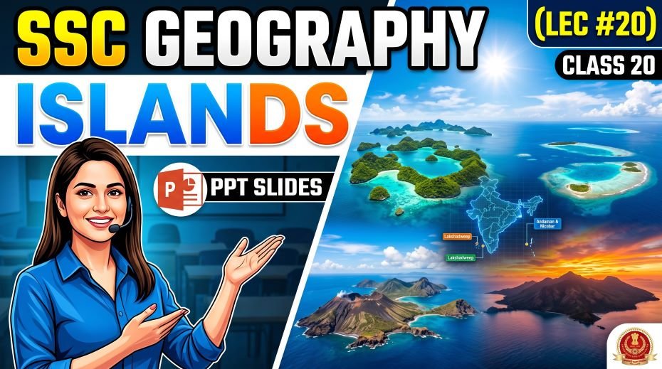
Today we will discuss about the SSC Geography Islands PPT Slides (LEC #20) – Serial #99 of the Complete Foundation Batch for All SSC Exams PPT Series on slideshareppt.net. With 122 slides in bilingual Hindi + English format, this PPT covers the Andaman and Nicobar Islands and Lakshadweep in complete depth, aligned to the SSC exam pattern.
India’s island territories – the Andaman & Nicobar Islands in the Bay of Bengal and the Lakshadweep Islands in the Arabian Sea – are among the most frequently tested topics in SSC CGL, SSC CHSL, SSC MTS, SSC GD Constable, and RRB Group D General Awareness sections. From their geological origin and physical geography to their indigenous tribes, wildlife, strategic importance, and administrative status, these islands offer a concentrated set of high-yield exam facts.
PPT Overview
| Detail | Information |
| Lecture Number | LEC #20 (Geography Series) |
| Serial Number in Complete Batch | #99 |
| Subject | Geography – Islands (द्वीप समूह) |
| Series Name | Complete Foundation Batch for All SSC Exams (PPT Series) |
| Total Slides | 122 PPT Slides |
| File Size | 35 MB |
| Language | Hindi + English (Bilingual) |
| Format Available | Google Slides & Google Drive (PDF also available) |
| Website | www.slideshareppt.net |
| Target Exams | SSC CGL, SSC CHSL, SSC MTS, SSC GD Constable, RRB Group D |
| Suitable For | Students (self-study & marathon revision) and Teachers (classroom use) |
SSC Geography Islands PPT Slides (LEC #20)
Note: Above is PPT in GOOGLE SLIDES (HTML AND IFRAME COMBINATION) and if you wish to download the Complete SSC series (PPT slides), visit this Link – REDIRECT PAGE.
India’s Islands – Overview
India’s island territories are broadly divided into two groups: the Andaman & Nicobar Islands in the Bay of Bengal (eastern side) and the Lakshadweep Islands in the Arabian Sea (western side). Together they contain approximately 1,382 islands, islets, rocks, and shoals, of which only about 48 are permanently inhabited. These islands collectively add approximately 8,249 sq km to India’s land area but contribute a disproportionately large Exclusive Economic Zone (EEZ) of ~2 million sq km to India’s maritime territory.
Andaman & Nicobar vs Lakshadweep – Master Comparison Table
| Feature | Andaman & Nicobar Islands | Lakshadweep Islands |
| Location | Bay of Bengal (northeast of Indian Ocean) | Arabian Sea (southwest off Kerala coast) |
| Nearest mainland city | Kolkata (~1,255 km); Chennai (~1,190 km by sea) | Kochi / Kozhikode (~200–400 km) |
| Capital / Headquarters | Port Blair (South Andaman Island) | Kavaratti |
| Total number of islands | ~572 islands (only ~38 inhabited) | 36 islands (only ~10 inhabited) |
| Total land area | ~8,249 sq km | ~32 sq km (India’s smallest UT by area) |
| Geological origin | Continental – submerged continuation of the Arakan-Yoma mountain range of Myanmar | Coral – built up by coral organisms on a shallow submarine volcanic platform |
| Terrain | Hilly; dense tropical rainforest; rising to ~700 m on South Andaman | Flat and low-lying; highest point 4–5 m above sea level; coconut palms |
| Climate | Tropical rainforest; heavy rainfall (~3,000 mm/year); hot and humid year-round | Tropical maritime; rainfall ~1,500 mm/year; drier than Andaman |
| Active Volcano | Barren Island – India’s only active volcano | None |
| Dormant Volcano | Narcondam Island – dormant; wildlife sanctuary | Not applicable |
| Southernmost point of India | Indira Point, Great Nicobar (~6°45’N) – southernmost tip of India | Not India’s southernmost territory |
| Northernmost island | Landfall Island (~13.6°N) | Amini Island (northernmost of the group) |
| Major channels within group | Ten Degree Channel (between Andaman and Nicobar groups); Duncan Passage (South Andaman to Little Andaman) | Eight Degree Channel (between Lakshadweep and Maldives); Nine Degree Channel (between Minicoy and main Lakshadweep group) |
| Religion majority | Hinduism (majority settlers); indigenous tribes practice animism | Islam – India’s only Muslim-majority UT |
| Languages spoken | Hindi, Bengali, Tamil, Telugu; indigenous languages (Andamanese, Nicobarese, Sentinelese, Onge) | Malayalam; Mahl (in Minicoy) |
| Administrative status | Union Territory with Lieutenant Governor | Union Territory with Administrator (no Legislature) |
| Indigenous tribes | Great Andamanese, Onge, Jarawa, Sentinelese (North Sentinel Island), Shompen, Nicobarese | No indigenous tribes; settled population speaking Malayalam |
| Ecosystem | Tropical rainforest; mangroves; coral reefs; rich biodiversity; sea turtles | Coral reefs and lagoons; extremely rich marine biodiversity; no freshwater rivers |
| Strategic importance | Near Strait of Malacca; INS Baaz (air base on Great Nicobar); Eastern Naval Command has presence | Near Lakshadweep Sea / Arabian Sea trade routes; no major military base currently |
| Cellular Jail | Kaala Paani – Port Blair – colonial-era prison; National Memorial; houses Andaman Museum | Not applicable |
| UNESCO / Conservation | Barren Island; Narcondam Hornbill (endemic bird); six national parks; rich endemic species | No UNESCO site; Pitti Island Bird Sanctuary; marine national parks |
Andaman & Nicobar Islands – Complete Reference
Basic Geography
| Parameter | Detail |
| Full Name | Andaman & Nicobar Islands (A&N Islands) |
| Capital | Port Blair (South Andaman Island) |
| Location | Bay of Bengal, northeast Indian Ocean |
| Latitudinal extent | ~6°N to ~14°N |
| Longitudinal extent | ~92°E to ~94°E |
| Total area | ~8,249 sq km |
| Number of islands | ~572 islands, rocks, reefs (38 inhabited) |
| Distance from mainland | ~1,190 km from Chennai; ~1,255 km from Kolkata |
| Highest point | Saddle Peak (732 m) – North Andaman Island |
| Major island groups | North Andaman, Middle Andaman, South Andaman, Little Andaman (Andaman group); Car Nicobar, Nancowry, Great Nicobar (Nicobar group) |
| Largest island | Middle Andaman (largest single island of the group) |
| Major channel between A and N | Ten Degree Channel – separates Andaman group from Nicobar group at 10°N latitude |
| Duncan Passage | Separates South Andaman from Little Andaman |
| Coco Channel | Separates North Andaman from the Coco Islands of Myanmar |
| Geological origin | Submerged continuation of the Arakan Yoma mountains of Myanmar – continental origin |
| Rock type | Primarily sedimentary and some volcanic; Barren Island is a stratovolcano |
| Barren Island | India’s only active volcano; in the Andaman Sea; has erupted multiple times since 1991 |
| Narcondam Island | Dormant/extinct volcanic island; wildlife sanctuary; home to the Narcondam Hornbill (endemic bird found nowhere else) |
Andaman & Nicobar – Key Historical and Administrative Facts
| Event / Fact | Detail |
| British colonial history | British established a penal colony on Ross Island, Port Blair in 1858 after the 1857 War of Independence |
| Cellular Jail (Kaala Paani) | Built by the British from 1896–1906 in Port Blair; housed Indian freedom fighters; called ‘Kaala Pani’ (Black Waters); now a National Memorial |
| Japanese occupation | Occupied by Japan during World War II (1942–1945) |
| Indian independence | Became part of India on 15 August 1947; administered as a Union Territory |
| Integration with Nicobar Islands | Both groups combined into single UT of Andaman & Nicobar Islands |
| 2004 Tsunami impact | Among the most severely affected regions in India; Indira Point on Great Nicobar partially submerged |
| INS Andaman / INS Baaz | India’s naval airbase on Great Nicobar (INS Baaz) and other military facilities; strategic location near Strait of Malacca |
| Holonomic Project | India’s ambitious plan to develop Great Nicobar Island as a major transshipment hub and naval base |
Indigenous Tribes of Andaman & Nicobar Islands
| Tribe | Island(s) | Status | Key SSC Fact |
| Sentinelese | North Sentinel Island | Uncontacted – all contact prohibited by law; aggressive toward outsiders | Most isolated people in the world; India legally protects their isolation; any contact prohibited under Protection of Aboriginal Tribes Regulations; North Sentinel Island is off-limits |
| Jarawa | South and Middle Andaman | Contact established but protected; semi-isolated | Emerged from isolation in 1990s; protected under Andaman Trunk Road regulation; approx. 250–400 individuals |
| Onge | Little Andaman | Controlled contact; declining population | Among the most ancient populations on Earth genetically; approx. 100 individuals remaining |
| Great Andamanese | Strait Island (resettled) | Contacted; very small population | Originally hundreds strong; now only ~70 individuals; speak Andamanese language (highly distinct) |
| Shompen | Great Nicobar Island | Semi-isolated; limited contact | Indigenous to Great Nicobar; hunter-gatherers; vulnerable to development of Great Nicobar |
| Nicobarese | Nicobar Islands (mainly Car Nicobar) | Integrated; larger population | Largest indigenous group; practice Christianity; maritime culture; more contact with the outside world |
Andaman & Nicobar – Wildlife and Ecology
| Species / Feature | Key Detail |
| Andaman Sea Turtle | Six of the world’s seven sea turtle species nest in the A&N Islands; Leatherback Sea Turtle is the largest |
| Saltwater Crocodile | A&N Islands have healthy populations; world’s largest reptile; Bhitarkanika (Odisha) also has them |
| Narcondam Hornbill | Endemic to Narcondam Island only; nowhere else in the world; classified as vulnerable |
| Andaman Wild Pig | Endemic subspecies of Wild Pig; found only in Andaman Islands |
| Dugong (Sea Cow) | Herbivorous marine mammal; rare; seagrass habitat in A&N Islands; India’s Marine Animal |
| Andaman Coral Reefs | Some of India’s best preserved coral reefs; high biodiversity; affected by 1998 and 2010 bleaching events |
| Mangrove Forests | Extensive mangrove cover in creek areas; supports diverse aquatic life |
| National Parks | Mahatma Gandhi Marine National Park (Wandoor, South Andaman); Campbell Bay National Park (Great Nicobar); Galathea National Park (Great Nicobar) |
| Saddle Peak National Park | North Andaman; Saddle Peak (732 m) – highest point in A&N Islands |
| Biosphere Reserve | Great Nicobar Biosphere Reserve – UNESCO Man and Biosphere Reserve |
Lakshadweep Islands – Complete Reference
Basic Geography
| Parameter | Detail |
| Full Name | Lakshadweep (meaning ‘One Hundred Thousand Islands’ in Sanskrit) |
| Capital / Headquarters | Kavaratti Island |
| Location | Arabian Sea, about 200–440 km off the Kerala coast |
| Latitudinal extent | ~8°N to ~12°N |
| Longitudinal extent | ~71°E to ~74°E |
| Total area | ~32 sq km – India’s smallest UT by area and population |
| Number of islands | 36 islands (only ~10 inhabited) |
| Distance from mainland | ~200–440 km from the Kerala coast |
| Geological origin | Coral atolls – built on top of a shallow submarine volcanic platform |
| Highest point | ~4–5 m above sea level – extremely low-lying |
| Major islands | Kavaratti (capital), Agatti (only airport), Minicoy, Amini, Andrott (largest island), Bangaram, Kalpeni |
| Nine Degree Channel | Separates Minicoy Island from the main Lakshadweep group |
| Eight Degree Channel | Separates the southernmost Lakshadweep islands from Maldives |
| Religion | Islam – only Muslim-majority UT in India; majority practice Sunni Islam |
| Language | Malayalam (mainly); Mahl (dialect of Divehi) in Minicoy Island |
| Administration | Union Territory without Legislature – directly administered by Centre through Administrator (not Lieutenant Governor) |
| Climate Threat | Among the most vulnerable places in India to rising sea levels; 1 m rise would submerge most islands |
| Economy | Fishing, coconut/copra production, tourism, tuna processing; no agriculture possible (no freshwater rivers) |
Lakshadweep – Key Islands and Their Facts
| Island | Key Facts |
| Kavaratti | Capital and administrative headquarters; only island with a degree college; mosque with beautiful wooden pillars |
| Agatti | Only island with a commercial airport; gateway to Lakshadweep from mainland |
| Andrott | Largest island in Lakshadweep by area; historically important |
| Minicoy | Southernmost inhabited island; separated from main group by Nine Degree Channel; has a lighthouse; language is Mahl (not Malayalam); distinct culture |
| Bangaram | Uninhabited; popular for eco-tourism and snorkelling |
| Amini | Northernmost inhabited island of Lakshadweep |
| Kalpeni | Known for coral rim and three surrounding islets (Tilakkam, Pitti, Cheriyam) |
| Pitti Island | Uninhabited; bird sanctuary; brown booby nesting site |
Lakshadweep – Wildlife and Marine Ecology
| Species / Feature | Key Detail |
| Coral Reefs | Lakshadweep is one of India’s most important coral reef systems; predominantly fringing reefs and lagoons |
| Green Sea Turtle | Major nesting site in Lakshadweep; an endangered species globally |
| Hawksbill Turtle | Also nests in Lakshadweep; critically endangered |
| Spinner Dolphin | Common in the waters around Lakshadweep |
| Whale Shark | Occasionally seen; world’s largest fish; gentle filter feeder |
| Manta Ray | Seen in Lakshadweep waters; large filter-feeding ray |
| Marine National Parks | Pitti Island Bird Sanctuary; no major terrestrial national parks due to tiny land area |
| Fishing | Tuna fishing is the main livelihood; skipjack and yellowfin tuna; Government-run tuna processing plant at Minicoy |
| Coconut | Coconut palms cover most habitable land; coconut and copra (dried coconut) are main agricultural products; coconut crab (Robber Crab) – largest land-living arthropod – found here |
Important Sea Channels Around India’s Islands
| Channel | Location / Between | Significance |
| Ten Degree Channel | Between Little Andaman (Andaman group) and Car Nicobar (Nicobar group) | Named because it lies approximately at 10°N latitude; separates the two main island groups of A&N Islands |
| Duncan Passage | Between South Andaman Island and Little Andaman Island | Named after a British naval officer; separates main Andaman group from Little Andaman |
| Coco Channel | Between North Andaman Island and the Coco Islands (Myanmar) | Myanmar’s Coco Islands are just north of the A&N Islands; strategically important |
| Preparis Channel | Between North Andaman Island and Preparis Island (Myanmar) | Northern channel of the Andaman group |
| Nine Degree Channel | Between Minicoy Island (Lakshadweep) and the main Lakshadweep group | Named because it lies approximately at 9°N latitude; Minicoy is culturally distinct from the main group |
| Eight Degree Channel | Between the southernmost Lakshadweep Islands and Maldives (Republic of) | Named for its ~8°N latitude; separates India’s territory (Lakshadweep) from the sovereign nation Maldives |
| Palk Strait | Between Tamil Nadu (India) and Sri Lanka | Very shallow (~60 m); connects Palk Bay to Gulf of Mannar; closest point between India and Sri Lanka (~22 km) |
| Palk Bay | Between Tamil Nadu coast and Sri Lanka (Jaffna Peninsula) | Lies within the Palk Strait region; shallower area |
| Gulf of Mannar | Between Tamil Nadu-Kerala coast and Sri Lanka | Lies south of Palk Strait; deeper than Palk Bay; Mannar Marine National Park; Adam’s Bridge / Ram Setu |
Strategic Importance of India’s Islands
| Aspect | Andaman & Nicobar Islands | Lakshadweep Islands |
| EEZ Contribution | Contributes significantly to India’s eastern maritime EEZ – extends India’s reach into the Bay of Bengal and eastern Indian Ocean | Extends India’s maritime presence in the Arabian Sea; provides EEZ coverage in western Indian Ocean |
| Military Significance | Very High – hosts tri-services command (India’s only one); near Strait of Malacca; INS Baaz naval air station on Great Nicobar; monitors shipping traffic | Moderate – no permanent military base currently; potential for maritime patrol |
| Proximity to Key Route | ~90 km from Strait of Malacca – through which ~40% of world’s trade passes | Along Arabian Sea trade routes connecting India to Middle East, Africa, and Europe |
| Great Nicobar Project | India planning a major transshipment port, international airport, and naval base on Great Nicobar; significant geopolitical implications for countering China’s presence in Indian Ocean | Not applicable |
| Tourism Potential | High – Havelock Island (Radhanagar Beach), Neil Island, Ross Island; scuba diving, marine national parks | High – Bangaram, Agatti; pristine coral reefs; snorkelling and diving |
| Environmental concern | Great Nicobar development threatens Great Nicobar Biosphere Reserve and Shompen tribe; major conservation debate | Extreme vulnerability to climate change and sea-level rise; coral bleaching is a serious threat |
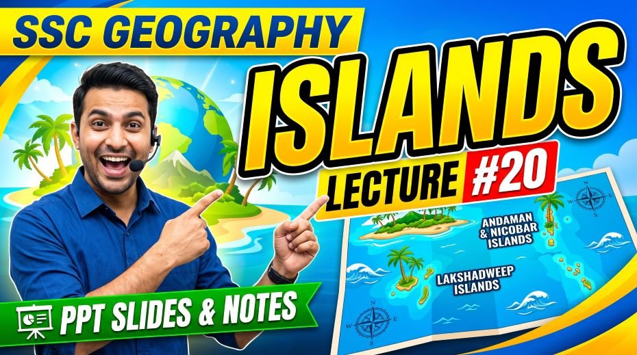
Quick Fact Table – Islands of India for SSC Exams
| Question / Fact | Answer |
| India’s island territories | Andaman & Nicobar Islands (Bay of Bengal) and Lakshadweep (Arabian Sea) |
| India’s only active volcano | Barren Island, Andaman & Nicobar Islands |
| India’s dormant volcano | Narcondam Island, Andaman & Nicobar Islands |
| India’s southernmost point | Indira Point, Great Nicobar Island (~6°45’N) |
| Capital of Andaman & Nicobar | Port Blair |
| Capital of Lakshadweep | Kavaratti |
| Number of islands in A&N group | ~572 (38 inhabited) |
| Number of islands in Lakshadweep | 36 (10 inhabited) |
| Geological origin of A&N Islands | Continental – submerged part of Myanmar’s Arakan Yoma mountains |
| Geological origin of Lakshadweep | Coral atolls – built on submarine volcanic platform |
| Smallest UT by area in India | Lakshadweep (~32 sq km) |
| Only Muslim-majority UT in India | Lakshadweep |
| Ten Degree Channel separates | Andaman Islands from Nicobar Islands |
| Eight Degree Channel separates | Lakshadweep from Maldives |
| Nine Degree Channel separates | Minicoy Island from the main Lakshadweep group |
| Duncan Passage separates | South Andaman from Little Andaman |
| Highest point in A&N Islands | Saddle Peak (732 m) – North Andaman |
| Only island in Lakshadweep with airport | Agatti Island |
| Lakshadweep island with Mahl-speaking population | Minicoy Island |
| India’s largest island (within India) | Middle Andaman Island |
| Most isolated tribe in the world | Sentinelese – North Sentinel Island; contact prohibited by law |
| Cellular Jail location and other name | Port Blair, A&N Islands; called ‘Kaala Paani’ (Black Waters) |
| 2004 Tsunami effect on islands | Indira Point on Great Nicobar partially submerged; A&N Islands heavily affected |
| Narcondam Hornbill significance | Endemic bird found ONLY on Narcondam Island; nowhere else in the world |
| Great Nicobar Biosphere Reserve | UNESCO Man and Biosphere Reserve; threatened by development plans |
| Coconut Crab (Robber Crab) | World’s largest land-living arthropod; found in Lakshadweep and A&N Islands |
| India’s only tri-services command | Andaman & Nicobar Command (ANC) – Army, Navy, Air Force – based at Port Blair |
| What does ‘Lakshadweep’ mean? | Sanskrit – ‘One Hundred Thousand Islands’ |
| Language of Minicoy vs rest of Lakshadweep | Minicoy speaks Mahl (a Divehi dialect); rest of Lakshadweep speaks Malayalam |
| Palk Strait connects | Bay of Bengal to Gulf of Mannar; between Tamil Nadu and Sri Lanka; shallowest (~60 m) |
also read: SSC Geography Coastal Plains PPT (LEC #19)
Q&A:
Q1: What is the geological difference between the Andaman & Nicobar Islands and Lakshadweep?
The Andaman & Nicobar Islands are continental islands – they are the exposed peaks of a submerged mountain range, specifically the southern extension of Myanmar’s Arakan Yoma fold mountains, which dip below the Bay of Bengal and re-emerge as the Andaman and Nicobar island chain. They are composed of sedimentary and volcanic rocks, have hilly terrain, dense tropical rainforests, and rise to 732 m at Saddle Peak. Lakshadweep, in contrast, is entirely made up of coral atolls – ring-shaped islands formed by coral organisms building up on the rim of shallow submarine volcanic platforms over millions of years. They are flat, rarely more than 4–5 metres above sea level, composed of coral sand and rock, have no rivers, and are extremely vulnerable to sea-level rise caused by climate change.
Q2: Why is North Sentinel Island legally off-limits to outsiders?
North Sentinel Island, part of the Andaman & Nicobar Islands, is home to the Sentinelese – widely described as the most isolated people on Earth. They have lived on this island for potentially 60,000 years with almost no contact with the outside world and have consistently rejected – often violently – any attempts at contact. The Indian government under the Andaman & Nicobar Islands Protection of Aboriginal Tribes Regulations prohibits any person from approaching within 3 nautical miles of North Sentinel Island. This protection exists to safeguard the Sentinelese from outside diseases (to which they would have zero immunity), from potential exploitation, and to respect their demonstrably expressed wish to remain uncontacted. The legal framework makes any contact with them a punishable offence under Indian law.
Q3: What makes Barren Island geographically unique in India?
Barren Island, located in the Andaman Sea approximately 138 km northeast of Port Blair, is India’s only active volcano and the only active volcano in South Asia. It is an uninhabited island forming a classic stratovolcano shape with a central crater. The island has erupted multiple times since 1991, with significant eruptive periods in 1991, 2005, 2008, 2010, and 2017–2018. Its volcanic activity is connected to the subduction of the Indian Plate beneath the Burmese Plate – the same tectonic process that makes the entire Andaman archipelago geologically active. Unlike continental India which has no active volcanoes, Barren Island provides India with direct volcanic monitoring data relevant to regional seismic and tsunami risk.
Q4: Why is Lakshadweep critically threatened by climate change?
Lakshadweep’s islands are coral atolls that rise only 4–5 metres above sea level at their highest point. Current projections for sea-level rise from climate change – ranging from 0.3 to over 1 metre by 2100 under various scenarios – mean that even moderate rises would render most or all of Lakshadweep uninhabitable. Beyond direct inundation, rising ocean temperatures are causing coral bleaching – when water temperatures rise, coral organisms expel their symbiotic algae and can die, destroying the reef structure that the islands are built upon. Saltwater intrusion into the freshwater lens (the small underground freshwater reservoir under each island) from rising seas is already affecting drinking water. Lakshadweep is therefore among the most climate-vulnerable territories in India.
Q5: What is the significance of the Cellular Jail in Port Blair?
The Cellular Jail – also called ‘Kaala Paani’ meaning Black Waters – was a British colonial prison built in Port Blair between 1896 and 1906. It was specifically designed for Indian political prisoners – freedom fighters who were considered the most dangerous threats to British rule, including Veer Savarkar, Batukeshwar Dutt, and many others. The name ‘Cellular’ refers to its design – a radial structure of individual cells from which prisoners had no line of sight to each other, preventing communication and community building among inmates. Transportation to the Andaman Islands was considered the most severe punishment short of execution – hence ‘Kaala Paani’ (Black Waters), referring to the feared crossing of the ocean (which was considered spiritually polluting in many Hindu traditions). The jail is now a National Memorial and one of the most visited sites in the Andaman Islands.
India’s island channels are critical to both commercial navigation and military strategy. The Ten Degree Channel, separating the Andaman and Nicobar island groups at 10°N latitude, is a major shipping lane through the Bay of Bengal. The Andaman & Nicobar Islands as a whole sit approximately 90 km from the Strait of Malacca – through which approximately 40% of global trade passes, including massive volumes of oil from the Middle East destined for East Asia. India’s Andaman & Nicobar Command (its only tri-services command) monitors this critical shipping route. The Eight Degree Channel between Lakshadweep and Maldives connects the Arabian Sea to the southern Indian Ocean and is important for Arabian Sea shipping. Control over these channels through island presence is a key element of India’s Indian Ocean Region (IOR) strategy.
Q7: Why is Minicoy Island culturally distinct from the rest of Lakshadweep?
Minicoy Island, the southernmost inhabited island in Lakshadweep, is geographically and culturally distinct from the rest of the archipelago. While all other Lakshadweep islands are inhabited by Malayalam-speaking people of South Indian cultural heritage, Minicoy’s inhabitants speak Mahl – a dialect of Divehi, the language of the Maldives – reflecting the island’s historically closer ties with the Maldivian culture rather than the Kerala-Lakshadweep cultural sphere. Minicoy is separated from the main Lakshadweep group by the Nine Degree Channel (at approximately 9°N latitude). The island has its own traditional architecture, boat-building culture, and a distinctive lighthouse built by the British in 1885. This cultural distinction makes Minicoy a frequently asked SSC question about linguistic geography of Indian territories.
Rapid Revision Cheat Sheet – Islands of India
| Topic | Key Point |
| Two island groups | Andaman & Nicobar (Bay of Bengal) + Lakshadweep (Arabian Sea) |
| A&N capital | Port Blair |
| Lakshadweep capital | Kavaratti |
| A&N total islands | ~572 (38 inhabited) |
| Lakshadweep total islands | 36 (10 inhabited) |
| A&N origin | Continental – submerged Arakan Yoma mountains of Myanmar |
| Lakshadweep origin | Coral atolls – on shallow submarine volcanic platform |
| Smallest UT by area | Lakshadweep – ~32 sq km |
| Only Muslim-majority UT | Lakshadweep |
| India’s southernmost point | Indira Point, Great Nicobar Island (~6°45’N) |
| India’s only active volcano | Barren Island – A&N Islands |
| Dormant volcano in A&N | Narcondam Island – Narcondam Hornbill (endemic bird) |
| Highest point in A&N | Saddle Peak (732 m) – North Andaman |
| Ten Degree Channel | Andaman Islands ↔ Nicobar Islands |
| Duncan Passage | South Andaman ↔ Little Andaman |
| Eight Degree Channel | Lakshadweep ↔ Maldives |
| Nine Degree Channel | Minicoy ↔ main Lakshadweep group |
| Cellular Jail | Port Blair; ‘Kaala Paani’; British colonial prison; National Memorial |
| Most isolated tribe | Sentinelese – North Sentinel Island – contact prohibited |
| Other A&N tribes | Jarawa, Onge, Great Andamanese, Shompen, Nicobarese |
| Minicoy language | Mahl (Divehi dialect) – distinct from rest of Lakshadweep (Malayalam) |
| Only Lakshadweep island with airport | Agatti Island |
| Largest island in Lakshadweep | Andrott Island |
| A&N military command | India’s only tri-services command (Andaman & Nicobar Command) |
| Distance to Strait of Malacca | ~90 km from A&N Islands – critical strategic position |
| 2004 Tsunami impact | Indira Point partially submerged; A&N Islands severely hit |
| Great Nicobar Biosphere Reserve | UNESCO Man and Biosphere Reserve |
| What ‘Lakshadweep’ means | Sanskrit – ‘One Hundred Thousand Islands’ |
| Serial number of this PPT | #99 in the Complete Foundation Batch |
Conclusion
India’s islands – the Andaman & Nicobar Islands and Lakshadweep – are compact geography topics that generate consistent, predictable SSC and RRB exam questions. The key facts are clearly defined and directly testable: geological origins, channel names, tribe names, Barren Island as the only active volcano, Indira Point as India’s southernmost tip, Cellular Jail history, Lakshadweep as the smallest UT, and the Muslim-majority status of Lakshadweep.
The SSC Geography Islands PPT Slides (LEC #20), Serial #99, available at slideshareppt.net in bilingual Hindi + English format across 122 slides, gives you the complete visual framework for both island groups. Study the master comparison table, memorise the channel names and what they separate, learn the indigenous tribe names and their islands, and use the Rapid Revision Cheat Sheet in your final preparation days. This topic can reliably deliver 2–4 marks in every SSC and RRB paper for well-prepared students.