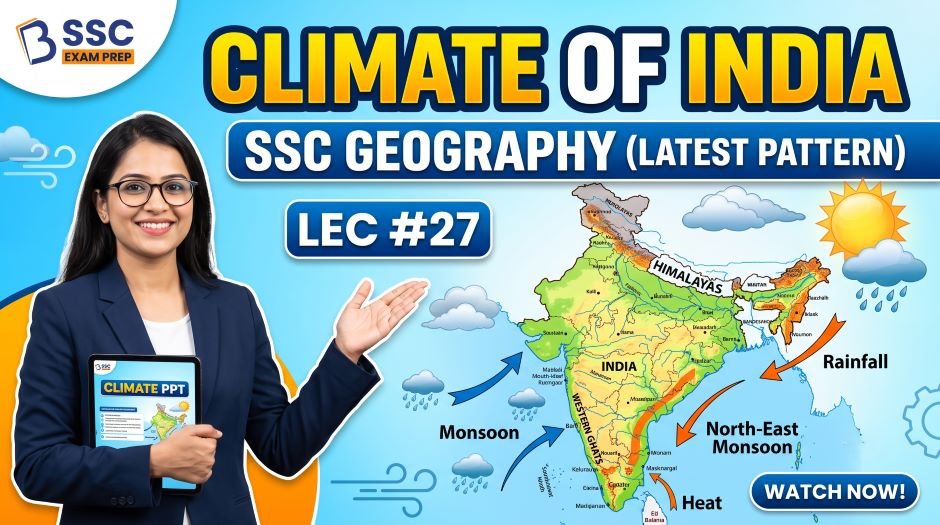
This article accompanies the SSC Geography Climate of India PPT (LEC #27) – Serial #105 of the Complete Foundation Batch for All SSC Exams PPT Series on slideshareppt.net. With 129 slides in bilingual Hindi + English format, this PPT covers India’s climate – factors affecting climate, seasons, the monsoon mechanism, rainfall patterns, climate types, and related geography – in complete depth, aligned to the SSC exam pattern. Climate of India is one of the most high-yield topics in SSC CGL, SSC CHSL, SSC MTS, SSC GD Constable, and RRB Group D – generating questions on the Indian monsoon mechanism, seasonal cycles, rainfall distribution, climate types, cyclones, and extreme weather events. The Indian monsoon alone is the single most important climatic phenomenon for this country and appears as a direct question in virtually every competitive exam.
PPT Resource Overview
| Detail | Information |
| Lecture Number | LEC #27 (Geography Series) |
| Serial Number in Complete Batch | #105 |
| Subject | Geography – Climate of India (भारत की जलवायु) |
| Series Name | Complete Foundation Batch for All SSC Exams (PPT Series) |
| Total Slides | 129 PPT Slides |
| File Size | 38 MB |
| Language | Hindi + English (Bilingual) |
| Format Available | Google Slides & Google Drive (PDF also available) |
| Website | www.slideshareppt.net |
| Target Exams | SSC CGL, SSC CHSL, SSC MTS, SSC GD Constable, RRB Group D |
| Suitable For | Students (self-study & marathon revision) and Teachers (classroom use) |
SSC Geography Climate of India PPT (LEC #27)
Note: Above is PPT in GOOGLE SLIDES (HTML AND IFRAME COMBINATION) and if you wish to download the Complete SSC series (PPT slides), visit this Link – REDIRECT PAGE.
Climate of India – Overview
India’s climate is primarily tropical monsoon in character – but the vast size of the country, its diverse topography, and its position between the Tropic of Cancer and the Himalayan range create an extraordinary variety of climates ranging from the cold desert of Ladakh to the tropical rainforest of the Northeast and the hot desert of Rajasthan. The entire Indian climate is dominated by the seasonal reversal of winds – the Indian monsoon – which brings approximately 75–80% of India’s total annual rainfall between June and September. India has four main seasons, and the variation in monsoon intensity, direction, and timing shapes the agricultural, economic, and social life of over 1.4 billion people.
Factors Affecting India’s Climate
| Factor | How It Affects India’s Climate |
| Latitude | India lies between ~8°N and 37°N; the southern part (below Tropic of Cancer at 23.5°N) is in the tropical zone with high temperatures; the northern part is in the subtropical zone with more seasonal variation |
| Himalayas (Northern Mountain Wall) | The Himalayas act as a climate barrier – they block cold Central Asian winds from entering India in winter (keeping winters milder than they would be); they force the moisture-laden monsoon winds to rise and deposit heavy rainfall on the Indian side; without the Himalayas, India would be much colder and drier |
| Land and Sea Breeze / Ocean Influence | India is surrounded by sea on three sides (Arabian Sea, Bay of Bengal, Indian Ocean); oceans moderate coastal temperatures and provide moisture for the monsoon |
| Relief (Topography) | Mountains and plateaus affect rainfall distribution through orographic effect; Western Ghats receive heavy rain on windward side, Deccan is in rain shadow; Eastern Ghats are lower and discontinuous |
| Distance from Sea | Interior areas (like MP, Rajasthan) experience continental climate with extreme temperature variation; coastal areas have moderate, equable climate |
| Upper Air Circulation (Jet Streams) | Western Disturbances (winter rainfall in NW India) are brought by the subtropical westerly jet stream; the eastward shift of the jet stream is linked to the onset of the monsoon |
| El Nino / La Nina (ENSO) | El Nino (warming of Pacific) weakens the Indian monsoon; La Nina (cooling) strengthens it; major drought years in India (1987, 2002, 2009) were El Nino years |
| Tibetan Plateau (Heat Source) | The Tibetan Plateau heats up intensely in summer, creating a low-pressure system that helps pull the monsoon northward into India – a key driver of the Indian monsoon onset |
Four Seasons of India – Complete Reference Table
| Season | Months | Other Name | Key Characteristics | Associated Winds / Rainfall |
| Winter Season (Cold Weather Season) | December to February | Ritu: Shishir (शिशिर) / Hemant | Cool and dry in most of India; cold waves in north; frost in Himalayan states; moderate temperatures in south India | North-East Trade Winds (dry); Western Disturbances bring winter rain to NW India (Punjab, Haryana, J&K, HP); Tamil Nadu gets some rain from NE monsoon |
| Summer Season (Hot Weather Season) | March to May | Ritu: Grishma (ग्रीष्म) | Very hot and dry; highest temperatures in May; Loo (hot dusty wind) blows in northern India; dust storms (Andhi) in Rajasthan; pre-monsoon showers in some areas | Loo (hot dry westerly wind in northern plains); Mango Showers (Kerala and Karnataka); Nor-Westers (Kalbaisakhi) in West Bengal and Assam; Cherry Blossoms (Blossom Showers) in Karnataka/Kerala |
| South-West Monsoon Season (Rainy Season) | June to September | Ritu: Varsha (वर्षा) | Brings 75–80% of India’s annual rainfall; arrives in Kerala first (around June 1); two branches: Arabian Sea branch and Bay of Bengal branch | South-West Monsoon winds (from Indian Ocean); Arabian Sea branch (hits Western Ghats first, then crosses to Deccan); Bay of Bengal branch (enters NE India, then moves NW) |
| North-East Monsoon (Retreating Monsoon Season) | October to November | Also called: Post-monsoon / Retreating Monsoon | Monsoon withdraws from NW India first (September), then retreats across India by November; North-East Monsoon affects Tamil Nadu coast (Oct-Dec) | Retreating South-West Monsoon; North-East Monsoon (winds from land to sea) brings rain to Tamil Nadu, AP coast, Sri Lanka |
The Indian Monsoon – Complete Mechanism and Facts
What is the Monsoon?
The word monsoon comes from the Arabic word ‘Mausim’ meaning season or seasonal wind. The Indian monsoon is a large-scale seasonal reversal of wind direction caused by differential heating of land and sea. In summer, the Indian landmass heats up much faster than the surrounding oceans, creating a strong low-pressure area over the land that draws in moisture-laden winds from the Indian Ocean. In winter, the process reverses – the land cools faster than the sea, creating high pressure over land that drives winds outward toward the sea.
| Parameter | Detail |
| Word origin | Arabic ‘Mausim’ (season/seasonal wind) |
| Type | Tropical Monsoon – seasonal reversal of wind direction driven by differential land-sea heating |
| Onset date (normal) | ~1 June – Kerala (Thiruvananthapuram); India Meteorological Department (IMD) officially declares onset |
| Withdrawal from Kerala | ~1 October (after about 4 months) |
| Full coverage of India | By ~15 July – covers all of India within 6 weeks of onset |
| Withdrawal from NW India | Begins ~1 September; NW India is first to see monsoon depart |
| Total duration | ~4 months (June–September) in most parts of India |
| Rainfall contribution | 75–80% of India’s annual rainfall comes from SW Monsoon |
| Two branches | Arabian Sea branch and Bay of Bengal branch |
| Arabian Sea Branch | Hits Western Ghats (heavy rain on windward side); then crosses to Deccan (reduced); continues to Northern India |
| Bay of Bengal Branch | Enters Meghalaya hills first (Cherrapunji/Mawsynram – heaviest rainfall); then divides: NW toward Ganga plains and Bangladesh; W toward NE states |
| Bay of Bengal branch covers more area | Bay of Bengal branch covers larger area of India; Arabian Sea branch is more intense in terms of rainfall intensity on Western Ghats |
| Why does monsoon onset in Kerala? | Kerala is closest to the Inter-Tropical Convergence Zone (ITCZ) shift; SW winds first hit the Indian landmass at Kerala’s coast |
| El Nino impact | Weakens/delays/reduces SW Monsoon rainfall; major drought years |
| La Nina impact | Strengthens/advances SW Monsoon; above-normal rainfall |
| Indian Ocean Dipole (IOD) | Positive IOD (western Indian Ocean warmer than eastern) strengthens Indian monsoon; often works in tandem with La Nina |
| Monsoon Break | Temporary weakening of monsoon during the monsoon season; Himalayan region may still get rain during a break |
Two Branches of the South-West Monsoon
| Feature | Arabian Sea Branch | Bay of Bengal Branch |
| Origin | Arabian Sea (southwest) | Bay of Bengal (southeast) |
| First landfall | Western Ghats (Kerala coast, around June 1) | Andaman & Nicobar Islands (late May); then Meghalaya/NE India coast (early June) |
| Direction of travel | Hits Western Ghats, then moves northward along the coast and inland across Deccan, Rajasthan, and Gujarat | Splits – one arm goes NE (Bangladesh, Assam); other arm goes NW (Ganga plains through Bihar, UP) |
| Heavy rainfall zones | Malabar Coast (3,000+ mm), Konkan Coast, Western Ghats windward slopes | Meghalaya (Cherrapunji/Mawsynram – world record rainfall), West Bengal, NE India |
| Rain shadow region | Deccan Plateau (behind Western Ghats) – receives much less rain | Not significant |
| Area coverage | Covers western India, central India, northwestern India | Covers NE India, eastern India, and much of the Ganga plains |
| Intensity | Very heavy on Western Ghats windward slopes; decreases inland | Moderate to heavy in NE India; moderate over Ganga plains |
| SSC Key Fact | Arabian Sea branch brings the first monsoon rains to India (Kerala, June 1) | Bay of Bengal branch covers more total area of India |
North-East Monsoon (Retreating Monsoon)
| Parameter | Detail |
| Period | October to December |
| Wind direction | From NE (land) to SW (sea) – opposite of SW Monsoon |
| Origin | As the SW Monsoon retreats, the NE Trade Winds resume over India; they pick up moisture over the Bay of Bengal |
| States affected most | Tamil Nadu (major rainfall during Oct-Dec); coastal Andhra Pradesh; Sri Lanka; Puducherry; parts of Kerala |
| Tamil Nadu significance | Tamil Nadu gets most of its annual rainfall from the NE Monsoon (not SW Monsoon); while the rest of India relies on SW Monsoon, Tamil Nadu’s agricultural calendar is based on the NE Monsoon |
| Famous phenomenon | NE Monsoon brings cyclones in the Bay of Bengal during Oct-Dec – Tamil Nadu coast and AP coast are cyclone-prone during this period |
| Cyclone Gaja, Ockhi, Vardah | Examples of cyclones that hit Tamil Nadu/AP coast during the NE Monsoon season |
| SSC Key Facts | Tamil Nadu gets maximum rainfall from NE Monsoon; NE Monsoon brings cyclones to East coast in Oct-Dec; winds blow from NE to SW |
Rainfall Distribution in India
| Rainfall Zone | Annual Rainfall | Region | Key SSC Fact |
| Very Heavy Rainfall Zone | Above 400 cm (4,000 mm) | Meghalaya (Mawsynram, Cherrapunji), Western Ghats windward slopes (Kerala, Goa, Maharashtra), Andaman & Nicobar Islands, NE India (Arunachal, Assam) | Mawsynram (Meghalaya) – wettest place on Earth (~11,872 mm average); Cherrapunji holds the record for most rainfall in a single year |
| Heavy Rainfall Zone | 200–400 cm | Malabar Coast (Kerala, Karnataka), West Bengal, Odisha, Assam (plains), NE states | Western Ghats coastal belt; paddy and plantation agriculture |
| Moderate Rainfall Zone | 100–200 cm | Gujarat (coastal), Eastern Rajasthan, UP, Bihar, Maharashtra (northern Deccan), Tamil Nadu (south) | Main crop-growing zone; wheat, sugarcane, rice with some irrigation |
| Low Rainfall Zone | 50–100 cm | Interior Deccan, MP (some parts), Eastern Rajasthan, Kutch, Punjab (some parts) | Dry farming; millets, pulses; irrigation needed for wheat |
| Very Low Rainfall Zone | Below 50 cm | Rajasthan (Thar Desert), J&K (rain shadow areas of Himalayan passes), Ladakh | Desert conditions; sparse vegetation; irrigation essential for any agriculture |
| Extremely Arid Zone | Below 20 cm (Ladakh some parts) | Ladakh (cold desert); parts of Rajasthan | Cold or hot desert; minimal vegetation; very challenging agriculture |

Climate Types in India – Koppen Classification Applied
| Climate Type | Region | Characteristics | Key SSC Fact |
| Tropical Wet (Am) | Western Ghats coast (Kerala, Konkan), Andaman & Nicobar Islands, parts of NE India | Heavy annual rainfall (>150 cm); no dry season; tropical rainforest vegetation | Malabar Coast; highest biodiversity zone in India |
| Tropical Wet and Dry (Aw – Savanna) | Most of peninsular India (Deccan Plateau, Maharashtra, MP, AP, Odisha), NE India plains | Distinct wet season (monsoon) and dry season; 75–150 cm rainfall; savanna and tropical deciduous forests | Most of peninsular India; major agricultural zone |
| Semi-Arid (BSh) | Eastern Rajasthan, parts of Punjab, Haryana, interior AP, some areas of Karnataka | Limited rainfall (30–60 cm); grassland and scrub vegetation; seasonal extremes | Transitional zone between desert and humid regions |
| Arid/Desert (BWh) | Western Rajasthan (Thar Desert), Rann of Kutch (Gujarat) | Less than 25 cm rainfall; extreme heat in summer; sparse vegetation | Thar Desert – largest hot desert in India; camels; sand dunes |
| Cold Desert (BWk) | Ladakh (Leh-Kargil region) | Cold; less than 10 cm rainfall (cold desert); extreme cold in winter | Ladakh – unique cold desert; low rainfall despite being surrounded by mountains |
| Humid Subtropical (Cwa) | Northern plains (UP, Bihar, WB, Haryana, Punjab) and MP | Hot dry summers; cool winters; moderate to high rainfall; seasonal frost possible | Ganga Plains; most densely populated climate zone in India |
| Humid Temperate (Cfb) | Himalayan valleys (HP, Uttarakhand) at medium altitude; Nilgiris | Mild temperatures; rain throughout the year; temperate vegetation | Hill stations (Ooty, Shimla, Darjeeling); apple cultivation zone |
| Alpine/Tundra (ET/EF) | High Himalayas, high Ladakh, high Uttarakhand | Permanent snow and ice above ~5,000 m; very cold; negligible rainfall (snow) | Glacial zones; source of Himalayan rivers |
Cyclones in India – Key Facts for SSC
| Parameter | Detail |
| Definition | A cyclone is a large-scale atmospheric disturbance with strong rotating winds around a low-pressure centre |
| Rotation direction in India (N. Hemisphere) | Anti-clockwise (due to Coriolis Effect in Northern Hemisphere) |
| When do cyclones affect India? | Pre-monsoon (April-May, mostly Bay of Bengal); Post-monsoon / NE Monsoon (Oct-Dec, Bay of Bengal and East coast); Occasional Arabian Sea cyclones |
| Most cyclone-prone coast in India | East coast (Bay of Bengal) – more cyclone-prone than West coast (Arabian Sea) |
| Why Bay of Bengal more cyclone-prone? | Bay of Bengal is shallower, warmer, and receives more river runoff – conditions favour more intense cyclone formation than Arabian Sea |
| SAFFIR-SIMPSON Scale | Hurricane/cyclone intensity scale (1 to 5) – Category 5 is most intense |
| India Meteorological Department (IMD) | IMD classifies cyclones: Depression (wind 31–49 km/h), Deep Depression (50–61), Cyclonic Storm (62–88), Severe Cyclonic Storm (89–117), Very Severe, Extremely Severe, Super Cyclonic Storm (>221 km/h) |
| Super Cyclone Orissa (1999) | One of the most devastating cyclones in Indian history; hit Odisha; Category 5 equivalent; ~10,000 deaths |
| Cyclone Fani (2019) | Extremely Severe Cyclonic Storm; hit Puri, Odisha; successful evacuation of ~1.2 million people |
| Cyclone Amphan (2020) | Super Cyclonic Storm; hit West Bengal and Bangladesh; most powerful cyclone in Bay of Bengal in recent years |
| Cyclone Biparjoy (2023) | Hit Gujarat coast – rare major Arabian Sea cyclone |
| Naming of Cyclones | Named alphabetically; WMO/ESCAP Panel on Tropical Cyclones assigns names; India also contributes names |
| Cyclone-prone states | Andhra Pradesh, Odisha, West Bengal, Tamil Nadu (East coast); Gujarat (West coast) |
ALSO READ: SSC Geography Mineral Resources of India PPT (LEC #26)
Western Disturbances – Winter Rainfall in North India
| Parameter | Detail |
| Definition | Extra-tropical cyclonic disturbances originating over the Mediterranean Sea (and sometimes Caspian/Black Sea region) that travel eastward along the subtropical westerly jet stream to bring rainfall to NW India in winter |
| Season | December to February (winter); occasionally in early spring (March) |
| States affected | Jammu & Kashmir, Himachal Pradesh, Uttarakhand (heavy snowfall); Punjab, Haryana, Delhi, UP, Rajasthan (light rain) |
| Importance for agriculture | Vital for the Rabi crop (wheat, mustard, barley) in Punjab, Haryana, UP – provides crucial winter moisture at the right time |
| Snowfall in Himalayas | Western Disturbances cause heavy snowfall in J&K, HP, and UK – builds up glacial reserves that feed Himalayan rivers in summer |
| Fog and Cold Waves | After a Western Disturbance passes, cold waves and dense fog affect the Indo-Gangetic plains, disrupting transport |
| SSC Key Facts | Mediterranean origin; brings winter rain to NW India; vital for wheat; causes snowfall in Himalayas; moves from W to E |
Special Rainfall Events and Regional Phenomena
| Phenomenon | Region | Season | Key SSC Fact |
| Mango Showers / Pre-monsoon Showers | Kerala and Karnataka | April-May | Pre-monsoon thundershowers that help ripen mangoes; important for coffee flowering in Karnataka |
| Cherry Blossom Showers (Coffee Blossom Showers) | Karnataka (Coorg/Kodagu) | March-April | Pre-monsoon showers that trigger coffee blossoming; important for coffee production calendar |
| Kalbaisakhi (Nor-Westers) | West Bengal and Assam | April-May (pre-monsoon) | Violent thunderstorms from NW to SE direction; cause destruction but also bring relief from summer heat; Tagore called them ‘Kalbaisakhi’ (Baisakhi storms) |
| Loo | Northern Plains (UP, Bihar, Rajasthan, Haryana) | May-June (summer) | Hot, dry, dusty wind; temperatures exceed 45°C; causes heat strokes; blows from SW to NE |
| Western Disturbances | J&K, HP, Punjab, Haryana, UP, Delhi | December-February | Mediterranean-origin cyclonic disturbances bringing winter rain and snowfall |
| Monsoon Break | All India (variable) | July-August (monsoon season) | Temporary pause in monsoon rainfall; Himalayan region may still get rain; can cause mid-season drought-like conditions |
| Indian Ocean Dipole (IOD) | Indian Ocean (effect on India) | June-November | Positive IOD (positive Indian Ocean Dipole) strengthens Indian monsoon; negative IOD weakens it |
| Retreat of Monsoon | NW India first, then SE | September-December | Monsoon retreats from NW India (Rajasthan) by ~1 September; last to retreat is SE India (Tamil Nadu) in December |
India’s Wettest and Driest Locations
| Category | Place | State | Annual Rainfall / Temperature | Key SSC Fact |
| Wettest place in India (and world) | Mawsynram | Meghalaya (Khasi Hills) | ~11,872 mm per year (average) | Mawsynram holds the record for the highest average annual rainfall on Earth; on the southern slopes of Khasi Hills facing Bay of Bengal moisture |
| 2nd Wettest (and formerly 1st) | Cherrapunji (Sohra) | Meghalaya (Khasi Hills) | ~11,430 mm per year (average); held single-year record | Cherrapunji holds the record for most rainfall in a single month and single year; Nohkalikai Falls nearby |
| Driest place in India | Leh / Ladakh region | Ladakh (UT) | ~50–100 mm per year | Cold desert; Ladakh is both coldest and driest region; some valleys even lower |
| Hottest place in India | Sri Ganganagar / Churu | Rajasthan | Summer temperatures exceed 50°C | Sri Ganganagar and Churu in Rajasthan regularly record India’s highest temperatures |
| Coldest permanently inhabited place | Dras (Drass) | J&K (near Kargil) | Can drop to -45°C in winter | Second coldest inhabited place in the world; only Oymyakon in Russia is colder |
| Most rainy days per year | Agumbe | Karnataka (Shivamogga) | ~250 rainy days per year; ~7,000 mm | Agumbe often called the ‘Cherrapunji of the South’; famous for king cobra research |
Quick Fact Table – Climate of India for SSC Exams
| Question / Fact | Answer |
| India’s dominant climate type | Tropical Monsoon climate |
| Word ‘monsoon’ comes from | Arabic ‘Mausim’ meaning season |
| SW Monsoon arrives in India first at | Kerala (Thiruvananthapuram) – around 1 June |
| SW Monsoon covers all of India by | ~15 July |
| SW Monsoon withdraws from NW India by | ~1 September |
| SW Monsoon contribution to annual rainfall | 75-80% of India’s total annual rainfall |
| Two branches of SW Monsoon | Arabian Sea Branch and Bay of Bengal Branch |
| Which branch covers more area of India | Bay of Bengal branch |
| Which branch arrives first in India | Arabian Sea branch (hits Kerala coast on ~1 June) |
| Wettest place on Earth | Mawsynram, Meghalaya (~11,872 mm average annual rainfall) |
| 2nd wettest (formerly 1st on record) | Cherrapunji (Sohra), Meghalaya |
| Driest region in India | Ladakh (cold desert; <100 mm rainfall) |
| Hottest place in India | Sri Ganganagar / Churu – Rajasthan |
| Coldest inhabited place in India | Dras (Drass) – J&K, near Kargil (~-45°C winter min) |
| Tamil Nadu gets rain mainly from | North-East Monsoon (Oct-Dec), NOT SW Monsoon |
| States most affected by Western Disturbances | J&K, HP, Uttarakhand (snow); Punjab, Haryana, Delhi, UP (rain) |
| Loo is associated with which season and region | Summer (May-June); northern plains (UP, Rajasthan, Bihar) |
| Kalbaisakhi (Nor-Westers) occur in | West Bengal and Assam in April-May (pre-monsoon) |
| Which Ocean is key to Indian Monsoon onset? | Indian Ocean; Tibetan Plateau heating also critical |
| El Nino effect on Indian monsoon | Weakens/reduces/delays – leads to drought |
| La Nina effect on Indian monsoon | Strengthens/advances – leads to above-normal rainfall |
| Most cyclone-prone coast in India | East coast (Bay of Bengal) |
| Why Bay of Bengal more cyclone-prone? | Shallower, warmer, more river input – better conditions for cyclone formation |
| Cyclone rotation direction in India | Anti-clockwise (Northern Hemisphere; Coriolis Effect) |
| Super Cyclone that hit Odisha in 1999 | Orissa Super Cyclone – one of the deadliest in India’s history |
| Cyclone Fani (2019) hit which state? | Odisha (Puri) |
| Cyclone Amphan (2020) hit which state? | West Bengal (and Bangladesh) |
| Mango Showers occur in | Kerala and Karnataka in April-May (pre-monsoon) |
| Agumbe is known as | Cherrapunji of the South – Karnataka; ~7,000 mm rainfall; famous for king cobras |
PYQ-
Q1: What is the Indian Monsoon and why does it arrive first in Kerala?
The Indian monsoon is a large-scale seasonal reversal of wind direction caused by the differential heating of the Indian landmass versus the surrounding oceans. In summer, India heats up much faster than the Indian Ocean, creating a strong low-pressure area over the subcontinent that draws in moisture-laden winds from the south and southwest. The monsoon arrives first in Kerala around June 1 because Kerala’s coastline is the closest point of the Indian landmass to the southward position of the Inter-Tropical Convergence Zone (ITCZ) as it migrates northward, and the Arabian Sea branch of the monsoon first makes landfall on Kerala’s west coast. The IMD (India Meteorological Department) officially declares the onset of the monsoon when rainfall criteria are met at a set of stations along the Kerala coast.
Q2: How does the Tibetan Plateau influence the Indian monsoon?
The Tibetan Plateau plays a critical role in driving the Indian monsoon through what scientists call the ‘elevated heat source’ mechanism. The plateau, which averages over 4,500 m above sea level, heats up intensely during spring and early summer when solar radiation is intense. This creates a powerful low-pressure system at high altitude over Tibet and Central Asia, which reinforces the pressure gradient between the Indian Ocean and the subcontinent, effectively ‘pulling’ the moisture-laden southwest monsoon winds northward across India at a greater intensity than would occur without the plateau. The Tibetan Plateau’s heat essentially acts as an additional pump for the monsoon, which is why major changes to the plateau’s snow cover or land use can potentially affect monsoon intensity – a topic with increasing relevance to climate change research.
Q3: Why does Tamil Nadu receive most of its rainfall from the North-East Monsoon rather than the South-West Monsoon?
Tamil Nadu occupies the southeastern tip of peninsular India, and its geography puts it in the rain shadow of the SW monsoon. When the Arabian Sea branch of the SW Monsoon strikes the Western Ghats, it drops most of its moisture on the windward (western) slopes, and by the time it reaches Tamil Nadu from the west, it has largely lost its moisture content. The Bay of Bengal branch of the SW Monsoon also largely bypasses Tamil Nadu’s main rain-receiving areas, depositing most moisture in the Northeast and Eastern India as it travels NW. However, when the monsoon retreats (October-December), the North-East Trade Winds pick up moisture over the Bay of Bengal and make landfall precisely on Tamil Nadu’s coast – delivering its primary annual rainfall. This reversal makes Tamil Nadu’s climate season unique in India.
Q4: What is the difference between a Depression and a Cyclone in the IMD classification?
The IMD (India Meteorological Department) classifies Bay of Bengal and Arabian Sea weather systems by wind speed in ascending order of intensity: a Low Pressure Area has wind speeds below 31 km/h; a Depression has winds of 31–49 km/h; a Deep Depression has winds of 50–61 km/h; a Cyclonic Storm has winds of 62–88 km/h; a Severe Cyclonic Storm has winds of 89–117 km/h; then Very Severe, Extremely Severe, and finally Super Cyclonic Storm with winds exceeding 221 km/h. In common SSC exam usage, the word ‘cyclone’ refers to any organised low-pressure weather system with circular wind patterns, while the intensity classifications distinguish the severity. The 1999 Odisha Super Cyclone, Cyclone Fani (2019), and Cyclone Amphan (2020) are the most frequently referenced examples in recent SSC papers.
Q5: What are Western Disturbances and why are they important for Indian agriculture?
Western Disturbances are extra-tropical cyclonic disturbances that originate over the Mediterranean Sea region and travel eastward along the upper-atmosphere subtropical westerly jet stream, reaching northwest India typically during December to February. As they cross Central Asia and enter the Indian subcontinent, they bring winter rainfall to Punjab, Haryana, Delhi, and western UP, and heavy snowfall to J&K, Himachal Pradesh, and Uttarakhand. This winter rainfall is critically important for the Rabi crop season – particularly for wheat cultivation in Punjab and Haryana, which depends on this winter moisture to establish the crop after the kharif season. Without Western Disturbances, northwestern India’s winter would be almost entirely dry, severely limiting winter crop production.
Q6: Why is Mawsynram wetter than Cherrapunji?
Both Mawsynram and Cherrapunji (Sohra) are located on the southern slopes of the Khasi Hills in Meghalaya, facing the Bay of Bengal, and both receive extraordinary rainfall because the moist Bay of Bengal winds are forced to rise sharply up the steep southern face of the Khasi Hills plateau – creating intense orographic rainfall. Mawsynram edges out Cherrapunji for the highest average annual rainfall (~11,872 mm vs ~11,430 mm) because of its slightly more favourable position relative to the funnel of moisture from the Bay of Bengal. However, Cherrapunji holds various extreme records including the highest rainfall in a single year (26,461 mm in 1861) and the highest rainfall in a single month. The two towns are often confused in SSC questions, so it is important to remember: Mawsynram = highest average annual rainfall (and considered wettest on Earth); Cherrapunji = various single-period record rainfalls.
Q7: How does El Nino specifically affect India’s monsoon and which years saw major droughts?
El Nino is the abnormal warming of surface waters in the central and eastern Pacific Ocean that occurs every 2-7 years. When the Pacific warms during El Nino, it disrupts global atmospheric circulation patterns – particularly it weakens the Walker Circulation that drives the Indian monsoon. The lower pressure difference between the Indian Ocean and the subcontinent during El Nino means the monsoon winds arrive weaker, later, and carry less moisture than normal, leading to below-normal rainfall across much of India. Major drought years in India strongly correlated with El Nino include 1877, 1899, 1918, 1987, 2002, 2009, and 2014. Conversely, La Nina – the abnormal cooling of Pacific waters – typically strengthens the Indian monsoon, leading to above-normal rainfall, sometimes causing floods in eastern and central India. The 2019 and 2020 monsoon seasons, associated with neutral-to-La-Nina conditions, produced above-normal rainfall.
Rapid Revision Cheat Sheet – Climate of India
| Topic | Key Point |
| India’s climate type | Tropical Monsoon (primarily) |
| Monsoon origin word | Arabic ‘Mausim’ = season |
| SW Monsoon onset (Kerala) | ~1 June |
| All of India covered by | ~15 July |
| SW Monsoon withdrawal from NW | ~1 September |
| SW Monsoon contribution | 75-80% of India’s annual rainfall |
| Two branches | Arabian Sea + Bay of Bengal |
| Branch covering more area | Bay of Bengal branch |
| Wettest place (Earth) | Mawsynram – Meghalaya (~11,872 mm) |
| 2nd wettest | Cherrapunji (Sohra) – Meghalaya |
| Driest region | Ladakh (<100 mm annual) |
| Hottest place | Sri Ganganagar / Churu – Rajasthan |
| Coldest inhabited place | Dras (Drass) – J&K (~-45°C winter) |
| Tamil Nadu rain source | NE Monsoon (Oct-Dec), NOT SW Monsoon |
| Loo wind | Hot dry wind; summer; northern plains; May-June |
| Kalbaisakhi (Nor-Westers) | Violent thunderstorms; West Bengal and Assam; April-May |
| Mango Showers | Pre-monsoon; Kerala and Karnataka; April-May |
| Western Disturbances | Mediterranean origin; winter rain to NW India; vital for wheat |
| El Nino effect | Weakens Indian monsoon; drought years (1987, 2002, 2009) |
| La Nina effect | Strengthens Indian monsoon; above-normal rainfall |
| Most cyclone-prone coast | East coast (Bay of Bengal) |
| Cyclone direction in India | Anti-clockwise (N. Hemisphere; Coriolis) |
| Super Cyclone (1999) | Orissa; one of deadliest |
| Cyclone Fani (2019) | Odisha (Puri); successful mass evacuation |
| Cyclone Amphan (2020) | West Bengal and Bangladesh |
| Tibetan Plateau role | Elevated heat source that amplifies monsoon pull |
| IOD (Positive) | Strengthens Indian monsoon |
| Agumbe | Cherrapunji of the South – Karnataka; king cobras |
| Serial number of this PPT | #105 in the Complete Foundation Batch |
Conclusion
Climate of India is a topic that rewards integrated understanding – the monsoon mechanism connects to river geography, agriculture, natural disasters, and current affairs all at once. For SSC and RRB exams, the key anchor facts are: monsoon onset in Kerala (~1 June); Mawsynram as the wettest place on Earth; Tamil Nadu’s dependence on the NE Monsoon; El Nino as the cause of drought years; Western Disturbances as vital for Rabi crops in NW India; and the East coast as more cyclone-prone than the West coast.
The SSC Geography Climate of India PPT (LEC #27), Serial #105, available at slideshareppt.net in bilingual Hindi + English format across 129 slides, gives you the complete visual companion for this topic. Study the four-seasons table, the two-branch monsoon comparison, the rainfall distribution map, and the cyclone classification table. Use the Rapid Revision Cheat Sheet in your final week to ensure every key climate fact is ready for exam day.