Today, This article accompanies the SSC Geography Transport PPT Slides (LEC #25) – Serial #104 of the Complete Foundation Batch for All SSC Exams PPT Series on slideshareppt.net. With 121 slides in bilingual Hindi + English format, this PPT covers India’s transport geography – roads, railways, waterways, airways, ports, and major infrastructure projects – in complete depth, aligned to the SSC exam pattern.
Transport Geography is one of the most important Economic Geography topics for SSC CGL, SSC CHSL, SSC MTS, SSC GD Constable, and RRB Group D General Awareness sections – generating questions on National Highways, major ports, airports, railway zones, metro systems, and key transport projects. India’s vast and diverse transport network spans road, rail, air, water, and pipeline systems, and questions on this topic often overlap with Current Affairs.
PPT Overview
| Detail | Information |
| Lecture Number | LEC #25 (Geography Series) |
| Serial Number in Complete Batch | #104 |
| Subject | Geography – Transport (परिवहन) |
| Series Name | Complete Foundation Batch for All SSC Exams (PPT Series) |
| Total Slides | 121 PPT Slides |
| File Size | 51 MB |
| Language | Hindi + English (Bilingual) |
| Format Available | Google Slides & Google Drive (PDF also available) |
| Website | www.slideshareppt.net |
| Target Exams | SSC CGL, SSC CHSL, SSC MTS, SSC GD Constable, RRB Group D |
| Suitable For | Students (self-study & marathon revision) and Teachers (classroom use) |
SSC Geography Transport PPT Slides (LEC #25)
Note: Above is PPT in GOOGLE SLIDES (HTML AND IFRAME COMBINATION) and if you wish to download the Complete SSC series (PPT slides), visit this Link – REDIRECT PAGE.
Transport in India – Overview
India has one of the world’s largest transport networks, covering road, rail, air, water (inland and coastal), and pipeline systems. Transport is the backbone of economic development – connecting producers to markets, raw materials to industries, and people to services. India’s transport sector is managed through various ministries: Ministry of Road Transport & Highways (MoRTH), Ministry of Railways, Ministry of Civil Aviation, Ministry of Ports, Shipping and Waterways, and Ministry of Petroleum. The Indian Railways is the world’s fourth-largest railway network and the largest employer in India, while India’s road network is the second-largest in the world.
Road Transport in India
| Parameter | Detail |
| Total Road Network | ~6.37 million km (2nd largest road network in the world after USA) |
| National Highways (NH) | ~1,46,000 km; connect major cities, ports, state capitals |
| State Highways (SH) | ~1,76,000 km; connect district headquarters |
| District / Rural Roads | Major portion; last-mile connectivity |
| Nodal Ministry | Ministry of Road Transport and Highways (MoRTH) |
| Implementing Agency | National Highways Authority of India (NHAI) – for NHs |
| India’s longest National Highway | NH 44 (formerly NH 7) – ~3,745 km; Srinagar (J&K) to Kanyakumari (Tamil Nadu) – longest NH in India |
| India’s shortest National Highway | NH 47A – 6 km (in Kerala, connects to Willingdon Island / Kochi Port); now some NHs shorter after renumbering |
| Golden Quadrilateral | 4-lane/6-lane expressway connecting Delhi, Mumbai, Chennai, and Kolkata (~5,846 km); completed in 2012; connects 4 major metros |
| North-South East-West Corridor (NSEW) | Connects Srinagar to Kanyakumari (N-S) and Silchar (Assam) to Porbandar (Gujarat) (E-W); forms a cross with Golden Quadrilateral |
| Expressways | Controlled-access highways; examples – Yamuna Expressway, Mumbai-Pune Expressway, Agra-Lucknow Expressway, Delhi-Meerut Expressway |
| PMGSY | Pradhan Mantri Gram Sadak Yojana – rural road connectivity scheme |
| Bharatmala Project | Phase 1 project for 34,800 km of new highways and expressways; includes economic corridors, ring roads, and border roads |
Important National Highways of India
| Highway | Route (From–To) | Length (approx.) | Key SSC Fact |
| NH 44 | Srinagar (J&K) to Kanyakumari (TN) | ~3,745 km | Longest National Highway in India; passes through 11 states; previously called NH 7 (Varanasi-Kanyakumari) and NH 1 & 2 |
| NH 27 | Porbandar (Gujarat) to Silchar (Assam) | ~3,332 km | 2nd longest NH; crosses central and eastern India |
| NH 48 | Delhi to Chennai | ~2,807 km | Major N-S highway; old NH 8 Delhi-Mumbai section merged |
| NH 52 | Sangrur (Punjab) to Sabroom (Tripura) | ~2,317 km | Eastern NE connectivity |
| NH 16 | Kolkata (WB) to Chennai (TN) | ~1,711 km | East coast highway; coastal Andhra Pradesh |
| NH 19 | Delhi to Kolkata | ~1,435 km | Part of old Grand Trunk Road (GT Road); passes through UP and Bihar |
| NH 30 | Sitamarhi (Bihar) to Ibrahimpatnam (AP) | ~1,784 km | North-south highway |
| NH 66 | Panvel (Maharashtra) to Kanyakumari (TN) | ~1,622 km | West coast highway; Konkan coast |
| NH 2 (Old) | Delhi to Kolkata | ~1,465 km | Historic Grand Trunk Road (Sher Shah Suri Marg); now part of NH 19 |
| NH 7 (Old, now NH 44 in part) | Varanasi to Kanyakumari | ~2,369 km | Was the longest NH before renumbering; remains famous as the highway from UP to the southern tip |
Railway Transport in India
| Parameter | Detail |
| Total Route Length | ~68,000 km – 4th largest railway network in the world |
| World Rank | 4th largest by network; 2nd largest (some sources say 4th) by freight traffic |
| Largest Employer | Indian Railways – one of the largest single employers in the world (~12 lakh employees) |
| Gauge Types | Broad Gauge (1.676 m – most common ~90%); Metre Gauge (1.0 m); Narrow Gauge (0.762 m or 0.610 m) |
| Headquarters | Rail Bhavan, New Delhi |
| Nodal Ministry | Ministry of Railways; Railway Board is apex body |
| Zones | 18 Railway Zones (as of current count) |
| Divisions | ~68 Railway Divisions across 18 zones |
| Largest Railway Zone by route km | Northern Railway (NR) – headquartered in Delhi |
| Largest Railway Zone by route km (actually) | North Eastern (NER) disputed; South Western Railway covers large area |
| Busiest Railway Station | Gorakhpur Station has the world’s longest railway platform (~1.3 km) – recently surpassed; Hubballi claimed current record |
| World’s Longest Railway Platform | Hubballi (Hubli) Junction – Karnataka – ~1.5 km (as of 2023 record); previously Gorakhpur, UP |
| First Railway in India | Mumbai (VT) to Thane – 16 April 1853 – first passenger train run in India; by Great Indian Peninsula Railway (GIPR) |
| First Metro Railway in India | Kolkata Metro – opened 1984 – first metro in India |
| Indian Railways Motto | Safety, Security, and Punctuality; served to over 10 million passengers daily |
| Vande Bharat Express | Fastest train in India; semi-high-speed; max speed 180 km/h (operational ~160 km/h); indigenous design |
| Bullet Train Project | Mumbai-Ahmedabad High Speed Rail Corridor (~508 km); Japan’s Shinkansen technology; under construction |
Indian Railway Zones – Complete Reference Table
| Zone | Abbreviation | Headquarters | Key States Covered |
| Northern Railway | NR | New Delhi | Delhi, UP, Haryana, Punjab, HP, J&K, Uttarakhand, Rajasthan (north) |
| North Eastern Railway | NER | Gorakhpur, UP | UP (eastern), Bihar (parts), NE states entry |
| Northeast Frontier Railway | NFR | Guwahati, Assam | Assam, NE states, West Bengal (north), parts of Bihar |
| Eastern Railway | ER | Kolkata, West Bengal | West Bengal, Bihar, Jharkhand, eastern UP |
| South Eastern Railway | SER | Kolkata, West Bengal | Jharkhand, Odisha, West Bengal (south), CG |
| South Central Railway | SCR | Secunderabad, Telangana | Telangana, Andhra Pradesh, Maharashtra (parts) |
| Southern Railway | SR | Chennai, Tamil Nadu | Tamil Nadu, Kerala, Karnataka (south), Puducherry |
| Central Railway | CR | Mumbai (CST), Maharashtra | Maharashtra, MP, Karnataka (north) |
| Western Railway | WR | Mumbai (Churchgate) | Maharashtra (west), Gujarat, Rajasthan (west), MP (parts) |
| South Western Railway | SWR | Hubballi, Karnataka | Karnataka, Goa, Kerala (north) |
| North Western Railway | NWR | Jaipur, Rajasthan | Rajasthan, Haryana (south), Gujarat (north) |
| West Central Railway | WCR | Jabalpur, MP | MP (central), Rajasthan (east), UP (south) |
| North Central Railway | NCR | Prayagraj, UP | UP (central), MP (north), Rajasthan (east) |
| East Central Railway | ECR | Hajipur, Bihar | Bihar, Jharkhand, UP (east) |
| East Coast Railway | ECoR | Bhubaneswar, Odisha | Odisha, AP, Chhattisgarh (east) |
| South East Central Railway | SECR | Bilaspur, Chhattisgarh | Chhattisgarh, MP (south), Odisha (west) |
| Metro Railway, Kolkata | MR | Kolkata, West Bengal | First metro in India; urban metro operations |
| South Coast Railway | SCR-South | Visakhapatnam, AP | Andhra Pradesh coastal region |
Water Transport in India
Inland Waterways
| Parameter | Detail |
| Total Navigable Waterways | ~14,500 km (rivers, canals, backwaters, creeks, tidal inlets); ~5,685 km suitable for mechanised craft |
| Nodal Authority | Inland Waterways Authority of India (IWAI) – established 1986 |
| National Waterways | India has declared 111 National Waterways (NWs) |
| NW-1 (Most Important) | Ganga-Bhagirathi-Hooghly system – Allahabad (Prayagraj) to Haldia – ~1,620 km; most important NW |
| NW-2 | Brahmaputra River – Sadiya to Dhubri (Assam) – ~891 km |
| NW-3 | West Coast Canal – Kottapuram to Kollam (Kerala) – ~205 km; Kerala backwaters |
| NW-4 | Kakinada-Puducherry canals system – Andhra Pradesh and Tamil Nadu |
| NW-16 | Barak River – Assam |
| Major Uses | Cargo transport (coal, food grains, fertilisers); passenger ferry services; tourism |
Major Ports of India (Sea Transport)
| Port | State | Sea | Type | Key SSC Fact |
| Mumbai Port | Maharashtra | Arabian Sea | Natural harbour | Largest port in India by general cargo; oldest major port |
| JNPT (Nhava Sheva) | Maharashtra | Arabian Sea | Man-made | Busiest container port in India; handles ~40% of India’s container traffic |
| Kandla (Deendayal Port) | Gujarat | Gulf of Kutch (Arabian Sea) | Natural | Largest port by total cargo tonnage in India; major oil and commodity port |
| Mormugao | Goa | Arabian Sea | Natural | Iron ore export port; historic port of Goa |
| Kochi (Cochin) | Kerala | Arabian Sea | Natural | Best natural harbour on west coast; container and cruise terminal |
| New Mangalore (Mangaluru) | Karnataka | Arabian Sea | Man-made | Petroleum products, fertilisers, granite |
| Chennai (Madras) | Tamil Nadu | Bay of Bengal | Man-made | Oldest artificial port in India; 2nd busiest port; automobiles, containers |
| Kamarajar (Ennore) | Tamil Nadu | Bay of Bengal | Corporate/Man-made | First corporate port in India; coal and petroleum |
| Visakhapatnam (Vizag) | Andhra Pradesh | Bay of Bengal | Natural | Deepest harbour in India; Eastern Naval Command HQ |
| Paradip | Odisha | Bay of Bengal | Man-made | Iron ore, coal; at mouth of Mahanadi River |
| V.O. Chidambaranar (Tuticorin) | Tamil Nadu | Gulf of Mannar | Man-made | Southern India; container, salt, coal |
| Kolkata-Haldia | West Bengal | Bay of Bengal (Hooghly River) | River Port | India’s oldest and only major river port; ~150 km from sea |
Air Transport in India
| Parameter | Detail |
| Nodal Ministry | Ministry of Civil Aviation |
| Airport Authority | Airports Authority of India (AAI) – manages ~137 airports |
| Total Airports (approx.) | ~140 (including civil enclaves); India is world’s 3rd largest domestic aviation market |
| Busiest Airport by Traffic | Indira Gandhi International Airport (IGIA), New Delhi – Terminal 3; busiest in India and South Asia |
| Largest Airport (area) | Rajiv Gandhi International Airport, Hyderabad / IGIA Delhi (among largest) |
| Air India | India’s national carrier; privatised and handed to Tata Group in January 2022 |
| IndiGo | India’s largest airline by market share (~55-60%); low-cost carrier |
| UDAN Scheme | Ude Desh Ka Aam Nagrik – regional connectivity scheme; affordable air travel to tier-2 and tier-3 cities; started 2016 |
| NABH Nirman | Next-generation airports for Bharat – initiative for airport capacity expansion |
| Airports named after personalities (examples) | IGIA Delhi (Indira Gandhi), CSI Mumbai (Chhatrapati Shivaji), Netaji Subhas Kolkata, MAA Chennai (pending rename) |
| Busiest cargo airport | IGIA Delhi and CSIA Mumbai handle most air cargo |
ALSO READ: SSC Geography Indian Soil PPT Slides (LEC #24)
Important Airports of India
| Airport | City / State | IATA Code | Key SSC Fact |
| Indira Gandhi International Airport (IGIA) | New Delhi | DEL | Busiest airport in India; T3 is largest terminal; international hub |
| Chhatrapati Shivaji Maharaj International Airport (CSIA) | Mumbai, Maharashtra | BOM | 2nd busiest; financial capital; international gateway |
| Netaji Subhas Chandra Bose International Airport | Kolkata, West Bengal | CCU | Gateway to NE India; oldest international airport in India (colonial era) |
| Kempegowda International Airport | Bengaluru, Karnataka | BLR | Serves India’s IT capital; 3rd busiest airport |
| Rajiv Gandhi International Airport | Hyderabad, Telangana | HYD | One of India’s largest airports; Greenfield airport |
| Chennai International Airport | Chennai, Tamil Nadu | MAA | Gateway to South India |
| Cochin International Airport (CIAL) | Kochi, Kerala | COK | First airport in India built with private participation; world’s first fully solar-powered airport |
| Sardar Vallabhbhai Patel International Airport | Ahmedabad, Gujarat | AMD | Major western India hub; near Statue of Unity |
| Lokpriya Gopinath Bordoloi International Airport | Guwahati, Assam | GAU | Gateway to Northeast India |
| Dabolim Airport (Goa International Airport) | Goa | GOI | Only international airport in Goa; dual-use (civil and navy) |
| Manohar International Airport (Mopa) | North Goa | GOX | New Greenfield airport in Goa; opened 2022 |
| Kushinagar International Airport | Kushinagar, UP | KBK | Buddhist circuit tourism; Buddha’s Mahaparinirvana site |
Pipeline Transport in India
| Parameter | Detail |
| Importance | Most economical and efficient mode for transporting petroleum, natural gas, and water over long distances |
| Total Pipeline Network | ~19,000 km of oil and gas pipelines |
| Nodal PSU | Indian Oil Corporation (IOC), Gas Authority of India Ltd (GAIL), Hindustan Petroleum (HPCL), Bharat Petroleum (BPCL) |
| Longest Petroleum Pipeline | Naharkatiya (Assam) to Barauni (Bihar) – part of Digboi oilfield supply network |
| HBJ Pipeline (GAIL) | Hazira (Gujarat) – Bijaipur – Jagdishpur – 1,750 km; major natural gas pipeline across central India |
| LPG Pipeline (HPCL) | Kandla–Gorakhpur LPG Pipeline – one of the longest LPG pipelines in the world |
| Paradip–Hyderabad Pipeline | HPCL; petroleum products from Paradip refinery to interior |
| Gas Authority of India (GAIL) | Manages India’s largest gas pipeline network; HBJ pipeline is its flagship |
Metro Rail Systems in India
| City | Metro Name | Operational Since | Key SSC Fact |
| Kolkata | Kolkata Metro | 1984 | First metro rail in India; North-South line under Kolkata streets |
| Delhi | Delhi Metro (DMRC) | 2002 | Largest metro network in India (~390+ km); managed by DMRC; Rapid Metro Gurugram integrated |
| Mumbai | Mumbai Metro | 2014 (Line 1) | Line 1: Versova–Ghatkopar; expanding; separate from Mumbai Suburban Railway |
| Bengaluru | Namma Metro (BMRCL) | 2011 | Namma Metro means ‘Our Metro’; expanding rapidly in IT city |
| Chennai | Chennai Metro | 2015 | Connects major parts of Chennai; connects to suburban rail |
| Hyderabad | Hyderabad Metro (L&T Metro) | 2017 | Largest metro built on Public-Private Partnership (PPP) model; L&T built and operates |
| Kochi | Kochi Metro | 2017 | First metro in Kerala; connected to water metro (ferry service) |
| Lucknow | Lucknow Metro | 2017 | Fastest built metro project in India |
| Ahmedabad | Ahmedabad Metro (MEGA) | 2019 (partial) | Gujarat’s first metro; MEGA = Metro-Link Express for Gandhinagar and Ahmedabad |
| Jaipur | Jaipur Metro | 2015 | Rajasthan’s first metro; Pink Line operational |
| Nagpur | Nagpur Metro | 2019 | Maharashtra’s second metro after Mumbai; Maha Metro |
| Pune | Pune Metro | 2022 (partial) | Maharashtra’s third metro project; Maha Metro |
| Bhopal | Bhopal Metro | 2023 (partial) | Madhya Pradesh’s first metro |
| Indore | Indore Metro | Under construction | MP’s second metro project |
| Mumbai RRTS / Rapid Rail | National Capital Region Transport Corporation | Under construction | Delhi-Meerut RRTS (Rapid Rail Transit System) – highest-speed suburban rail project in India |
Key National Transport Projects and Corridors
| Project | Description | Key SSC Fact |
| Golden Quadrilateral (GQ) | 4/6-lane expressway connecting Delhi, Mumbai, Chennai, Kolkata (~5,846 km) | First major expressway project by NHAI; completed 2012; connects 4 major metros |
| North-South East-West Corridor (NSEW) | Connects Srinagar–Kanyakumari (N-S) and Porbandar–Silchar (E-W) | Intersects with Golden Quadrilateral; part of same NHDP programme |
| Bharatmala Pariyojana | Phase I: 34,800 km of economic corridors, ring roads, expressways, border roads | Flagship road connectivity project; economic corridors for freight movement |
| PM Gati Shakti | National Master Plan for multi-modal connectivity; integrated planning for roads, railways, airports, ports, waterways | Launched 2021; comprehensive infrastructure planning platform |
| Sagarmala Programme | Port-led development; connecting 12 major ports to roads, railways, inland waterways | Ministry of Ports, Shipping and Waterways; modernising port connectivity |
| Mumbai-Ahmedabad HSR (Bullet Train) | ~508 km high-speed rail; Japan’s Shinkansen E5 technology; maximum design speed 350 km/h | Under construction; partially funded by Japanese ODA (soft loan); first bullet train in India |
| Delhi-Mumbai Expressway | ~1,386 km expressway; India’s longest expressway when completed | Connects Delhi to Mumbai in ~12 hours; under construction/partial operations |
| Eastern and Western Dedicated Freight Corridors (DFC) | Two freight-only railway corridors: Western DFC (Ludhiana–Mumbai, ~1,506 km) and Eastern DFC (Ludhiana–Dankuni, WB, ~1,875 km) | Separate freight railways to free up existing tracks for passenger trains; under DFCCIL |
| UDAN Scheme | Ude Desh Ka Aam Nagrik – regional air connectivity; subsidised fares for tier-2/3 cities | Launched 2016; 100-seater flights; opens small airports |
| Jal Jeevan Mission / Namami Gange | Not transport but water-linked infrastructure; Ganga rejuvenation affects inland waterway transport | Context: NW-1 on Ganga system is crucial |
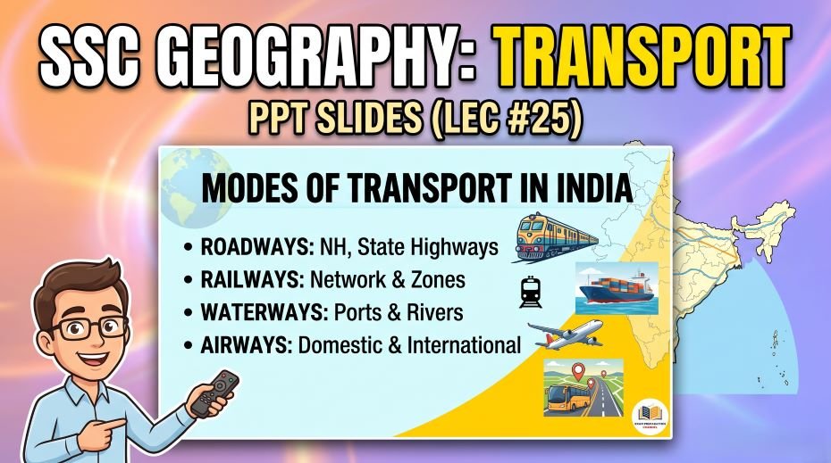
Quick Fact Table – Transport of India for SSC Exams
| Question / Fact | Answer |
| India’s road network rank in the world | 2nd largest (after USA) – ~6.37 million km |
| Longest National Highway in India | NH 44 (~3,745 km) – Srinagar to Kanyakumari |
| India’s railway network rank in the world | 4th largest (~68,000 km route length) |
| First passenger train in India | Mumbai (VT) to Thane – 16 April 1853 |
| First metro rail in India | Kolkata Metro – 1984 |
| Largest metro network in India | Delhi Metro (~390+ km) |
| Largest railway zone by route km | Northern Railway (NR) – headquartered in Delhi |
| World’s longest railway platform | Hubballi (Hubli) Junction, Karnataka (~1.5 km, as of 2023) |
| Busiest container port in India | JNPT (Nhava Sheva), Maharashtra |
| Largest port by cargo volume in India | Kandla (Deendayal Port), Gujarat |
| Deepest natural harbour in India | Visakhapatnam, Andhra Pradesh |
| Oldest artificial port in India | Chennai (Madras) Port |
| First corporate port in India | Kamarajar (Ennore) Port, Tamil Nadu |
| Only major river port in India | Kolkata Port (on Hooghly River) |
| Busiest airport in India | Indira Gandhi International Airport (IGIA), New Delhi |
| World’s first fully solar-powered airport | Cochin International Airport (CIAL), Kochi, Kerala |
| First airport built with private participation in India | Cochin International Airport (CIAL) |
| India’s national carrier (privatised to Tata) | Air India – sold to Tata Group in January 2022 |
| UDAN scheme stands for | Ude Desh Ka Aam Nagrik – regional air connectivity |
| Most important National Waterway | NW-1 – Ganga from Prayagraj to Haldia (~1,620 km) |
| NW-2 | Brahmaputra River – Sadiya to Dhubri, Assam (~891 km) |
| NW-3 | West Coast Canal – Kerala Backwaters (Kottapuram to Kollam) |
| Golden Quadrilateral connects | Delhi, Mumbai, Chennai, Kolkata (~5,846 km) |
| India’s first bullet train project | Mumbai-Ahmedabad HSR (~508 km); Japan’s Shinkansen tech |
| Dedicated Freight Corridors (DFC) | Western DFC (Ludhiana–Mumbai) and Eastern DFC (Ludhiana–Dankuni) |
| PM Gati Shakti launched in | 2021 – National Master Plan for multi-modal connectivity |
| Sagarmala Programme focus | Port-led development; port connectivity with roads, rail, waterways |
| Bharatmala Pariyojana Phase I | 34,800 km of new expressways and economic corridors |
| Grand Trunk Road (GT Road) old NH number | NH 1 (Delhi-Amritsar) and NH 2 (Delhi-Kolkata) – now part of NH 44 and NH 19 |
| First metro in South India | Chennai Metro – 2015 |
PYQ:
Q1: Why is transport geography important for competitive exams and what are the main modes?
Transport geography is important for SSC and RRB exams because India’s massive transport infrastructure directly connects economic geography (ports, trade corridors), political geography (connectivity to border areas, remote regions), and current affairs (new expressways, bullet train, metro systems). India’s main modes of transport are: Roads (~6.37 million km, 2nd largest in world), Railways (~68,000 km, 4th largest), Waterways (inland and coastal), Airways (~140 airports; 3rd largest domestic market), and Pipelines (for petroleum and gas). Each mode has its own ministry, policy, and examination-relevant projects, making this a multi-layered topic that generates questions across different paper sections.
Q2: What is the significance of NH 44 as India’s longest National Highway?
NH 44, stretching approximately 3,745 km from Srinagar in Jammu & Kashmir to Kanyakumari at India’s southernmost tip in Tamil Nadu, is the longest National Highway in India. It replaced the old numbering system where NH 7 (Varanasi to Kanyakumari) was considered the longest. NH 44 passes through 11 states – J&K, Punjab, Haryana, Delhi, UP, MP, Maharashtra, Telangana, Andhra Pradesh, Karnataka, and Tamil Nadu – connecting India’s northernmost accessible road point to its southernmost tip. This highway is important not just for trade and movement, but symbolically represents India’s north-south connectivity. The renaming and renumbering of National Highways in 2010 is itself a frequently asked SSC question.
Q3: Why is Kolkata Metro historically significant?
Kolkata Metro, which began operations in 1984, was India’s first metro railway system – predating Delhi Metro by almost two decades. It runs primarily underground through central Kolkata along a north-south corridor, and while it is no longer India’s largest or most technologically advanced metro system, it holds the unique distinction of being the pioneer of urban metro rail in India. The Kolkata Metro is now being expanded significantly under the East-West Metro project (connecting Howrah to Salt Lake Sector V through a tunnel under the Hooghly River – India’s first underwater metro tunnel). The underwater tunnel beneath the Hooghly River is itself a landmark engineering achievement and a current affairs topic.
Q4: What makes the Dedicated Freight Corridor (DFC) project strategically important?
The Dedicated Freight Corridor (DFC) project creates two separate railway lines exclusively for freight movement, running parallel to the existing passenger railway network: the Western DFC (Ludhiana in Punjab to Mumbai’s JNPT port, ~1,506 km) and the Eastern DFC (Ludhiana to Dankuni near Kolkata, ~1,875 km). Currently, passenger and freight trains share the same tracks, which creates congestion, slow speeds, and delays for both. Dedicated freight tracks will allow freight trains to run at 100+ km/h (currently averaging ~25 km/h) and free up the existing network for more passenger trains. The DFC also integrates with logistics parks and Multimodal Logistics Hubs at key points – making it India’s most transformative infrastructure investment for economic logistics since the development of the Golden Quadrilateral.
Q5: What is Cochin (Kochi) International Airport’s significance?
Cochin International Airport (CIAL) holds two notable distinctions relevant to SSC exam questions: it was the first airport in India to be built through private participation (the rest of the funding from Non-Resident Keralites and the state government), pioneering the public-private partnership model in Indian airport development. More famously, CIAL became the world’s first fully solar-powered airport in 2015, when it commissioned a massive solar farm that generates enough electricity to power all airport operations. This sustainability achievement received international recognition and made CIAL a symbol of renewable energy adoption in Indian infrastructure – a topic relevant to both Transport Geography and Environment sections of SSC exams.
Q6: How does the Golden Quadrilateral differ from the North-South East-West Corridor?
The Golden Quadrilateral (GQ) is a diamond-shaped expressway network connecting India’s four largest metro cities – Delhi, Mumbai, Chennai, and Kolkata – in a rough quadrilateral shape, covering approximately 5,846 km. It was the first phase of India’s National Highway Development Project (NHDP) and was largely completed by 2012. The North-South East-West (NSEW) Corridor, on the other hand, is a cross-shaped network – the North-South arm connects Srinagar to Kanyakumari (~4,076 km) and the East-West arm connects Silchar (Assam) to Porbandar (Gujarat) (~3,640 km). The two corridors intersect near Jharkhand-UP border. Together, the GQ and NSEW form India’s core expressway backbone, and the intersection of these systems is a point often highlighted in SSC transport geography questions.
Q7: What is the PM Gati Shakti National Master Plan?
PM Gati Shakti, launched in October 2021, is a National Master Plan for Multi-Modal Connectivity that brings together 16 ministries under a single integrated planning platform to coordinate infrastructure development across roads, railways, airports, ports, mass transport, waterways, and logistics. Before Gati Shakti, infrastructure projects were planned and implemented by different ministries in silos – leading to cases where a new road would be dug up to lay railway lines, or a port would be built without adequate road connectivity. Gati Shakti uses a GIS-based technology platform to map existing and planned infrastructure and align new projects with each other. It is considered India’s most ambitious infrastructure coordination initiative and is frequently referenced in Current Affairs-linked Geography questions in SSC papers.
Rapid Revision Cheat Sheet – Transport of India
| Topic | Key Point |
| Road network rank | 2nd largest in world (~6.37 million km) |
| Longest NH in India | NH 44 – Srinagar to Kanyakumari (~3,745 km) |
| Golden Quadrilateral | Delhi-Mumbai-Chennai-Kolkata (~5,846 km) |
| NSEW Corridor | Srinagar–Kanyakumari (N-S) + Porbandar–Silchar (E-W) |
| Railway network rank | 4th largest in world (~68,000 km) |
| First passenger train in India | Mumbai (VT) to Thane – 16 April 1853 |
| Number of Railway Zones | 18 Railway Zones |
| World’s longest platform (2023) | Hubballi (Hubli) Junction, Karnataka (~1.5 km) |
| First metro in India | Kolkata Metro – 1984 |
| Largest metro network | Delhi Metro (~390+ km) |
| Busiest container port | JNPT (Nhava Sheva), Maharashtra |
| Largest port by cargo volume | Kandla (Deendayal Port), Gujarat |
| Deepest harbour | Visakhapatnam, AP |
| Oldest artificial port | Chennai (Madras) Port |
| First corporate port | Kamarajar (Ennore), Tamil Nadu |
| Only river port (major) | Kolkata Port (Hooghly River) |
| Busiest airport | IGIA, New Delhi |
| First solar-powered airport (world) | Cochin International Airport (CIAL), Kerala |
| Air India handed to | Tata Group – January 2022 |
| UDAN scheme | Regional air connectivity – affordable fares for small cities |
| NW-1 | Ganga – Prayagraj to Haldia (~1,620 km) |
| NW-3 | West Coast Canal, Kerala backwaters |
| Bullet Train Project | Mumbai–Ahmedabad ~508 km; Japan’s Shinkansen tech |
| Dedicated Freight Corridors | Western (Ludhiana–Mumbai) + Eastern (Ludhiana–Dankuni) |
| PM Gati Shakti | 2021 – multi-modal connectivity master plan |
| Sagarmala | Port-led development; port connectivity |
| Bharatmala Phase I | 34,800 km expressways and economic corridors |
| NHAI | National Highways Authority of India – manages NHs |
| Grand Trunk Road old NHs | NH 1 (Delhi–Amritsar) and NH 2 (Delhi–Kolkata); now NH 44 and NH 19 |
| Serial number of this PPT | #104 in the Complete Foundation Batch |
Conclusion
Transport Geography of India is a topic that straddles physical geography, economic geography, and current affairs – making it one of the most versatile sources of SSC and RRB General Awareness marks. From the historical First Passenger Train in 1853 to the futuristic Bullet Train project, from Kolkata Metro’s 1984 start to the expanding metro networks of 15+ cities, and from the longest National Highway (NH 44) to the busiest container port (JNPT), this topic offers a wide range of direct, predictable question types.
The SSC Geography Transport PPT Slides (LEC #25), Serial #104, available at slideshareppt.net in bilingual Hindi + English format across 121 slides, gives you the complete visual companion for this topic. Memorise the NH superlatives, Railway Zone headquarters, major port rankings, airport distinctions, and key transport projects. Use the Rapid Revision Cheat Sheet in your final week to consolidate all the key transport facts for reliable exam scoring.