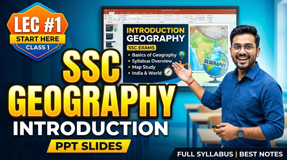
This article is built around the SSC Geography Introduction PPT Slides (LEC #1) – Serial #79 of the Complete Foundation Batch for All SSC Exams PPT Series published on slideshareppt.net. Geography is one of the highest-scoring and most consistently tested subjects across SSC CGL, SSC CHSL, SSC MTS, SSC GD Constable, and RRB Group D exams. The PPT is available in both Google Slides and Google Drive formats, in bilingual Hindi + English medium, making it ideal for a wide range of students. Whether you are doing a marathon revision session before the exam or a teacher preparing structured classroom material, this resource gives you everything in one place.
PPT Resource Overview
| Detail | Information |
| Lecture Number | LEC #1 (Geography Series) |
| Serial Number in Complete Batch | #79 |
| Subject | Geography – Introduction (परिचय) |
| Series Name | Complete Foundation Batch for All SSC Exams (PPT Series) |
| Total Slides | 20 PPT Slides |
| File Size | 6 MB |
| Language | Hindi + English (Bilingual) |
| Format Available | Google Slides & Google Drive (PDF also available) |
| Website | www.slideshareppt.net |
| Target Exams | SSC CGL, SSC CHSL, SSC MTS, SSC GD Constable, RRB Group D |
| Suitable For | Students (self-study & marathon revision) and Teachers (classroom use) |
SSC Geography Introduction PPT Slides (LEC #1)
Note: Above is PPT in GOOGLE SLIDES (HTML AND IFRAME COMBINATION) and if you wish to download the Complete SSC series (PPT slides), visit this Link – REDIRECT PAGE.
Master Timeline: History and Development of Geography
| Period / Era | Key Development | SSC Exam Relevance |
| Before 500 BCE – Ancient India | Vedic texts reference Bhu-Mandal (Earth sphere), rivers, and sacred mountains | Origin of Indian geographical thought |
| ~600 BCE – Ancient Greece | Anaximander creates the first known world map; Pythagoras proposes a spherical Earth | Concept of globe and map origin |
| 276–194 BCE | Eratosthenes calculates Earth’s circumference (~40,000 km) and coins the word ‘Geography’ | Father of Geography – very frequently asked |
| ~150 CE – Ptolemy | Ptolemy publishes Geographia – introduces coordinate system, map projections | Foundation of modern cartography |
| 700–1400 CE – Arab Scholars | Al-Idrisi and Ibn Battuta advance map-making and travel-based geographical knowledge | Historical Geography context |
| 1492 | Columbus’s voyage demonstrates practical spherical Earth navigation | Age of Exploration begins |
| 1543 – Copernicus | Heliocentric model proposed – Earth revolves around the Sun | Solar system basics for SSC Science-GK |
| 17th–18th Century | Modern Geography branches emerge: Physical, Human, Economic Geography | Branch classification in SSC syllabus |
| 1830 | Royal Geographical Society founded in London – geography institutionalised | Institutional history of Geography |
| 19th–20th Century | Climatology, Oceanography, and Geomorphology develop as formal sub-disciplines | Sub-branches asked in SSC CGL & CHSL |
| Post-1950 | Remote Sensing and GIS (Geographic Information System) introduced | Modern tools – SSC CGL Tier II |
| Present Day | Satellite mapping, Google Earth, and ISRO’s Bhuvan platform transform geography | Current Affairs + Geography integration |
Topic-Wise Lesson Roadmap: What to Study and in What Order
Use this roadmap to build a clear study plan for Geography under SSC exams. Each category contains the main topic, sub-topics to cover, and the sequence to follow. Start from Category 1 and move forward step by step – do not skip any category, as each builds on the previous one.
| CATEGORY 1 – FOUNDATIONS OF GEOGRAPHY (Start Here) | |||
| Step | Main Topic | Sub-Topics to Cover | Priority for SSC |
| 1.1 | Introduction to Geography | Meaning of Geography, origin of the word (Geo + Graphia), definition, scope | High |
| 1.2 | Father of Geography | Eratosthenes – life, contribution, calculation of Earth’s circumference, coining the term | Very High |
| 1.3 | Branches of Geography | Physical Geography, Human Geography, Economic Geography, Political Geography, Cartography, Climatology, Oceanography, Geomorphology, Biogeography, Remote Sensing & GIS | High |
| 1.4 | Tools of Geography | Maps, Globe, Compass, GPS, GIS, Remote Sensing, Satellite Imagery, ISRO Bhuvan | Medium |
| CATEGORY 2 – THE EARTH: SHAPE, SIZE & MOTIONS | |||
| Step | Main Topic | Sub-Topics to Cover | Priority for SSC |
| 2.1 | Shape of the Earth | Oblate Spheroid (Geoid), equatorial bulge, polar flattening, difference between equatorial and polar radius | Very High |
| 2.2 | Size of the Earth | Equatorial circumference (~40,075 km), polar circumference, total surface area (510 mn sq km), land vs water ratio (29:71) | High |
| 2.3 | Rotation of the Earth | Direction (West to East), duration (23h 56m 4s), effect: Day & Night, Coriolis Effect | Very High |
| 2.4 | Revolution of the Earth | Duration (365d 5h 48m 46s), effect: Seasons, Solstices, Equinoxes, variation in day length | Very High |
| 2.5 | Eclipses | Solar Eclipse, Lunar Eclipse – conditions and types | Medium |
| CATEGORY 3 – LATITUDES AND LONGITUDES (Most Asked in SSC) | |||
| Step | Main Topic | Sub-Topics to Cover | Priority for SSC |
| 3.1 | What are Latitudes? | Definition, direction (parallel lines), range (0° to 90° N/S), Equator as reference | Very High |
| 3.2 | Important Latitudes | Equator (0°), Tropic of Cancer (23.5°N), Tropic of Capricorn (23.5°S), Arctic Circle (66.5°N), Antarctic Circle (66.5°S), North Pole (90°N), South Pole (90°S) | Very High |
| 3.3 | What are Longitudes? | Definition, direction (vertical lines), range (0° to 180° E/W), Prime Meridian as reference | Very High |
| 3.4 | Prime Meridian & GMT | 0° longitude, passes through Greenwich England, basis for world time zones, GMT/UTC | Very High |
| 3.5 | International Date Line | 180° longitude, zigzag path to avoid countries, crossing rules (gain/lose a day) | High |
| 3.6 | Indian Standard Time (IST) | 82.5°E meridian, Mirzapur UP, IST = GMT + 5:30, why India has one time zone | Very High |
| 3.7 | Time Zones | Concept of time zones, how longitude determines local time, countries with multiple zones | Medium |
| CATEGORY 4 – INDIA’S GEOGRAPHY: BASICS & BOUNDARIES | |||
| Step | Main Topic | Sub-Topics to Cover | Priority for SSC |
| 4.1 | India’s Location & Extent | Latitudinal extent (8°4’N to 37°6’N), Longitudinal extent (68°7’E to 97°25’E) | Very High |
| 4.2 | India’s Size & Rank | Area: 32.87 lakh sq km, 7th largest country, 1st in population (2023) | Very High |
| 4.3 | India’s Extreme Points | Northernmost: Indira Col, Southernmost: Indira Point, Easternmost: Kibithu, Westernmost: Sir Creek | High |
| 4.4 | India’s Borders | Total land border: 15,200 km, coastline: 7,516.6 km, longest border: Bangladesh (4,156 km) | Very High |
| 4.5 | India’s Neighbours | 7 land neighbours: Pakistan, Afghanistan, China, Nepal, Bhutan, Bangladesh, Myanmar; 2 sea neighbours: Sri Lanka, Maldives | Very High |
| 4.6 | Tropic of Cancer through India | Passes through 8 states: Gujarat, Rajasthan, MP, Chhattisgarh, Jharkhand, West Bengal, Tripura, Mizoram | Very High |
| 4.7 | India’s Coastline States | 9 coastal states, longest coastline: Gujarat, southernmost coastline: Tamil Nadu | High |
| CATEGORY 5 – PHYSICAL DIVISIONS OF INDIA | |||
| Step | Main Topic | Sub-Topics to Cover | Priority for SSC |
| 5.1 | The Himalayas | Formation (folded mountains), three ranges (Himadri, Himachal, Shivalik), highest peaks, rivers originating | Very High |
| 5.2 | The Northern Plains | Formation (alluvial deposits), rivers (Indus, Ganga, Brahmaputra systems), importance for agriculture | Very High |
| 5.3 | The Peninsular Plateau | Deccan Plateau, Eastern Ghats, Western Ghats, minerals, rivers | High |
| 5.4 | The Coastal Plains | Eastern Coastal Plain, Western Coastal Plain, features and importance | Medium |
| 5.5 | The Islands | Andaman & Nicobar (Bay of Bengal), Lakshadweep (Arabian Sea), coral reefs, Indira Point | High |
| 5.6 | The Thar Desert | Location (Rajasthan), hot desert features, vegetation, rivers | Medium |
| CATEGORY 6 – RIVERS OF INDIA | |||
| Step | Main Topic | Sub-Topics to Cover | Priority for SSC |
| 6.1 | Himalayan Rivers (Perennial) | Indus system, Ganga system (Ganga, Yamuna, Ghaghra, Gandak, Kosi), Brahmaputra, river interlinking | Very High |
| 6.2 | Peninsular Rivers (Seasonal) | East-flowing: Mahanadi, Godavari, Krishna, Cauvery; West-flowing: Narmada, Tapi | Very High |
| 6.3 | River Basics | Source, mouth, tributary, distributary, delta, estuary, basin, watershed | High |
| 6.4 | River-wise Facts | Longest river in India: Ganga; Largest basin: Ganga; Only west-flowing major rivers: Narmada & Tapi | Very High |
| CATEGORY 7 – CLIMATE OF INDIA | |||
| Step | Main Topic | Sub-Topics to Cover | Priority for SSC |
| 7.1 | Factors Affecting Climate | Latitude, altitude, distance from sea, wind direction, relief features, ocean currents | High |
| 7.2 | Indian Monsoon | Southwest monsoon (June–September), Northeast monsoon, Arabian Sea branch, Bay of Bengal branch | Very High |
| 7.3 | Seasons in India | Summer (March–May), Monsoon (June–Sept), Retreating Monsoon (Oct–Nov), Winter (Dec–Feb) | Very High |
| 7.4 | Cyclones | Tropical cyclones in Bay of Bengal and Arabian Sea, naming convention, recent cyclones | High |
| 7.5 | El Nino & La Nina | Effect on Indian monsoon, Pacific Ocean phenomenon, drought years in India | High |
| CATEGORY 8 – SOILS, VEGETATION & FORESTS | |||
| Step | Main Topic | Sub-Topics to Cover | Priority for SSC |
| 8.1 | Types of Soil in India | Alluvial soil, Black soil (Regur), Red soil, Laterite soil, Desert soil, Mountain soil – location and crops | Very High |
| 8.2 | Natural Vegetation | Tropical rainforest, Tropical deciduous, Tropical thorn, Montane forests, Mangroves | High |
| 8.3 | Forest Cover | India’s forest cover %, Project Tiger, Project Elephant, biosphere reserves | High |
| CATEGORY 9 – RESOURCES & ECONOMIC GEOGRAPHY | |||
| Step | Main Topic | Sub-Topics to Cover | Priority for SSC |
| 9.1 | Minerals of India | Iron ore (Jharkhand, Odisha), Coal (Jharkhand, MP), Bauxite, Mica, Copper, Petroleum zones | Very High |
| 9.2 | Agriculture | Kharif and Rabi crops, crop types, Green Revolution, major crop-producing states | Very High |
| 9.3 | Industries | Iron & Steel, Textile, Petrochemical, Automobile, IT – location and importance | High |
| 9.4 | Transport & Ports | Major ports, National Highways, Golden Quadrilateral, rail network | High |
| CATEGORY 10 – WORLD GEOGRAPHY BASICS | |||
| Step | Main Topic | Sub-Topics to Cover | Priority for SSC |
| 10.1 | Continents & Oceans | 7 continents, 5 oceans – area, location, largest/smallest facts | Very High |
| 10.2 | World Mountains & Deserts | Andes, Alps, Rockies, Sahara, Arabian, Gobi deserts | High |
| 10.3 | World Rivers & Lakes | Amazon, Nile, Congo; Caspian Sea, Lake Superior, Lake Baikal | High |
| 10.4 | Important World Facts | Largest country by area: Russia; most populous: India; smallest: Vatican; longest river: Nile/Amazon (debated) | Very High |
| 10.5 | Straits, Gulfs & Passes | Strait of Hormuz, Palk Strait, Strait of Malacca, Gulf of Mannar, Bolan Pass, Khyber Pass | High |
What is Geography? – Core Concepts for SSC
The word Geography comes from the Greek words Geo (Earth) and Graphia (description or writing). Literally, Geography means ‘description of the Earth.’ It is the scientific study of Earth’s surface, physical features, atmosphere, resources, people, and the spatial relationships that exist between all of these elements.
For SSC exams, Geography is broadly split into two parts:
- Physical Geography – Studies natural features: landforms, climate, rivers, oceans, soil, and vegetation
- Human Geography – Studies population, settlements, agriculture, industries, transport, and trade
Most SSC General Awareness sections draw questions from both Physical and Human Geography, often linking them with Current Affairs and Environmental topics.
Branches of Geography – SSC Reference Table
| Branch | What It Studies | Common SSC Exam Topic |
| Physical Geography | Natural features: landforms, climate, water bodies | Himalayas, Deccan Plateau, monsoon mechanism |
| Human Geography | Population, migration, settlements, culture | Indian population distribution, urbanisation trends |
| Economic Geography | Agriculture, industries, trade, resources | Mineral belts, crop zones, major ports |
| Political Geography | Boundaries, territories, nations, regions | India’s neighbours, state borders, disputed territories |
| Climatology | Climate systems, weather patterns, seasons | Monsoon, cyclones, La Nina and El Nino |
| Oceanography | Ocean currents, tides, marine ecosystems | Indian Ocean currents, Bay of Bengal features |
| Geomorphology | Formation of Earth’s surface features | Types of mountains, plateau formation, erosion |
| Biogeography | Distribution of plants and animals across regions | Biomes, wildlife sanctuaries, biodiversity hotspots |
| Cartography | Science of map-making | Map reading, latitude and longitude, scale, projection |
| Remote Sensing & GIS | Satellite imagery and spatial data analysis | ISRO, Bhuvan, GPS applications in governance |
Earth – Basic Facts for SSC Aspirants
Shape and Size
- Shape: Oblate Spheroid (slightly flattened at poles, bulging at equator)
- Equatorial radius: 6,378 km
- Polar radius: 6,357 km
- Equatorial circumference: approximately 40,075 km
- Total surface area: 510 million sq km
- Land area: ~149 million sq km (29%)
- Water area: ~361 million sq km (71%)
Earth’s Motions
| Motion | Direction | Duration | Effect |
| Rotation (on its own axis) | West to East | 23 hours 56 minutes 4 seconds | Day and Night; Coriolis Effect |
| Revolution (around the Sun) | West to East (anticlockwise from North Pole) | 365 days 5 hours 48 min 46 sec | Seasons, Solstices, Equinoxes |
Latitudes and Longitudes – Most Asked Topic in SSC
Key Latitudes
| Latitude | Degree | Key Facts for SSC |
| Equator | 0° | Divides Earth into Northern and Southern Hemispheres; maximum solar heat zone; 12-hour day throughout the year |
| Tropic of Cancer | 23.5° N | Passes through 8 Indian states: Gujarat, Rajasthan, MP, Chhattisgarh, Jharkhand, West Bengal, Tripura, Mizoram |
| Tropic of Capricorn | 23.5° S | Southern equivalent of Tropic of Cancer; passes through Australia, South Africa, Brazil |
| Arctic Circle | 66.5° N | Start of Midnight Sun zone – 6 months of continuous daylight in summer; Polar Night in winter |
| Antarctic Circle | 66.5° S | Southern equivalent; midnight sun during southern hemisphere summer |
| North Pole | 90° N | Northernmost point of Earth; 6 months day and 6 months night |
| South Pole | 90° S | Southernmost point; location of Antarctica; coldest place on Earth |
Key Longitudes
| Longitude | Degree | Key Facts for SSC |
| Prime Meridian | 0° | Passes through Greenwich, England; basis for all time zones worldwide; divides Earth into Eastern and Western Hemispheres |
| International Date Line (IDL) | 180° | Opposite the Prime Meridian; zigzag to avoid islands and countries; crossing East to West adds a day; West to East removes a day |
| Indian Standard Meridian | 82.5° E | Passes through Mirzapur, Uttar Pradesh; IST = GMT + 5 hours 30 minutes; India has one time zone for the entire country |
India – Key Geographical Parameters
| Parameter | Detail |
| Total Area | 32,87,263 sq km – 7th largest country in the world |
| Latitudinal Extent | 8°4’N to 37°6’N |
| Longitudinal Extent | 68°7’E to 97°25’E |
| North–South Length | 3,214 km |
| East–West Width | 2,933 km |
| Coastline Length | 7,516.6 km (including Andaman & Nicobar and Lakshadweep islands) |
| Total Land Border | 15,200 km |
| Tropic of Cancer | Passes through 8 Indian states at 23.5°N |
| Standard Time Meridian | 82.5°E – Mirzapur, Uttar Pradesh (IST = GMT + 5:30) |
| Northernmost Point | Indira Col (near Siachen Glacier, Jammu & Kashmir) |
| Southernmost Point | Indira Point (Great Nicobar Island – submerged partially after 2004 tsunami) |
| Easternmost Point | Kibithu (Arunachal Pradesh) |
| Westernmost Point | Sir Creek (Gujarat) |
| Longest Border Country | Bangladesh – 4,156 km |
| Neighbouring Countries (Land) | Pakistan, Afghanistan, China, Nepal, Bhutan, Bangladesh, Myanmar |
| Neighbouring Countries (Sea) | Sri Lanka and Maldives |
| Longest Coastline State | Gujarat |
| Rank by Population (2023) | 1st in the world (surpassed China in April 2023) |
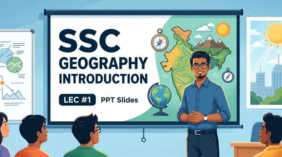
Quick Fact Table – Geography Introduction (SSC Focus)
| Fact / Question | Answer |
| Who coined the term ‘Geography’? | Eratosthenes (Greek scholar, 276–194 BCE) |
| Father of Geography | Eratosthenes |
| Shape of the Earth | Oblate Spheroid (Geoid) |
| Earth’s total surface area | 510 million sq km |
| Percentage of Earth covered by water | 71% |
| Earth’s equatorial circumference | ~40,075 km |
| Earth’s polar circumference | ~40,008 km |
| Highest peak on Earth | Mt. Everest – 8,848.86 m (Nepal-China border) |
| Deepest point on Earth | Mariana Trench (Pacific Ocean) – ~11,034 m below sea level |
| Largest continent | Asia |
| Smallest continent | Australia |
| Largest ocean | Pacific Ocean |
| Smallest ocean | Arctic Ocean |
| India’s total area | 32.87 lakh sq km |
| India’s world rank by area | 7th |
| India’s world rank by population (2023) | 1st |
| India’s Standard Time Meridian | 82.5°E – Mirzapur, Uttar Pradesh |
| Tropic of Cancer in India | 23.5°N – passes through 8 states |
| India’s longest coastline state | Gujarat |
| ISRO’s satellite mapping platform | Bhuvan |
| GIS full form | Geographic Information System |
| Father of Modern Geography | Alexander von Humboldt |
| Father of Cartography | Anaximander (Ancient Greece) |
Podcast-Style Q&A – Rapid Oral Revision
Q1: What does the word Geography literally mean?
Geography comes from the Greek words Geo (Earth) and Graphia (description or writing), so it literally means description of the Earth. The term was coined by the Greek scholar Eratosthenes around 276–194 BCE, which is why he is called the Father of Geography.
Q2: What is the exact shape of the Earth?
Earth is an oblate spheroid – it is slightly flattened at the poles and bulges slightly at the equator. This means the equatorial radius (6,378 km) is slightly larger than the polar radius (6,357 km). SSC exams sometimes ask for the term ‘oblate spheroid’ or ‘geoid’ so remember both.
Q3: Which 8 Indian states does the Tropic of Cancer pass through?
The Tropic of Cancer at 23.5°N passes through these 8 states from west to east: Gujarat, Rajasthan, Madhya Pradesh, Chhattisgarh, Jharkhand, West Bengal, Tripura, and Mizoram. A popular trick to remember them is the acronym GRMC-JWTM.
Q4: What is IST and which place determines it?
IST stands for Indian Standard Time, which is based on the 82.5°E longitude passing through Mirzapur in Uttar Pradesh. IST is GMT plus 5 hours 30 minutes. India maintains a single time zone for the entire country, unlike the USA, Russia, and Canada, which have multiple time zones.
Q5: What is the difference between Rotation and Revolution of the Earth?
Rotation is the spinning of Earth on its own axis from west to east, completing one full rotation in approximately 23 hours 56 minutes – this is what causes day and night. Revolution is Earth’s journey around the Sun, completing one orbit in 365 days 5 hours 48 minutes – this is what causes the four seasons and variation in day length across months.
Q6: What is the International Date Line and why does it zigzag?
The International Date Line (IDL) is located at 180° longitude, directly opposite the Prime Meridian. It is not a perfectly straight line – it bends and zigzags around islands and countries in the Pacific Ocean so that nations like Kiribati, Fiji, and Russia do not get split into two different calendar days. Crossing from west to east across the IDL removes a calendar day; crossing from east to west adds one.
Q7: What is the significance of IST being at 82.5°E and not 82°E or 83°E?
India’s standard meridian is specifically set at 82.5°E because it is exactly 5 hours 30 minutes ahead of the Prime Meridian (0°). Every 15° of longitude equals exactly 1 hour difference in time, and every 1° equals 4 minutes. So 82.5° divides exactly to give a neat 5h 30m time offset from GMT, which is why 82.5° was chosen over 82° or 83°.
30 MCQ Practice Questions – Geography Introduction
All questions are modelled on SSC CGL, CHSL, MTS, and GD Constable previous year patterns. Answers follow at the end of this section.
- Who coined the term ‘Geography’?
A) Ptolemy B) Eratosthenes C) Aristotle D) Strabo
- What does ‘Geo’ mean in the word Geography?
A) Water B) Sky C) Earth D) Life
- The shape of the Earth is best described as:
A) Perfect sphere B) Oblate spheroid C) Prolate spheroid D) Flat disc
- Earth’s equatorial circumference is approximately:
A) 30,000 km B) 35,000 km C) 40,075 km D) 45,000 km
- What percentage of Earth’s surface is covered by water?
A) 50% B) 60% C) 71% D) 80%
- The Tropic of Cancer passes through how many Indian states?
A) 6 B) 7 C) 8 D) 9
- India’s Standard Meridian at 82.5°E passes through which state?
A) Bihar B) Madhya Pradesh C) Uttar Pradesh D) Odisha
- Indian Standard Time (IST) is ahead of GMT by:
A) 5 hours B) 5 hours 30 minutes C) 6 hours D) 4 hours 30 minutes
- Rotation of Earth causes:
A) Seasons B) Day and Night C) Ocean tides D) Solar eclipses
- Earth completes one revolution around the Sun in approximately:
A) 24 hours B) 30 days C) 365 days 6 hours D) 366 days
- The International Date Line is located at:
A) 0° longitude B) 90° E C) 180° longitude D) 90° W
- The Prime Meridian passes through which city?
A) Paris B) London C) Greenwich D) New York
- India’s total area is approximately:
A) 20 lakh sq km B) 25 lakh sq km C) 32.87 lakh sq km D) 40 lakh sq km
- India is the ___ largest country by area in the world.
A) 5th B) 6th C) 7th D) 8th
- The southernmost point of India is:
A) Cape Comorin (Kanyakumari) B) Indira Point C) Indira Col D) Port Blair
- Which state does the Tropic of Cancer NOT pass through?
A) Gujarat B) Maharashtra C) Madhya Pradesh D) Chhattisgarh
- The largest ocean in the world is:
A) Atlantic B) Indian C) Pacific D) Arctic
- The highest peak on Earth is:
A) K2 B) Kangchenjunga C) Mt. Everest D) Makalu
- The deepest point on Earth is located in:
A) Atlantic Ocean B) Indian Ocean C) Southern Ocean D) Pacific Ocean
- India shares its longest land border with which country?
A) China B) Pakistan C) Bangladesh D) Nepal
- The science of map-making is called:
A) Geomorphology B) Cartography C) Climatology D) Oceanography
- GIS stands for:
A) Global Information System B) Geographic Information System C) General Integration Software D) Ground Information Survey
- Which scholar first calculated the circumference of the Earth?
A) Aristotle B) Plato C) Eratosthenes D) Pythagoras
- The Arctic Circle is located at:
A) 23.5° N B) 66.5° N C) 90° N D) 45° N
- India’s standard time meridian passes through which city?
A) Allahabad B) Varanasi C) Mirzapur D) Agra
- India’s coastline length (including islands) is approximately:
A) 5,000 km B) 6,100 km C) 7,516 km D) 9,000 km
- Which Indian state has the longest coastline?
A) Tamil Nadu B) Andhra Pradesh C) Maharashtra D) Gujarat
- Earth’s polar radius is:
A) 6,378 km B) 6,357 km C) 6,400 km D) 6,300 km
- The scientific study of climate patterns is called:
A) Meteorology B) Climatology C) Hydrology D) Ecology
- ISRO’s satellite-based mapping platform is called:
A) Google Earth B) GPS Map C) Bhuvan D) GeoStar
Answer Key
| Q | Ans | Q | Ans | Q | Ans |
| 1 | B | 11 | C | 21 | B |
| 2 | C | 12 | C | 22 | B |
| 3 | B | 13 | C | 23 | C |
| 4 | C | 14 | C | 24 | B |
| 5 | C | 15 | B | 25 | C |
| 6 | C | 16 | B | 26 | C |
| 7 | C | 17 | C | 27 | D |
| 8 | B | 18 | C | 28 | B |
| 9 | B | 19 | D | 29 | B |
| 10 | C | 20 | C | 30 | C |
also read: SSC Polity Constitutional Amendment PPT Slides (LEC #22)
Rapid Revision Cheat Sheet – Geography Introduction
| Topic | Key Point |
| Term ‘Geography’ | Coined by Eratosthenes – Greek: Geo (Earth) + Graphia (writing) |
| Father of Geography | Eratosthenes (276–194 BCE) |
| Father of Modern Geography | Alexander von Humboldt |
| Earth’s shape | Oblate Spheroid – flattened at poles, bulging at equator |
| Equatorial circumference | ~40,075 km |
| Water vs Land ratio | 71% water : 29% land |
| Rotation | West to East – 23h 56m – causes Day & Night |
| Revolution | Around Sun – 365d 5h 48m – causes Seasons |
| Equator | 0° latitude – maximum heat – divides N & S hemispheres |
| Tropic of Cancer | 23.5°N – 8 Indian states (Guj, Raj, MP, CG, JH, WB, Tripura, Mizoram) |
| Tropic of Capricorn | 23.5°S – passes through Australia, South Africa, Brazil |
| Prime Meridian | 0° longitude – Greenwich, England – global time zone base |
| IST Meridian | 82.5°E – Mirzapur, UP – IST = GMT + 5 hours 30 minutes |
| International Date Line | 180° longitude – zigzag path – crossing adds/removes a day |
| India’s area | 32.87 lakh sq km – 7th largest country in world |
| India’s coastline | 7,516.6 km including islands |
| Longest coastline state | Gujarat |
| India population rank (2023) | 1st in the world |
| Southernmost point of India | Indira Point, Great Nicobar Island |
| Standard meridian city | Mirzapur, Uttar Pradesh (82.5°E) |
| Highest peak on Earth | Mt. Everest – 8,848.86 m |
| Deepest point on Earth | Mariana Trench – ~11,034 m – Pacific Ocean |
| Largest continent | Asia | Largest ocean: Pacific Ocean |
| ISRO mapping platform | Bhuvan |
| GIS full form | Geographic Information System |
| Serial Number of this PPT | #79 in the Complete Foundation Batch |
Conclusion
Geography Introduction forms the bedrock of your entire Geography preparation for SSC and RRB exams. Understanding the basics – what Geography means, Earth’s shape and dimensions, latitudes and longitudes, India’s geographic parameters, and the foundational branches – equips you for every subsequent topic that builds on top of this lecture.
The SSC Geography Introduction PPT Slides (LEC #1), Serial #79 of the Complete Foundation Batch, is available in bilingual Hindi + English format on slideshareppt.net via Google Slides and Google Drive. It is a self-made resource, regularly updated to reflect the current SSC and RRB exam pattern, and is suitable for both students revising independently and teachers conducting batch classes.
Use the topic-wise lesson roadmap provided in this article to structure your full Geography study plan from Category 1 right through to Category 10. Revisit the rapid revision cheat sheet in the week before your exam and practice the 30 MCQs to test how well the concepts have been absorbed. Bookmark this page and the PPT for easy access during pre-exam revision.